Browns Valley Topo Map South Dakota
To zoom in, hover over the map of Browns Valley
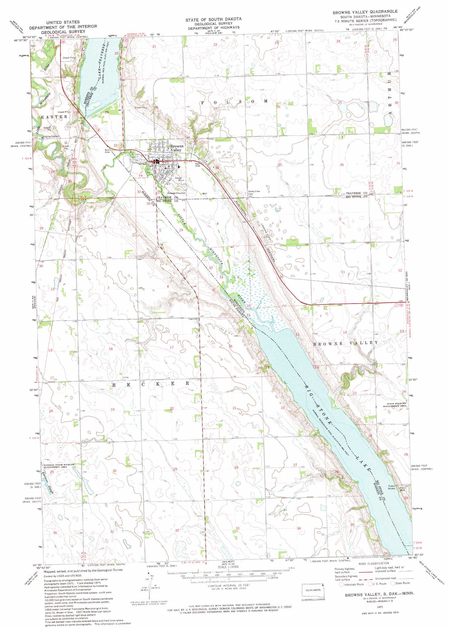
USGS Topo Quad 45096e7 - 1:24,000 scale
| Topo Map Name: | Browns Valley |
| USGS Topo Quad ID: | 45096e7 |
| Print Size: | ca. 21 1/4" wide x 27" high |
| Southeast Coordinates: | 45.5° N latitude / 96.75° W longitude |
| Map Center Coordinates: | 45.5625° N latitude / 96.8125° W longitude |
| U.S. States: | SD, MN |
| Filename: | o45096e7.jpg |
| Download Map JPG Image: | Browns Valley topo map 1:24,000 scale |
| Map Type: | Topographic |
| Topo Series: | 7.5´ |
| Map Scale: | 1:24,000 |
| Source of Map Images: | United States Geological Survey (USGS) |
| Alternate Map Versions: |
Browns Valley MN 1971, updated 1974 Download PDF Buy paper map Browns Valley MN 1977, updated 1979 Download PDF Buy paper map Browns Valley MN 2010 Download PDF Buy paper map Browns Valley MN 2013 Download PDF Buy paper map Browns Valley MN 2016 Download PDF Buy paper map |
1:24,000 Topo Quads surrounding Browns Valley
Claire City |
New Effington |
Victor |
Rosholt |
Wheaton West |
Sisseton |
Peever Nw |
Peever Ne |
Beardsley Nw |
Beardsley Ne |
Goodwill |
Peever |
Browns Valley |
Beardsley |
Barry |
Summit Ne |
Wilmot Nw |
Wilmot |
Big Stone Lake West |
Big Stone Lake East |
Summit |
Marvin |
Corona |
Big Stone Lake Sw |
Big Stone Lake Se |
> Back to 45096e1 at 1:100,000 scale
> Back to 45096a1 at 1:250,000 scale
> Back to U.S. Topo Maps home
Browns Valley topo map: Gazetteer
Browns Valley: Airports
Bullock Airport elevation 335m 1099′Browns Valley: Channels
Ancient River Warren Channel elevation 299m 980′Browns Valley: Dams
Browns Valley Dike elevation 298m 977′Holtz Irrigation Pond Dam elevation 305m 1000′
Browns Valley: Parks
Browns Valley Man Historical Marker elevation 302m 990′Browns Valley Wayside Park elevation 300m 984′
Continental Divide Historical Marker elevation 299m 980′
Sam Brown Memorial Park elevation 299m 980′
Samuel J Brown State Monument elevation 299m 980′
Wadsworth Trail Historical Marker elevation 299m 980′
Browns Valley: Populated Places
Browns Valley elevation 301m 987′Browns Valley: Post Offices
Browns Valley Post Office elevation 299m 980′Browns Valley: Streams
Little Minnesota River elevation 295m 967′Little Minnesota River elevation 295m 967′
Browns Valley digital topo map on disk
Buy this Browns Valley topo map showing relief, roads, GPS coordinates and other geographical features, as a high-resolution digital map file on DVD:
Eastern North Dakota & Eastern South Dakota
Buy digital topo maps: Eastern North Dakota & Eastern South Dakota