Herman Nw Topo Map Minnesota
To zoom in, hover over the map of Herman Nw
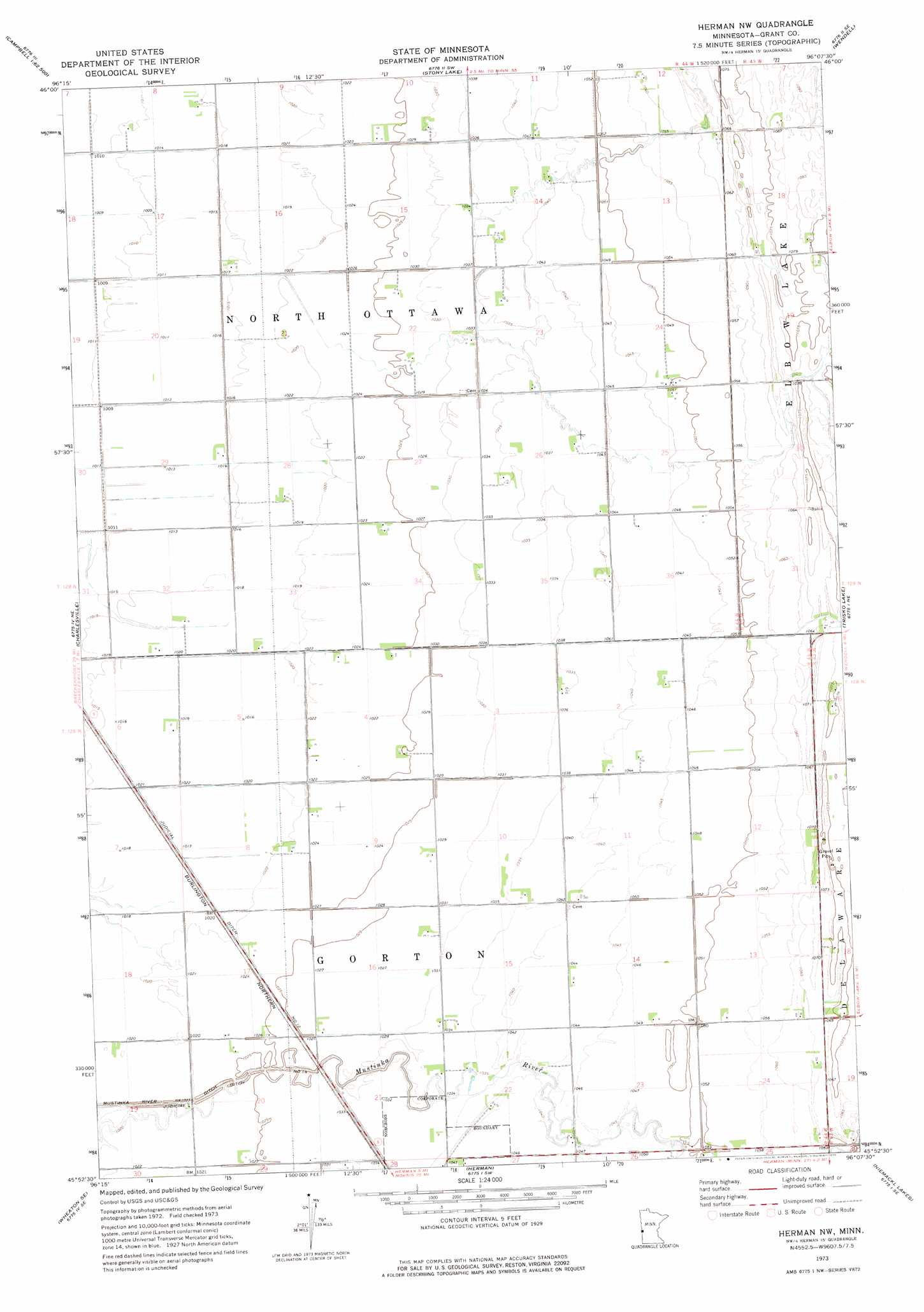
USGS Topo Quad 45096h2 - 1:24,000 scale
| Topo Map Name: | Herman Nw |
| USGS Topo Quad ID: | 45096h2 |
| Print Size: | ca. 21 1/4" wide x 27" high |
| Southeast Coordinates: | 45.875° N latitude / 96.125° W longitude |
| Map Center Coordinates: | 45.9375° N latitude / 96.1875° W longitude |
| U.S. State: | MN |
| Filename: | o45096h2.jpg |
| Download Map JPG Image: | Herman Nw topo map 1:24,000 scale |
| Map Type: | Topographic |
| Topo Series: | 7.5´ |
| Map Scale: | 1:24,000 |
| Source of Map Images: | United States Geological Survey (USGS) |
| Alternate Map Versions: |
Herman NW MN 1973, updated 1975 Download PDF Buy paper map Herman NW MN 2010 Download PDF Buy paper map Herman NW MN 2013 Download PDF Buy paper map Herman NW MN 2016 Download PDF Buy paper map |
1:24,000 Topo Quads surrounding Herman Nw
Doran |
Campbell Ne |
Orwell Lake |
Dayton Hollow Dam |
Dalton |
Campbell |
Tintah |
Stony Lake |
Wendell |
Fourmile Lake |
Wheaton Nw |
Charlesville |
Herman Nw |
Trisko Lake |
Elbow Lake |
Wheaton East |
Wheaton Se |
Herman |
Niemackl Lakes |
Patchen Lake |
Dumont |
Graceville Ne |
Chokio Nw |
Donnelly |
Wintermute Lake |
> Back to 45096e1 at 1:100,000 scale
> Back to 45096a1 at 1:250,000 scale
> Back to U.S. Topo Maps home
Herman Nw topo map: Gazetteer
Herman Nw: Airports
Ricks Field elevation 321m 1053′Herman Nw: Canals
Judicial Ditch Number Fourteen elevation 311m 1020′Herman Nw digital topo map on disk
Buy this Herman Nw topo map showing relief, roads, GPS coordinates and other geographical features, as a high-resolution digital map file on DVD:
Eastern North Dakota & Eastern South Dakota
Buy digital topo maps: Eastern North Dakota & Eastern South Dakota