Heggs Lake Topo Map South Dakota
To zoom in, hover over the map of Heggs Lake
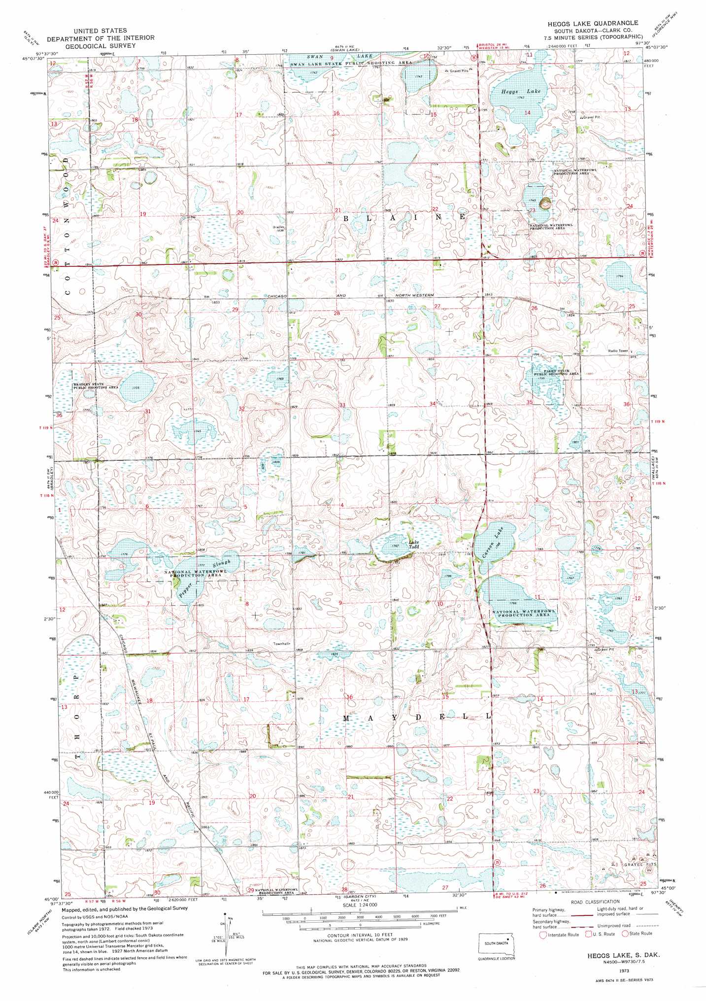
USGS Topo Quad 45097a5 - 1:24,000 scale
| Topo Map Name: | Heggs Lake |
| USGS Topo Quad ID: | 45097a5 |
| Print Size: | ca. 21 1/4" wide x 27" high |
| Southeast Coordinates: | 45° N latitude / 97.5° W longitude |
| Map Center Coordinates: | 45.0625° N latitude / 97.5625° W longitude |
| U.S. State: | SD |
| Filename: | o45097a5.jpg |
| Download Map JPG Image: | Heggs Lake topo map 1:24,000 scale |
| Map Type: | Topographic |
| Topo Series: | 7.5´ |
| Map Scale: | 1:24,000 |
| Source of Map Images: | United States Geological Survey (USGS) |
| Alternate Map Versions: |
Heggs Lake SD 1973, updated 1976 Download PDF Buy paper map Heggs Lake SD 2012 Download PDF Buy paper map Heggs Lake SD 2015 Download PDF Buy paper map |
1:24,000 Topo Quads surrounding Heggs Lake
Bristol West |
Bristol East |
Webster |
Waubay Sw |
Waubay |
Lone Tree Lake |
Lily |
Swan Lake |
Florence Nw |
Florence Ne |
Crocker |
Bradley |
Heggs Lake |
Wallace |
Florence |
Baileys Lake |
Clark North |
Garden City |
Henry |
Kampeska |
Raymond Se |
Clark South |
Naples |
Hazel |
Grover |
> Back to 45097a1 at 1:100,000 scale
> Back to 45096a1 at 1:250,000 scale
> Back to U.S. Topo Maps home
Heggs Lake topo map: Gazetteer
Heggs Lake: Lakes
Carson Lake elevation 541m 1774′Heggs Lake elevation 532m 1745′
Lake Todd elevation 539m 1768′
Pepper Slough elevation 542m 1778′
Heggs Lake: Parks
Bradley State Public Shooting Area elevation 527m 1729′Faehn State Public Shooting Area elevation 547m 1794′
Swan Lake State Public Shooting Area elevation 533m 1748′
Heggs Lake digital topo map on disk
Buy this Heggs Lake topo map showing relief, roads, GPS coordinates and other geographical features, as a high-resolution digital map file on DVD:
Eastern North Dakota & Eastern South Dakota
Buy digital topo maps: Eastern North Dakota & Eastern South Dakota