Bradley Topo Map South Dakota
To zoom in, hover over the map of Bradley
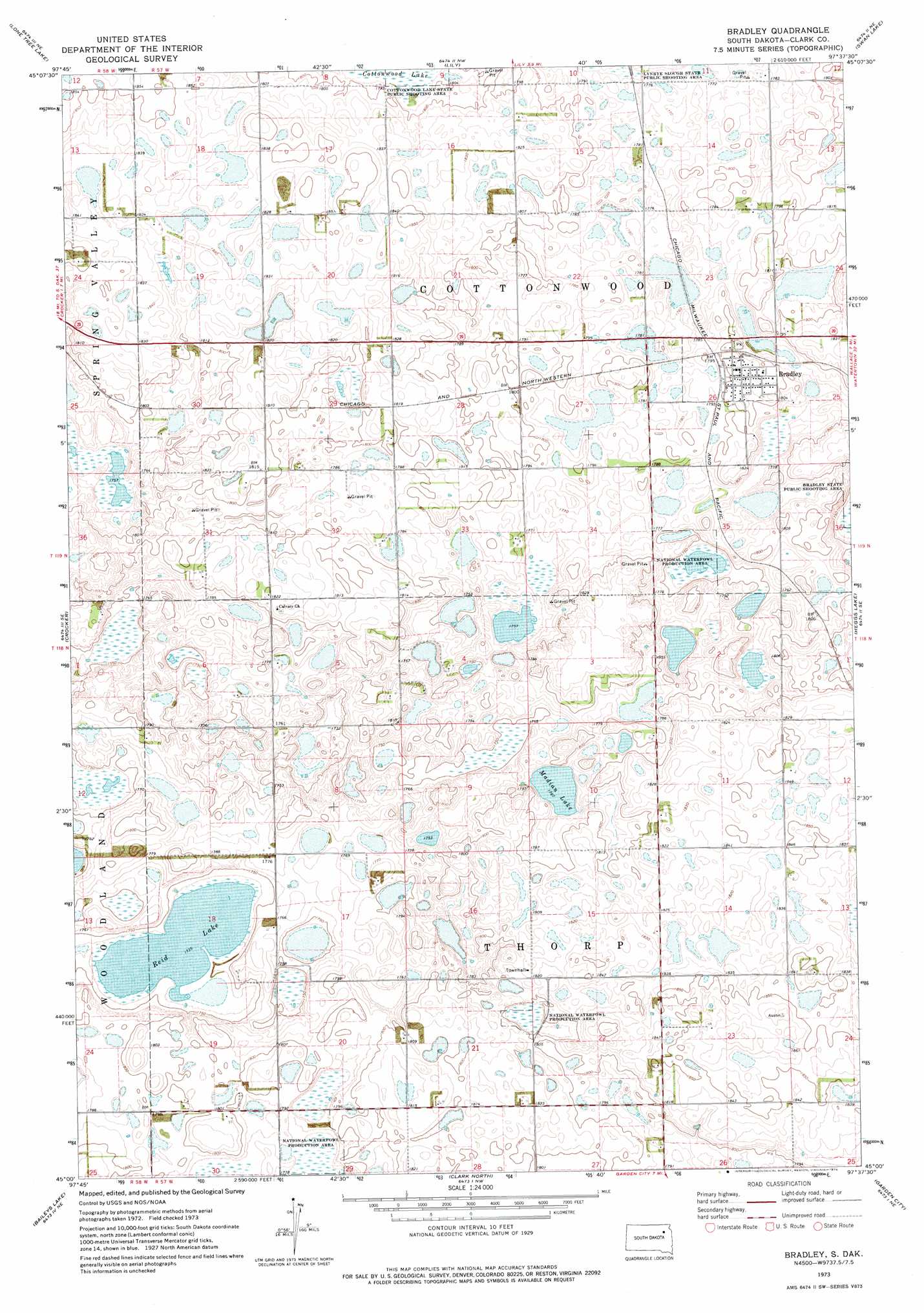
USGS Topo Quad 45097a6 - 1:24,000 scale
| Topo Map Name: | Bradley |
| USGS Topo Quad ID: | 45097a6 |
| Print Size: | ca. 21 1/4" wide x 27" high |
| Southeast Coordinates: | 45° N latitude / 97.625° W longitude |
| Map Center Coordinates: | 45.0625° N latitude / 97.6875° W longitude |
| U.S. State: | SD |
| Filename: | o45097a6.jpg |
| Download Map JPG Image: | Bradley topo map 1:24,000 scale |
| Map Type: | Topographic |
| Topo Series: | 7.5´ |
| Map Scale: | 1:24,000 |
| Source of Map Images: | United States Geological Survey (USGS) |
| Alternate Map Versions: |
Bradley SD 1973, updated 1976 Download PDF Buy paper map Bradley SD 2012 Download PDF Buy paper map Bradley SD 2015 Download PDF Buy paper map |
1:24,000 Topo Quads surrounding Bradley
Andover Sw |
Bristol West |
Bristol East |
Webster |
Waubay Sw |
Crandall |
Lone Tree Lake |
Lily |
Swan Lake |
Florence Nw |
Crocker Sw |
Crocker |
Bradley |
Heggs Lake |
Wallace |
Raymond |
Baileys Lake |
Clark North |
Garden City |
Henry |
Fordham Dam |
Raymond Se |
Clark South |
Naples |
Hazel |
> Back to 45097a1 at 1:100,000 scale
> Back to 45096a1 at 1:250,000 scale
> Back to U.S. Topo Maps home
Bradley topo map: Gazetteer
Bradley: Lakes
Madian Lake elevation 539m 1768′Reid Lake elevation 529m 1735′
Bradley: Populated Places
Bradley elevation 553m 1814′Lily (historical) elevation 546m 1791′
Bradley digital topo map on disk
Buy this Bradley topo map showing relief, roads, GPS coordinates and other geographical features, as a high-resolution digital map file on DVD:
Eastern North Dakota & Eastern South Dakota
Buy digital topo maps: Eastern North Dakota & Eastern South Dakota