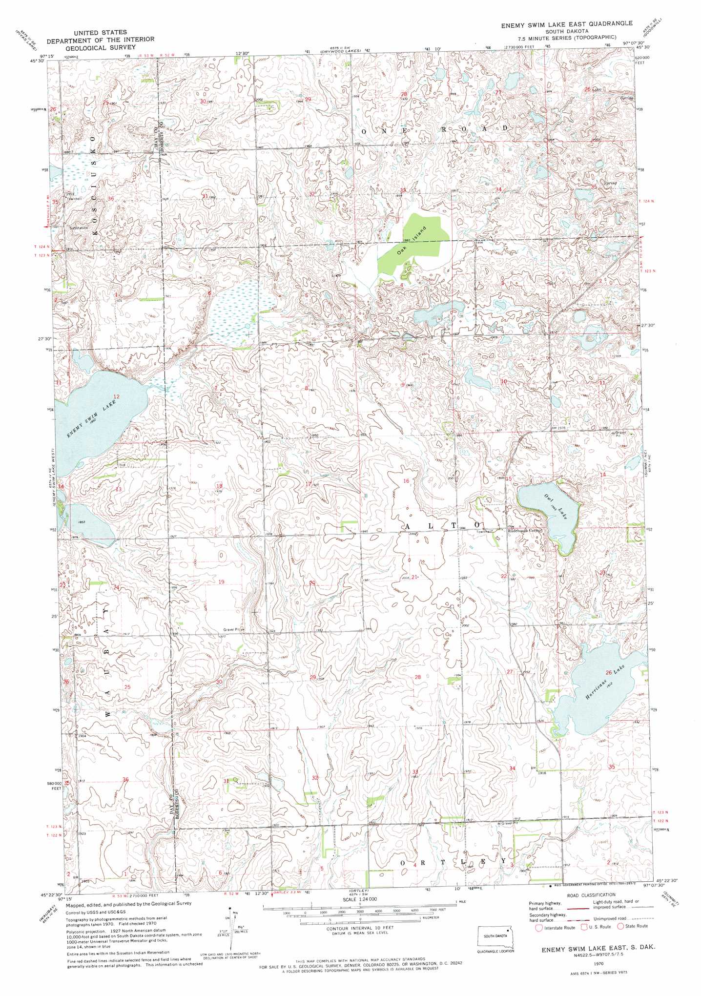
Enemy Swim Lake East Topo Map South Dakota
To zoom in, hover over the map of Enemy Swim Lake East
USGS Topo Quad 45097d2 - 1:24,000 scale
| Topo Map Name: | Enemy Swim Lake East |
| USGS Topo Quad ID: | 45097d2 |
| Print Size: | ca. 21 1/4" wide x 27" high |
| Southeast Coordinates: | 45.375° N latitude / 97.125° W longitude |
| Map Center Coordinates: | 45.4375° N latitude / 97.1875° W longitude |
| U.S. State: | SD |
| Filename: | o45097d2.jpg |
| Download Map JPG Image: | Enemy Swim Lake East topo map 1:24,000 scale |
| Map Type: | Topographic |
| Topo Series: | 7.5´ |
| Map Scale: | 1:24,000 |
| Source of Map Images: | United States Geological Survey (USGS) |
| Alternate Map Versions: |
Enemy Swim Lake East SD 1970, updated 1973 Download PDF Buy paper map Enemy Swim Lake East SD 2012 Download PDF Buy paper map Enemy Swim Lake East SD 2015 Download PDF Buy paper map |
1:24,000 Topo Quads surrounding Enemy Swim Lake East
Lake City |
South Red Iron Lake |
Whitestone Lake |
Sisseton |
Peever Nw |
Eden |
Piyas Lake |
Drywood Lakes |
Goodwill |
Peever |
Roslyn |
Enemy Swim Lake West |
Enemy Swim Lake East |
Summit Ne |
Wilmot Nw |
Waubay Sw |
Waubay |
Ortley |
Summit |
Marvin |
Florence Nw |
Florence Ne |
Lonesome Lake |
Still Lake Ne |
Antelope Valley |
> Back to 45097a1 at 1:100,000 scale
> Back to 45096a1 at 1:250,000 scale
> Back to U.S. Topo Maps home
Enemy Swim Lake East topo map: Gazetteer
Enemy Swim Lake East: Flats
Oak Island elevation 576m 1889′Enemy Swim Lake East: Lakes
Hurricane Lake elevation 583m 1912′Owl Lake elevation 593m 1945′
Enemy Swim Lake East: Populated Places
Rudebusch Corner elevation 608m 1994′Enemy Swim Lake East digital topo map on disk
Buy this Enemy Swim Lake East topo map showing relief, roads, GPS coordinates and other geographical features, as a high-resolution digital map file on DVD:
Eastern North Dakota & Eastern South Dakota
Buy digital topo maps: Eastern North Dakota & Eastern South Dakota