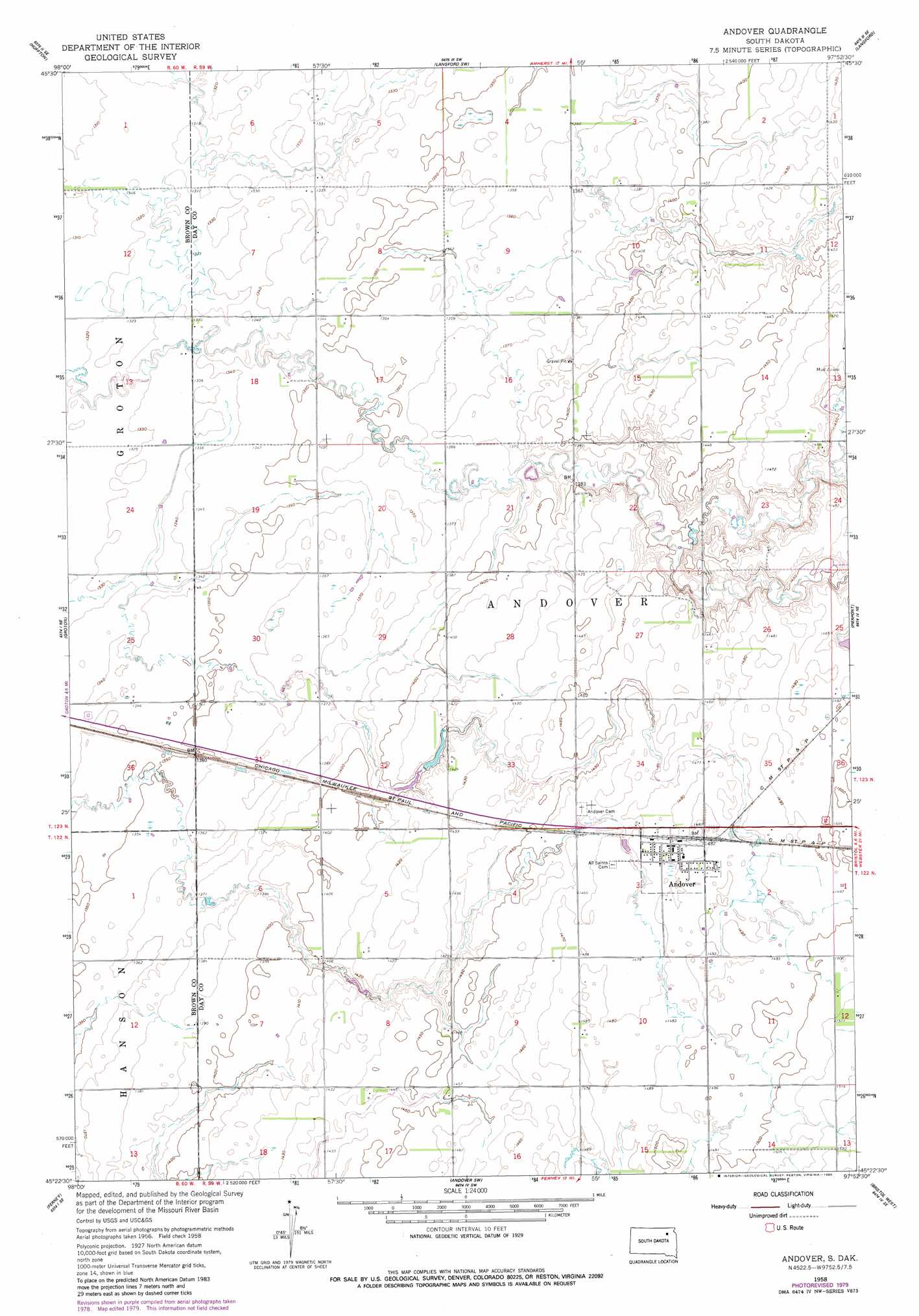
Andover Topo Map South Dakota
To zoom in, hover over the map of Andover
USGS Topo Quad 45097d8 - 1:24,000 scale
| Topo Map Name: | Andover |
| USGS Topo Quad ID: | 45097d8 |
| Print Size: | ca. 21 1/4" wide x 27" high |
| Southeast Coordinates: | 45.375° N latitude / 97.875° W longitude |
| Map Center Coordinates: | 45.4375° N latitude / 97.9375° W longitude |
| U.S. State: | SD |
| Filename: | o45097d8.jpg |
| Download Map JPG Image: | Andover topo map 1:24,000 scale |
| Map Type: | Topographic |
| Topo Series: | 7.5´ |
| Map Scale: | 1:24,000 |
| Source of Map Images: | United States Geological Survey (USGS) |
| Alternate Map Versions: |
Andover SD 1958, updated 1960 Download PDF Buy paper map Andover SD 1958, updated 1980 Download PDF Buy paper map Andover SD 2012 Download PDF Buy paper map Andover SD 2015 Download PDF Buy paper map |
1:24,000 Topo Quads surrounding Andover
Daly Corners |
Claremont |
Amherst |
Spain |
Britton 4 Nw |
Putney |
Huffton |
Langford Sw |
Langford |
Britton 4 Sw |
James |
Groton |
Andover |
Pierpont |
Lynn Lake |
Groton Sw |
Ferney |
Andover Sw |
Bristol West |
Bristol East |
Randolph |
Conde |
Crandall |
Lone Tree Lake |
Lily |
> Back to 45097a1 at 1:100,000 scale
> Back to 45096a1 at 1:250,000 scale
> Back to U.S. Topo Maps home
Andover digital topo map on disk
Buy this Andover topo map showing relief, roads, GPS coordinates and other geographical features, as a high-resolution digital map file on DVD:
Eastern North Dakota & Eastern South Dakota
Buy digital topo maps: Eastern North Dakota & Eastern South Dakota