Claire City Sw Topo Map South Dakota
To zoom in, hover over the map of Claire City Sw
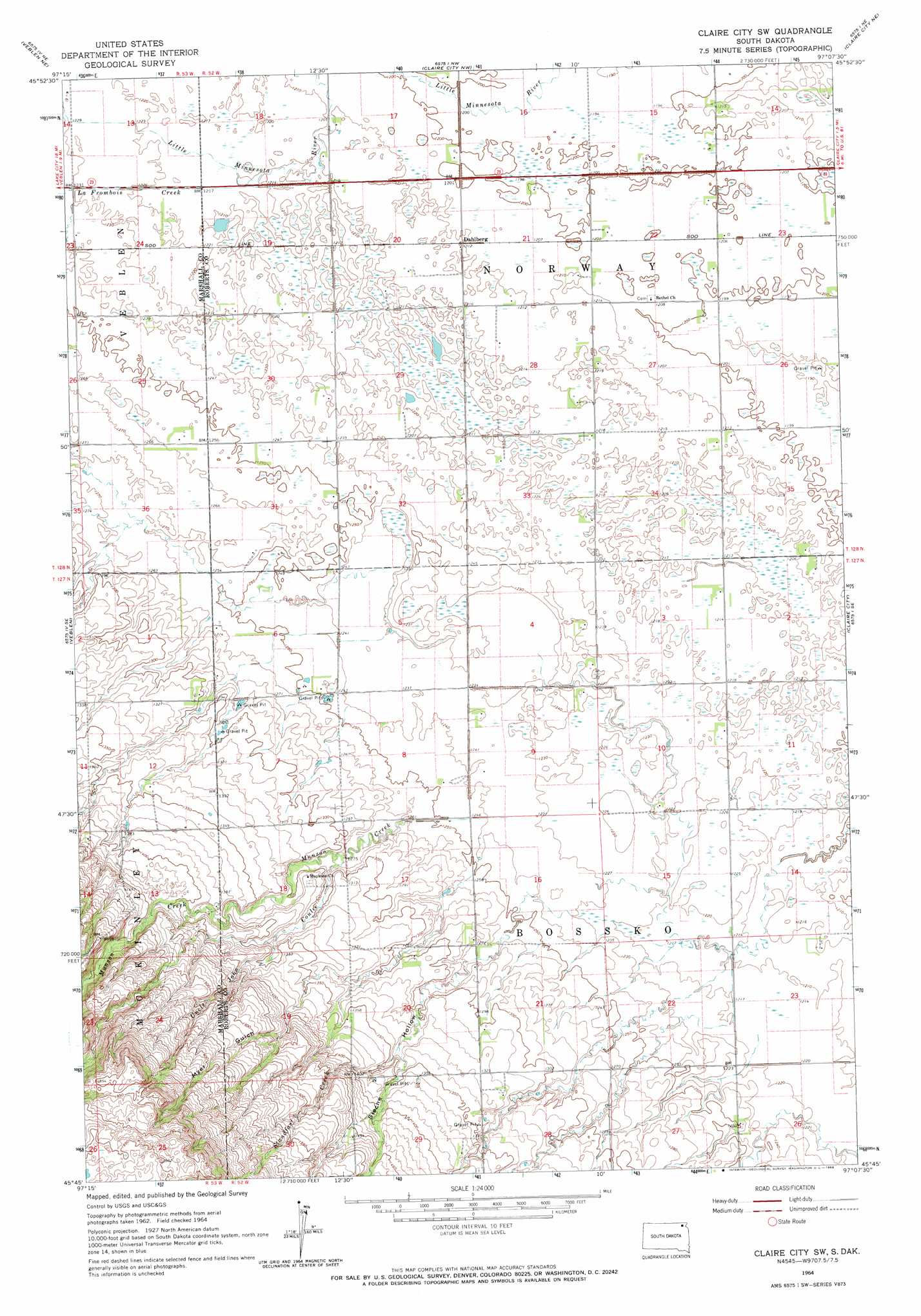
USGS Topo Quad 45097g2 - 1:24,000 scale
| Topo Map Name: | Claire City Sw |
| USGS Topo Quad ID: | 45097g2 |
| Print Size: | ca. 21 1/4" wide x 27" high |
| Southeast Coordinates: | 45.75° N latitude / 97.125° W longitude |
| Map Center Coordinates: | 45.8125° N latitude / 97.1875° W longitude |
| U.S. State: | SD |
| Filename: | o45097g2.jpg |
| Download Map JPG Image: | Claire City Sw topo map 1:24,000 scale |
| Map Type: | Topographic |
| Topo Series: | 7.5´ |
| Map Scale: | 1:24,000 |
| Source of Map Images: | United States Geological Survey (USGS) |
| Alternate Map Versions: |
Claire City SW SD 1964, updated 1967 Download PDF Buy paper map Claire City SW SD 2012 Download PDF Buy paper map Claire City SW SD 2015 Download PDF Buy paper map |
1:24,000 Topo Quads surrounding Claire City Sw
Cayuga |
Geneseo |
Lidgerwood |
Swan Lake |
Hankinson |
Marlow |
Veblen Ne |
Claire City Nw |
Claire City Ne |
New Effington Nw |
Hillhead |
Veblen |
Claire City Sw |
Claire City |
New Effington |
Lake City |
South Red Iron Lake |
Whitestone Lake |
Sisseton |
Peever Nw |
Eden |
Piyas Lake |
Drywood Lakes |
Goodwill |
Peever |
> Back to 45097e1 at 1:100,000 scale
> Back to 45096a1 at 1:250,000 scale
> Back to U.S. Topo Maps home
Claire City Sw topo map: Gazetteer
Claire City Sw: Populated Places
Dahlberg elevation 369m 1210′Claire City Sw: Streams
LaFrambois Creek elevation 369m 1210′Munson Creek elevation 377m 1236′
Standfast Creek elevation 403m 1322′
Claire City Sw: Valleys
Myer Gulch elevation 422m 1384′Sieche Hollow elevation 380m 1246′
Uncle John Coulee elevation 388m 1272′
Claire City Sw digital topo map on disk
Buy this Claire City Sw topo map showing relief, roads, GPS coordinates and other geographical features, as a high-resolution digital map file on DVD:
Eastern North Dakota & Eastern South Dakota
Buy digital topo maps: Eastern North Dakota & Eastern South Dakota