Northville Topo Map South Dakota
To zoom in, hover over the map of Northville
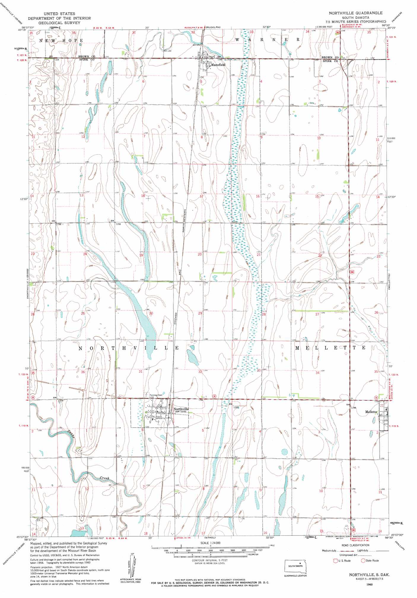
USGS Topo Quad 45098b5 - 1:24,000 scale
| Topo Map Name: | Northville |
| USGS Topo Quad ID: | 45098b5 |
| Print Size: | ca. 21 1/4" wide x 27" high |
| Southeast Coordinates: | 45.125° N latitude / 98.5° W longitude |
| Map Center Coordinates: | 45.1875° N latitude / 98.5625° W longitude |
| U.S. State: | SD |
| Filename: | o45098b5.jpg |
| Download Map JPG Image: | Northville topo map 1:24,000 scale |
| Map Type: | Topographic |
| Topo Series: | 7.5´ |
| Map Scale: | 1:24,000 |
| Source of Map Images: | United States Geological Survey (USGS) |
| Alternate Map Versions: |
Northville SD 1960, updated 1961 Download PDF Buy paper map Northville SD 2012 Download PDF Buy paper map Northville SD 2015 Download PDF Buy paper map |
1:24,000 Topo Quads surrounding Northville
Mina |
Lake Parmley |
Aberdeen West |
Aberdeen East |
Bath |
Mina Se |
Lake Parmley Sw |
Rudolph |
Warner |
Stratford |
Cresbard Ne |
Chelsea |
Northville |
Mellette |
Brentford |
Cresbard Se |
Northville Sw |
Athol |
Gallup |
Brentford Se |
Rockham |
Zell |
Redfield North |
Ashton |
Frankfort |
> Back to 45098a1 at 1:100,000 scale
> Back to 45098a1 at 1:250,000 scale
> Back to U.S. Topo Maps home
Northville topo map: Gazetteer
Northville: Guts
Big Slough elevation 392m 1286′Northville: Populated Places
Mansfield elevation 395m 1295′Northville elevation 395m 1295′
Northville digital topo map on disk
Buy this Northville topo map showing relief, roads, GPS coordinates and other geographical features, as a high-resolution digital map file on DVD:
Eastern North Dakota & Eastern South Dakota
Buy digital topo maps: Eastern North Dakota & Eastern South Dakota