Plainview Colony Ne Topo Map South Dakota
To zoom in, hover over the map of Plainview Colony Ne
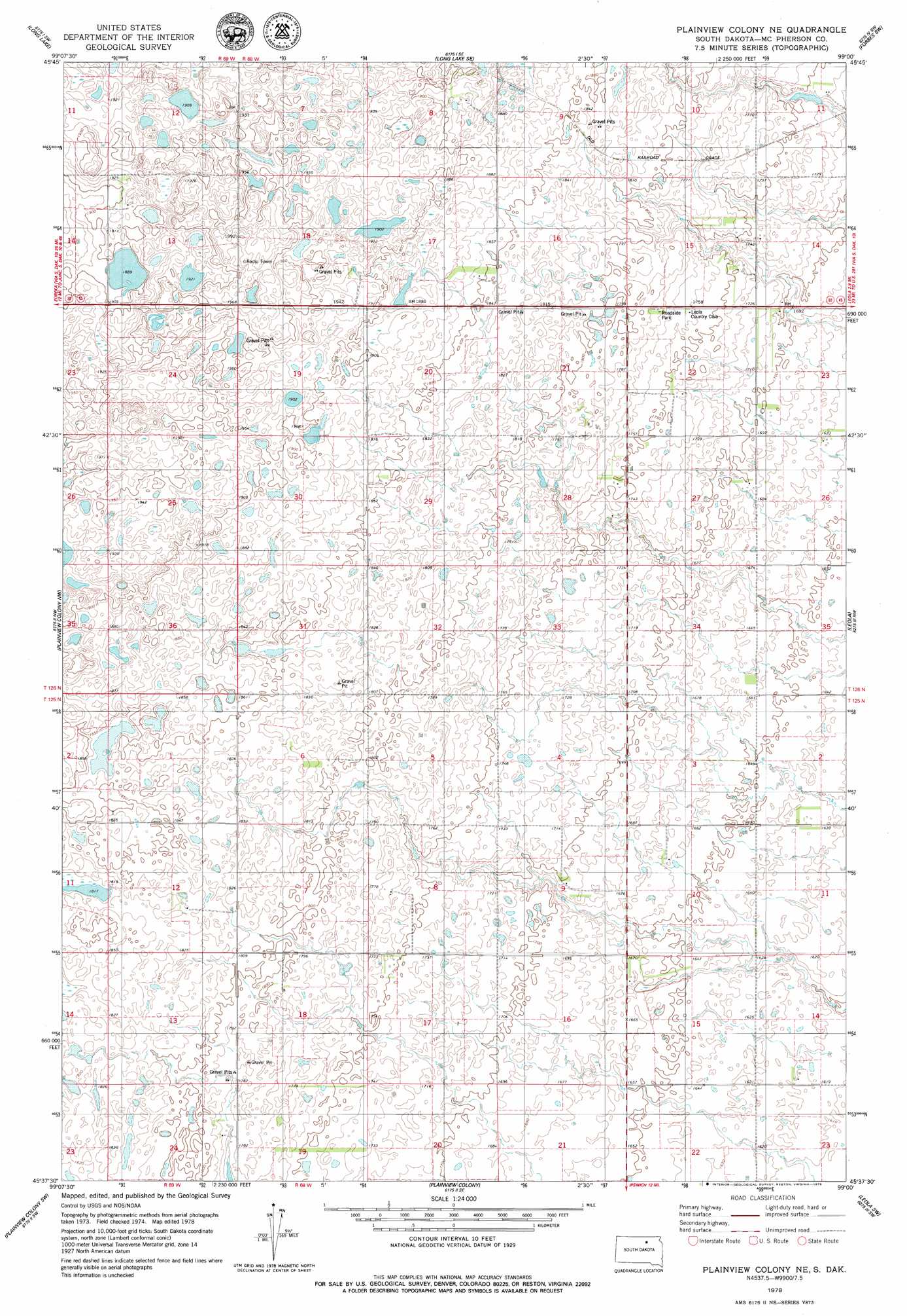
USGS Topo Quad 45099f1 - 1:24,000 scale
| Topo Map Name: | Plainview Colony Ne |
| USGS Topo Quad ID: | 45099f1 |
| Print Size: | ca. 21 1/4" wide x 27" high |
| Southeast Coordinates: | 45.625° N latitude / 99° W longitude |
| Map Center Coordinates: | 45.6875° N latitude / 99.0625° W longitude |
| U.S. State: | SD |
| Filename: | o45099f1.jpg |
| Download Map JPG Image: | Plainview Colony Ne topo map 1:24,000 scale |
| Map Type: | Topographic |
| Topo Series: | 7.5´ |
| Map Scale: | 1:24,000 |
| Source of Map Images: | United States Geological Survey (USGS) |
| Alternate Map Versions: |
Plainview Colony NE SD 1978, updated 1979 Download PDF Buy paper map Plainview Colony NE SD 2012 Download PDF Buy paper map Plainview Colony NE SD 2015 Download PDF Buy paper map |
1:24,000 Topo Quads surrounding Plainview Colony Ne
Schumacher Lake Ne |
Long Lake Nw |
Long Lake Ne |
Forbes Nw |
Forbes |
Schumacher Lake |
Long Lake |
Long Lake Se |
Forbes Sw |
Forbes Se |
Hosmer Ne |
Plainview Colony Nw |
Plainview Colony Ne |
Leola |
Wetonka North |
Hosmer Se |
Plainview Colony Sw |
Plainview Colony |
Leola Sw |
Wetonka South |
Roscoe |
Beebe |
Ipswich |
Mina Nw |
Mina |
> Back to 45099e1 at 1:100,000 scale
> Back to 45098a1 at 1:250,000 scale
> Back to U.S. Topo Maps home
No gazetteer data is available for the Plainview Colony Ne topo map sheet.
Plainview Colony Ne digital topo map on disk
Buy this Plainview Colony Ne topo map showing relief, roads, GPS coordinates and other geographical features, as a high-resolution digital map file on DVD:
Eastern North Dakota & Eastern South Dakota
Buy digital topo maps: Eastern North Dakota & Eastern South Dakota