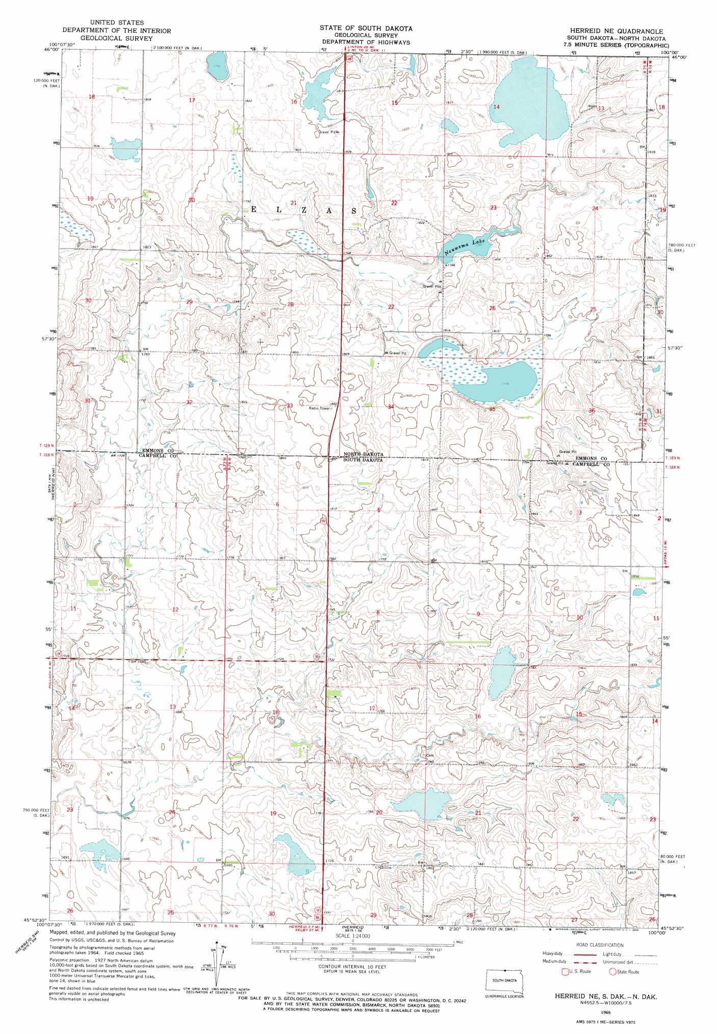
Herreid Ne Topo Map South Dakota
To zoom in, hover over the map of Herreid Ne
USGS Topo Quad 45100h1 - 1:24,000 scale
| Topo Map Name: | Herreid Ne |
| USGS Topo Quad ID: | 45100h1 |
| Print Size: | ca. 21 1/4" wide x 27" high |
| Southeast Coordinates: | 45.875° N latitude / 100° W longitude |
| Map Center Coordinates: | 45.9375° N latitude / 100.0625° W longitude |
| U.S. States: | SD, ND |
| Filename: | o45100h1.jpg |
| Download Map JPG Image: | Herreid Ne topo map 1:24,000 scale |
| Map Type: | Topographic |
| Topo Series: | 7.5´ |
| Map Scale: | 1:24,000 |
| Source of Map Images: | United States Geological Survey (USGS) |
| Alternate Map Versions: |
Herreid NE SD 1965, updated 1966 Download PDF Buy paper map Herreid NE SD 2011 Download PDF Buy paper map Herreid NE SD 2012 Download PDF Buy paper map Herreid NE SD 2015 Download PDF Buy paper map |
1:24,000 Topo Quads surrounding Herreid Ne
Grassna Ne |
Strasburg |
Senger Lake North |
Weisser Dam West |
Weisser Dam East |
Grassna |
Westfield |
Senger Lake South |
Hague |
Hague Se |
Pollock |
Herreid Nw |
Herreid Ne |
Zeeland Nw |
Zeeland |
Pollock Se |
Herreid Sw |
Herreid |
Zeeland Sw |
Mutske Lake |
Mobridge Ne |
Selby Nw |
Mound City |
Salt Lake |
Flat Lake |
> Back to 45100e1 at 1:100,000 scale
> Back to 45100a1 at 1:250,000 scale
> Back to U.S. Topo Maps home
Herreid Ne topo map: Gazetteer
Herreid Ne: Dams
Nieusma Dam elevation 543m 1781′Herreid Ne: Lakes
Neuwsma Lake elevation 544m 1784′Herreid Ne digital topo map on disk
Buy this Herreid Ne topo map showing relief, roads, GPS coordinates and other geographical features, as a high-resolution digital map file on DVD:
Eastern North Dakota & Eastern South Dakota
Buy digital topo maps: Eastern North Dakota & Eastern South Dakota