Pollock Topo Map South Dakota
To zoom in, hover over the map of Pollock
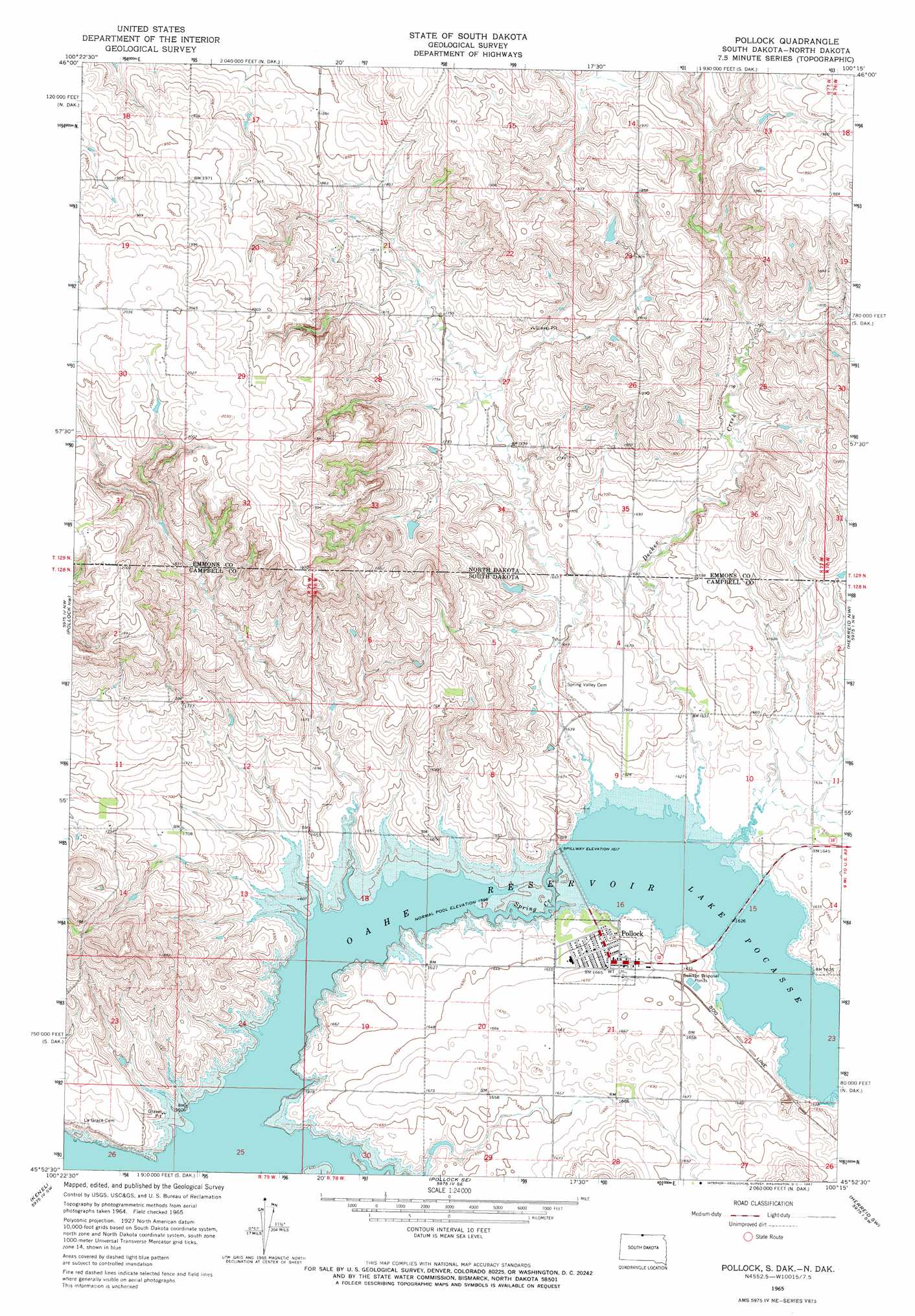
USGS Topo Quad 45100h3 - 1:24,000 scale
| Topo Map Name: | Pollock |
| USGS Topo Quad ID: | 45100h3 |
| Print Size: | ca. 21 1/4" wide x 27" high |
| Southeast Coordinates: | 45.875° N latitude / 100.25° W longitude |
| Map Center Coordinates: | 45.9375° N latitude / 100.3125° W longitude |
| U.S. States: | SD, ND |
| Filename: | o45100h3.jpg |
| Download Map JPG Image: | Pollock topo map 1:24,000 scale |
| Map Type: | Topographic |
| Topo Series: | 7.5´ |
| Map Scale: | 1:24,000 |
| Source of Map Images: | United States Geological Survey (USGS) |
| Alternate Map Versions: |
Pollock SD 1965, updated 1967 Download PDF Buy paper map Pollock SD 2011 Download PDF Buy paper map Pollock SD 2012 Download PDF Buy paper map Pollock SD 2015 Download PDF Buy paper map |
1:24,000 Topo Quads surrounding Pollock
Fort Yates Ne |
Grassna Nw |
Grassna Ne |
Strasburg |
Senger Lake North |
Fort Yates Se |
Kiefer Buttes |
Grassna |
Westfield |
Senger Lake South |
Mahto Ne |
Pollock Nw |
Pollock |
Herreid Nw |
Herreid Ne |
Kline Buttes |
Kenel |
Pollock Se |
Herreid Sw |
Herreid |
Wakpala |
Mobridge Nw |
Mobridge Ne |
Selby Nw |
Mound City |
> Back to 45100e1 at 1:100,000 scale
> Back to 45100a1 at 1:250,000 scale
> Back to U.S. Topo Maps home
Pollock topo map: Gazetteer
Pollock: Bays
Pollock Bay elevation 491m 1610′Vanderlaan Bay elevation 491m 1610′
Pollock: Parks
Pocasse National Wildlife Refuge elevation 493m 1617′Pollock Recreation Area elevation 496m 1627′
West Pollock Recreation Area elevation 507m 1663′
Pollock: Populated Places
Pollock elevation 504m 1653′Pollock: Reservoirs
Lake Pocasse elevation 494m 1620′Pollock: Streams
Decker Creek elevation 493m 1617′Decker Creek elevation 494m 1620′
Pollock digital topo map on disk
Buy this Pollock topo map showing relief, roads, GPS coordinates and other geographical features, as a high-resolution digital map file on DVD:
Eastern North Dakota & Eastern South Dakota
Buy digital topo maps: Eastern North Dakota & Eastern South Dakota