Dupree Topo Map South Dakota
To zoom in, hover over the map of Dupree
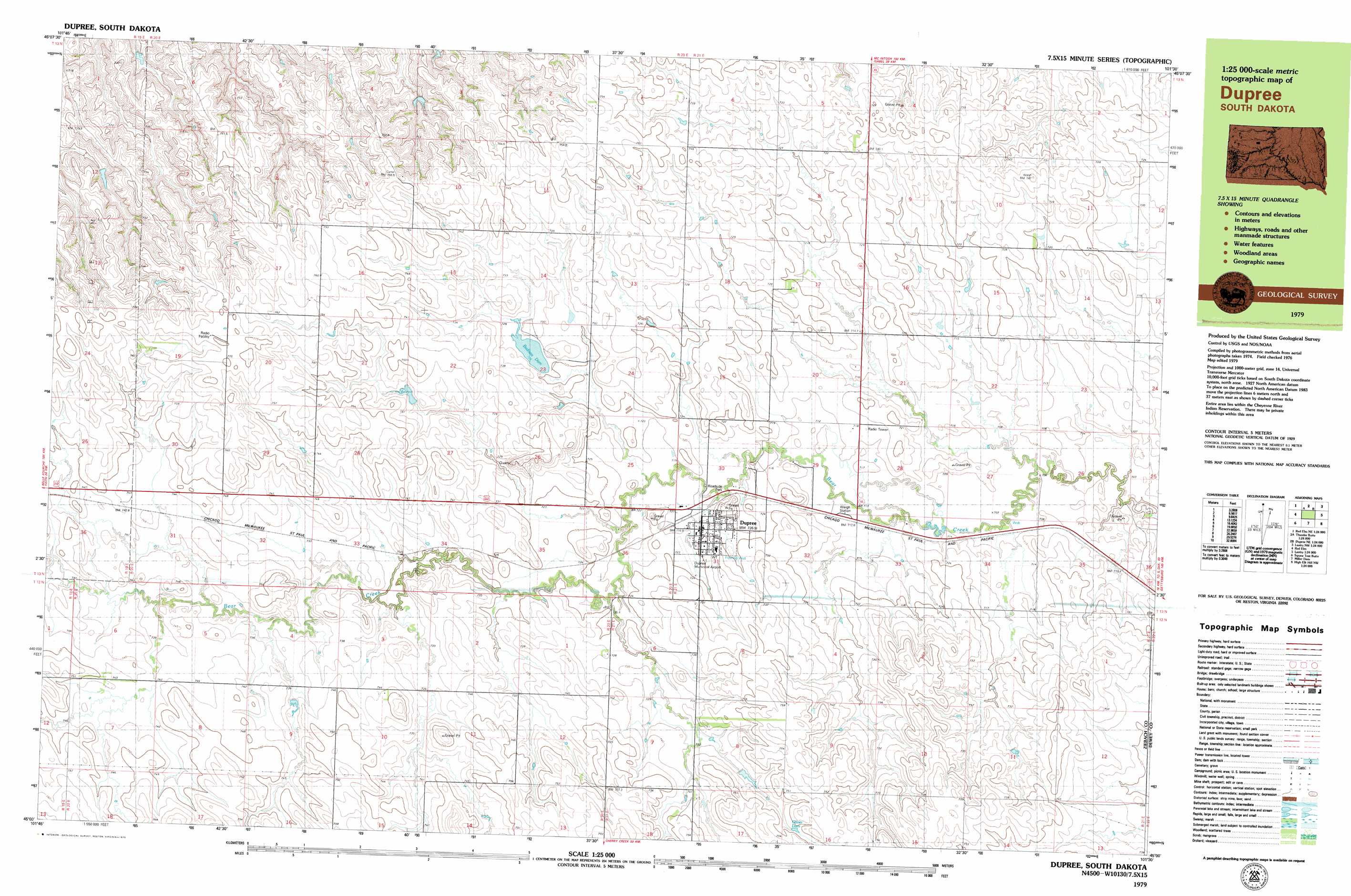
USGS Topo Quad 45101a5 - 1:25,000 scale
| Topo Map Name: | Dupree |
| USGS Topo Quad ID: | 45101a5 |
| Print Size: | ca. 39" wide x 24" high |
| Southeast Coordinates: | 45° N latitude / 101.5° W longitude |
| Map Center Coordinates: | 45.0625° N latitude / 101.625° W longitude |
| U.S. State: | SD |
| Filename: | k45101a5.jpg |
| Download Map JPG Image: | Dupree topo map 1:25,000 scale |
| Map Type: | Topographic |
| Topo Series: | 7.5´x15´ |
| Map Scale: | 1:25,000 |
| Source of Map Images: | United States Geological Survey (USGS) |
| Alternate Map Versions: |
1:24,000 Topo Quads surrounding Dupree
Glad Valley Se |
Irish Creek Sw |
Irish Creek Se |
Isabel Sw |
Peach Lake |
Redelm Ne |
Thunder Butte |
Dupree Ne |
Lantry Nw |
Lantry Ne |
Red Elm |
Dupree |
Lantry |
Lantry Se |
|
Bull Creek 2 Ne |
Diermier Ranch |
Miller Dam |
High Elk Hill Nw |
High Elk Hill |
Red Scaffold |
Longbrake Ranch |
Sears Dam |
High Elk Hill Sw |
High Elk Hill Se |
> Back to 45101a1 at 1:100,000 scale
> Back to 45100a1 at 1:250,000 scale
> Back to U.S. Topo Maps home
Dupree topo map: Gazetteer
Dupree: Airports
Dupree Municipal Airport elevation 741m 2431′Dupree: Dams
A Dosch Dam elevation 747m 2450′B Butler Number 1 Dam elevation 746m 2447′
B Butler Number 2 Dam elevation 753m 2470′
B Butler Number 3 Dam elevation 742m 2434′
Bednar Dam elevation 728m 2388′
C Mraz Dam elevation 742m 2434′
Jay A Lake Number 2 Dam elevation 755m 2477′
L Woodward Dam elevation 710m 2329′
Roy Veit Number 4 Dam elevation 728m 2388′
Tribe Number 2 Dam elevation 735m 2411′
Dupree: Populated Places
Dupree elevation 729m 2391′Dupree: Reservoirs
Bedners Dam elevation 728m 2388′Oliver Dam elevation 747m 2450′
Dupree digital topo map on disk
Buy this Dupree topo map showing relief, roads, GPS coordinates and other geographical features, as a high-resolution digital map file on DVD:
Eastern North Dakota & Eastern South Dakota
Buy digital topo maps: Eastern North Dakota & Eastern South Dakota