Lantry Nw Topo Map South Dakota
To zoom in, hover over the map of Lantry Nw
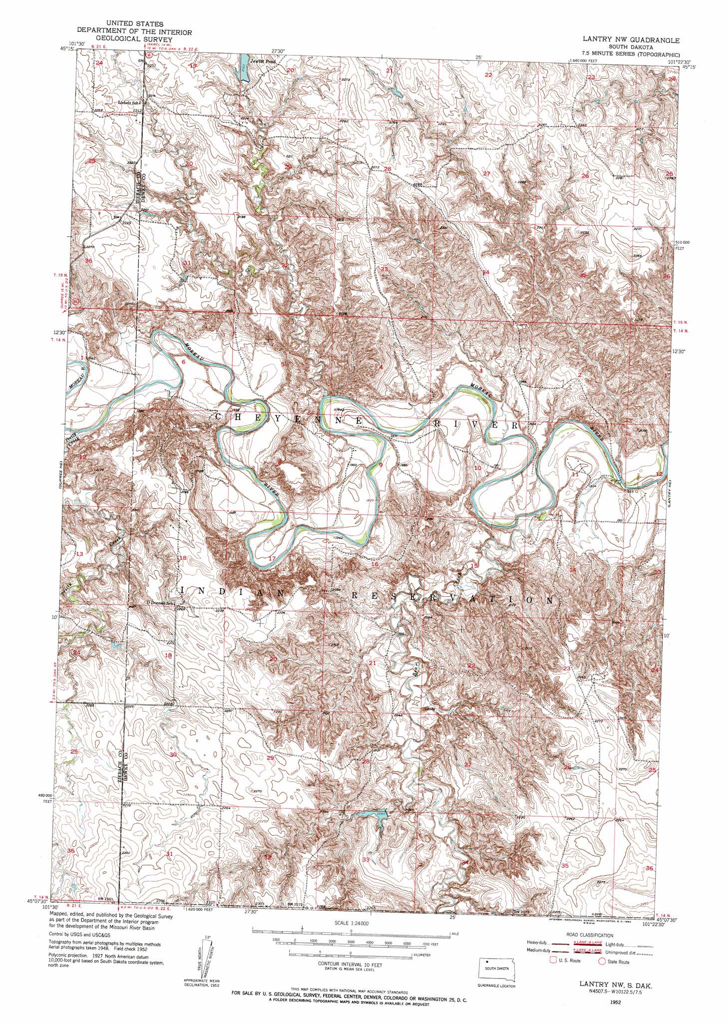
USGS Topo Quad 45101b4 - 1:24,000 scale
| Topo Map Name: | Lantry Nw |
| USGS Topo Quad ID: | 45101b4 |
| Print Size: | ca. 21 1/4" wide x 27" high |
| Southeast Coordinates: | 45.125° N latitude / 101.375° W longitude |
| Map Center Coordinates: | 45.1875° N latitude / 101.4375° W longitude |
| U.S. State: | SD |
| Filename: | o45101b4.jpg |
| Download Map JPG Image: | Lantry Nw topo map 1:24,000 scale |
| Map Type: | Topographic |
| Topo Series: | 7.5´ |
| Map Scale: | 1:24,000 |
| Source of Map Images: | United States Geological Survey (USGS) |
| Alternate Map Versions: |
Lantry NW SD 1952, updated 1954 Download PDF Buy paper map Lantry NW SD 1952, updated 1954 Download PDF Buy paper map Lantry NW SD 2012 Download PDF Buy paper map Lantry NW SD 2015 Download PDF Buy paper map |
1:24,000 Topo Quads surrounding Lantry Nw
Irish Creek Nw |
Irish Creek Ne |
Isabel |
Firesteel |
Brewer Butte |
Irish Creek Sw |
Irish Creek Se |
Isabel Sw |
Peach Lake |
Livermant Lake |
Thunder Butte |
Dupree Ne |
Lantry Nw |
Lantry Ne |
Parade Nw |
Dupree |
Lantry |
Lantry Se |
Parade Sw |
|
Diermier Ranch |
Miller Dam |
High Elk Hill Nw |
High Elk Hill |
Herbert Creek |
> Back to 45101a1 at 1:100,000 scale
> Back to 45100a1 at 1:250,000 scale
> Back to U.S. Topo Maps home
Lantry Nw topo map: Gazetteer
Lantry Nw: Dams
J Reich Number 1 Dam elevation 704m 2309′J Reich Number 2 Dam elevation 704m 2309′
Johnson Dam elevation 659m 2162′
O Jewett Dam elevation 679m 2227′
P Garr Dam elevation 687m 2253′
Lantry Nw: Reservoirs
Jewitt Pond elevation 669m 2194′Lantry Nw: Streams
Bear Creek elevation 580m 1902′Pretty Creek elevation 597m 1958′
Lantry Nw digital topo map on disk
Buy this Lantry Nw topo map showing relief, roads, GPS coordinates and other geographical features, as a high-resolution digital map file on DVD:
Eastern North Dakota & Eastern South Dakota
Buy digital topo maps: Eastern North Dakota & Eastern South Dakota