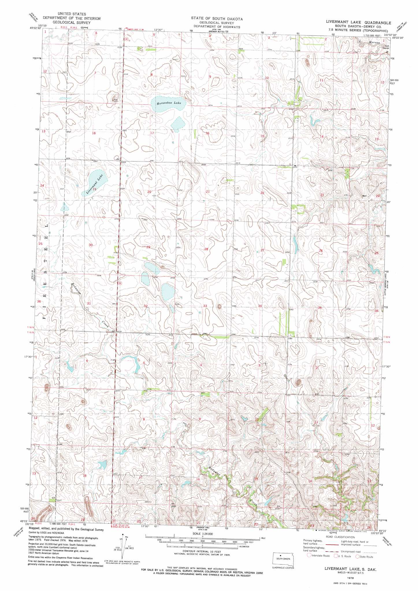
Livermant Lake Topo Map South Dakota
To zoom in, hover over the map of Livermant Lake
USGS Topo Quad 45101c2 - 1:24,000 scale
| Topo Map Name: | Livermant Lake |
| USGS Topo Quad ID: | 45101c2 |
| Print Size: | ca. 21 1/4" wide x 27" high |
| Southeast Coordinates: | 45.25° N latitude / 101.125° W longitude |
| Map Center Coordinates: | 45.3125° N latitude / 101.1875° W longitude |
| U.S. State: | SD |
| Filename: | o45101c2.jpg |
| Download Map JPG Image: | Livermant Lake topo map 1:24,000 scale |
| Map Type: | Topographic |
| Topo Series: | 7.5´ |
| Map Scale: | 1:24,000 |
| Source of Map Images: | United States Geological Survey (USGS) |
| Alternate Map Versions: |
Livermant Lake SD 1978, updated 1979 Download PDF Buy paper map Livermant Lake SD 2012 Download PDF Buy paper map Livermant Lake SD 2015 Download PDF Buy paper map |
1:24,000 Topo Quads surrounding Livermant Lake
Black Horse Sw |
Black Horse Se |
Miscol Sw |
Miscol Se |
Little Eagle Sw |
Isabel |
Firesteel |
Brewer Butte |
Timber Lake |
Glencross |
Isabel Sw |
Peach Lake |
Livermant Lake |
Little Moreau Lake |
White Horse |
Lantry Nw |
Lantry Ne |
Parade Nw |
Parade Ne |
Ridgeview Nw |
Lantry |
Lantry Se |
Parade Sw |
Parade |
Ridgeview Sw |
> Back to 45101a1 at 1:100,000 scale
> Back to 45100a1 at 1:250,000 scale
> Back to U.S. Topo Maps home
Livermant Lake topo map: Gazetteer
Livermant Lake: Dams
B Oleary Dam elevation 678m 2224′O'Leary Dam elevation 676m 2217′
Livermant Lake: Lakes
Horseshoe Lake elevation 675m 2214′Livermant Lake elevation 675m 2214′
Livermant Lake digital topo map on disk
Buy this Livermant Lake topo map showing relief, roads, GPS coordinates and other geographical features, as a high-resolution digital map file on DVD:
Eastern North Dakota & Eastern South Dakota
Buy digital topo maps: Eastern North Dakota & Eastern South Dakota