Irish Creek Sw Topo Map South Dakota
To zoom in, hover over the map of Irish Creek Sw
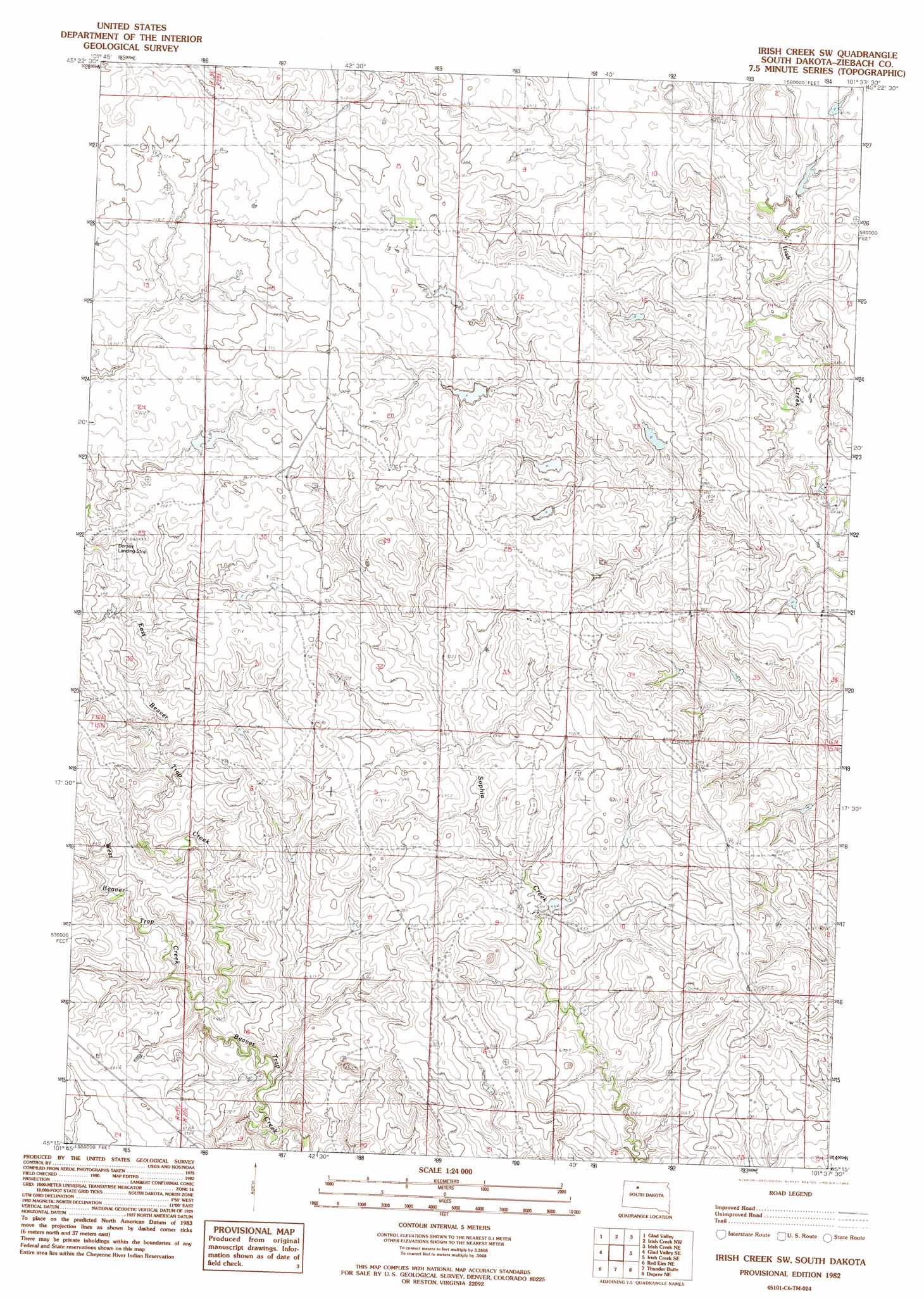
USGS Topo Quad 45101c6 - 1:24,000 scale
| Topo Map Name: | Irish Creek Sw |
| USGS Topo Quad ID: | 45101c6 |
| Print Size: | ca. 21 1/4" wide x 27" high |
| Southeast Coordinates: | 45.25° N latitude / 101.625° W longitude |
| Map Center Coordinates: | 45.3125° N latitude / 101.6875° W longitude |
| U.S. State: | SD |
| Filename: | o45101c6.jpg |
| Download Map JPG Image: | Irish Creek Sw topo map 1:24,000 scale |
| Map Type: | Topographic |
| Topo Series: | 7.5´ |
| Map Scale: | 1:24,000 |
| Source of Map Images: | United States Geological Survey (USGS) |
| Alternate Map Versions: |
Irish Creek SW SD 1982, updated 1983 Download PDF Buy paper map Irish Creek SW SD 2012 Download PDF Buy paper map Irish Creek SW SD 2015 Download PDF Buy paper map |
1:24,000 Topo Quads surrounding Irish Creek Sw
Black Horse Butte |
Twin Butte |
Cottonwood Creek Sw |
Cottonwood Creek Se |
Black Horse Sw |
Glad Valley Nw |
Glad Valley |
Irish Creek Nw |
Irish Creek Ne |
Isabel |
Glad Valley Sw |
Glad Valley Se |
Irish Creek Sw |
Irish Creek Se |
Isabel Sw |
Redelm Nw |
Redelm Ne |
Thunder Butte |
Dupree Ne |
Lantry Nw |
Red Elm Sw |
Red Elm |
Dupree |
Lantry |
> Back to 45101a1 at 1:100,000 scale
> Back to 45100a1 at 1:250,000 scale
> Back to U.S. Topo Maps home
Irish Creek Sw topo map: Gazetteer
Irish Creek Sw: Airports
Dorsey Landing Strip elevation 700m 2296′Irish Creek Sw: Dams
Bud Young Section 3 Dam elevation 695m 2280′Clarence Smith Dam elevation 673m 2208′
K Dorsey Number 1 Dam elevation 710m 2329′
K Dorsey Number 2 Dam elevation 707m 2319′
M Alspach Dam elevation 695m 2280′
Roby Meyer Number 1 Dam elevation 677m 2221′
Roby Meyer Number 2 Dam elevation 709m 2326′
Roby Meyer Number 3 Dam elevation 700m 2296′
Irish Creek Sw: Streams
East Beaver Trap Creek elevation 653m 2142′West Beaver Trap Creek elevation 653m 2142′
Irish Creek Sw digital topo map on disk
Buy this Irish Creek Sw topo map showing relief, roads, GPS coordinates and other geographical features, as a high-resolution digital map file on DVD:
Eastern North Dakota & Eastern South Dakota
Buy digital topo maps: Eastern North Dakota & Eastern South Dakota