Firesteel Topo Map South Dakota
To zoom in, hover over the map of Firesteel
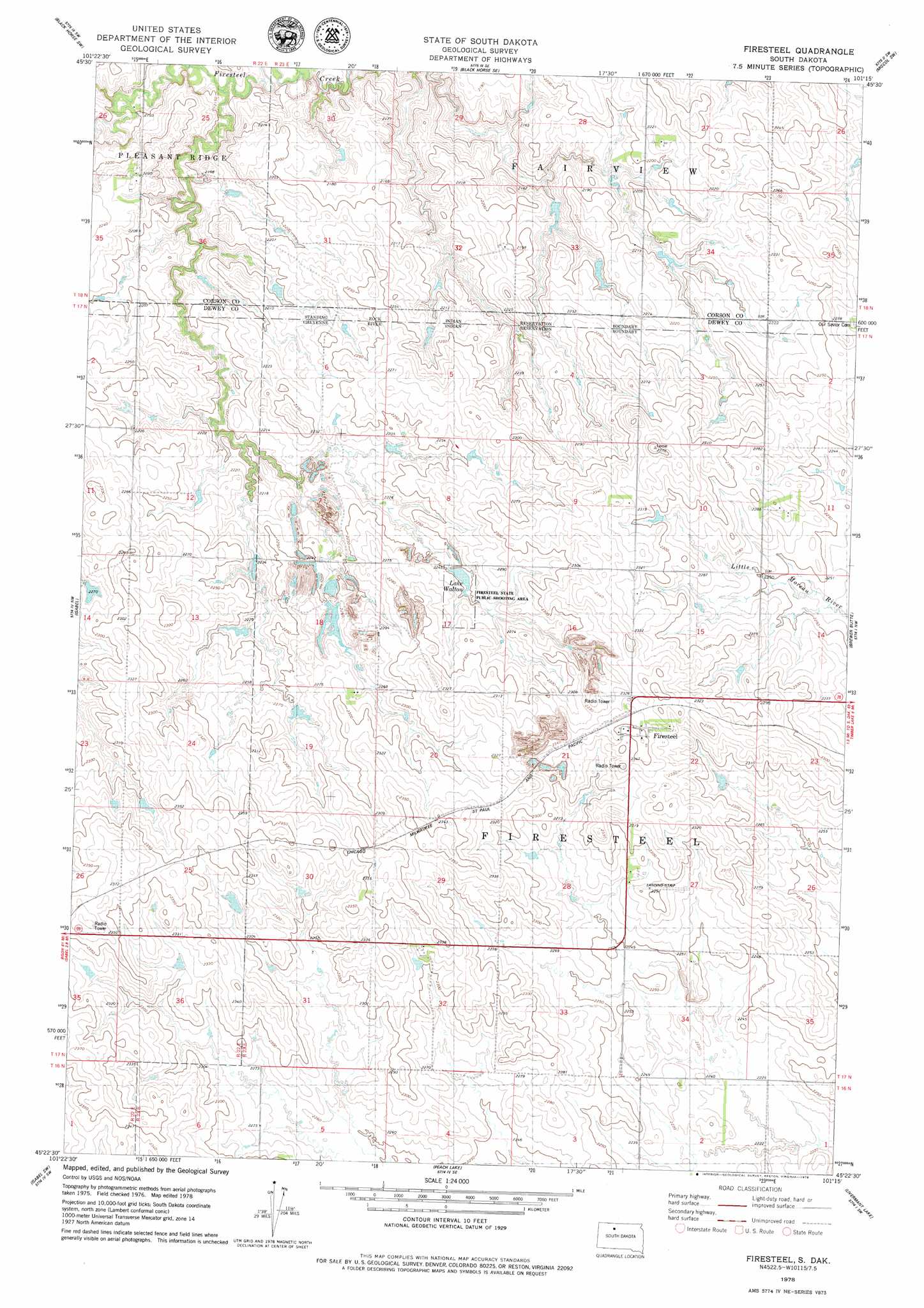
USGS Topo Quad 45101d3 - 1:24,000 scale
| Topo Map Name: | Firesteel |
| USGS Topo Quad ID: | 45101d3 |
| Print Size: | ca. 21 1/4" wide x 27" high |
| Southeast Coordinates: | 45.375° N latitude / 101.25° W longitude |
| Map Center Coordinates: | 45.4375° N latitude / 101.3125° W longitude |
| U.S. State: | SD |
| Filename: | o45101d3.jpg |
| Download Map JPG Image: | Firesteel topo map 1:24,000 scale |
| Map Type: | Topographic |
| Topo Series: | 7.5´ |
| Map Scale: | 1:24,000 |
| Source of Map Images: | United States Geological Survey (USGS) |
| Alternate Map Versions: |
Firesteel SD 1978, updated 1979 Download PDF Buy paper map Firesteel SD 2012 Download PDF Buy paper map Firesteel SD 2015 Download PDF Buy paper map |
1:24,000 Topo Quads surrounding Firesteel
Cottonwood Creek Ne |
Black Horse |
Black Horse Ne |
Miscol |
Miscol Ne |
Cottonwood Creek Se |
Black Horse Sw |
Black Horse Se |
Miscol Sw |
Miscol Se |
Irish Creek Ne |
Isabel |
Firesteel |
Brewer Butte |
Timber Lake |
Irish Creek Se |
Isabel Sw |
Peach Lake |
Livermant Lake |
Little Moreau Lake |
Dupree Ne |
Lantry Nw |
Lantry Ne |
Parade Nw |
Parade Ne |
> Back to 45101a1 at 1:100,000 scale
> Back to 45100a1 at 1:250,000 scale
> Back to U.S. Topo Maps home
Firesteel topo map: Gazetteer
Firesteel: Dams
School Land Dam elevation 717m 2352′Firesteel: Lakes
Lake Wilson elevation 685m 2247′Firesteel: Parks
Firesteel State Public Shooting Area elevation 688m 2257′Firesteel: Populated Places
Firesteel elevation 717m 2352′Firesteel: Reservoirs
Lake Walton elevation 686m 2250′Firesteel digital topo map on disk
Buy this Firesteel topo map showing relief, roads, GPS coordinates and other geographical features, as a high-resolution digital map file on DVD:
Eastern North Dakota & Eastern South Dakota
Buy digital topo maps: Eastern North Dakota & Eastern South Dakota