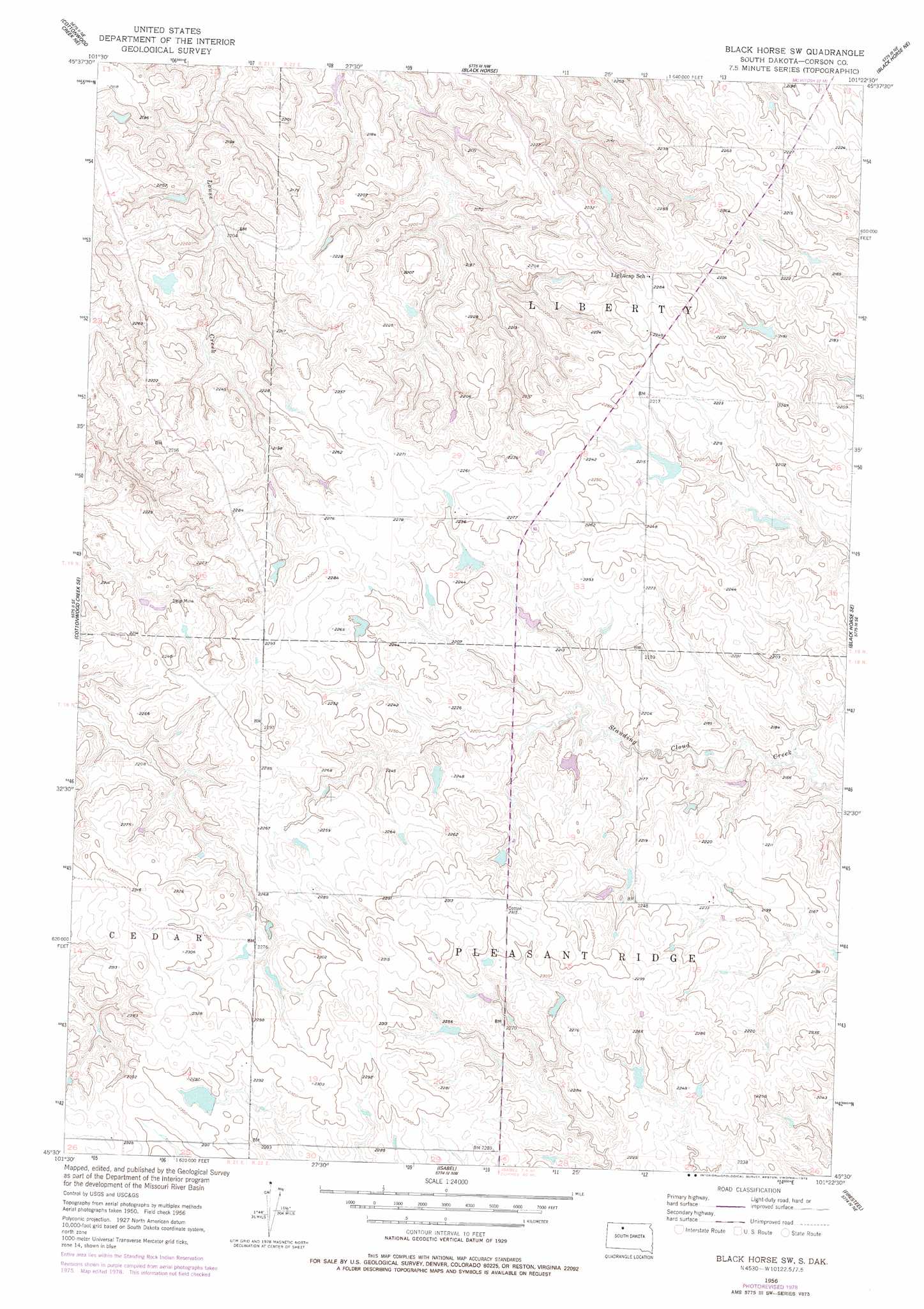
Black Horse Sw Topo Map South Dakota
To zoom in, hover over the map of Black Horse Sw
USGS Topo Quad 45101e4 - 1:24,000 scale
| Topo Map Name: | Black Horse Sw |
| USGS Topo Quad ID: | 45101e4 |
| Print Size: | ca. 21 1/4" wide x 27" high |
| Southeast Coordinates: | 45.5° N latitude / 101.375° W longitude |
| Map Center Coordinates: | 45.5625° N latitude / 101.4375° W longitude |
| U.S. State: | SD |
| Filename: | o45101e4.jpg |
| Download Map JPG Image: | Black Horse Sw topo map 1:24,000 scale |
| Map Type: | Topographic |
| Topo Series: | 7.5´ |
| Map Scale: | 1:24,000 |
| Source of Map Images: | United States Geological Survey (USGS) |
| Alternate Map Versions: |
Black Horse SW SD 1956, updated 1957 Download PDF Buy paper map Black Horse SW SD 1956, updated 1978 Download PDF Buy paper map Black Horse SW SD 2012 Download PDF Buy paper map Black Horse SW SD 2015 Download PDF Buy paper map |
1:24,000 Topo Quads surrounding Black Horse Sw
Skull Butte |
Morristown Se |
Mcintosh Sw |
Mcintosh Se |
Bullhead Sw |
Cottonwood Creek Nw |
Cottonwood Creek Ne |
Black Horse |
Black Horse Ne |
Miscol |
Cottonwood Creek Sw |
Cottonwood Creek Se |
Black Horse Sw |
Black Horse Se |
Miscol Sw |
Irish Creek Nw |
Irish Creek Ne |
Isabel |
Firesteel |
Brewer Butte |
Irish Creek Sw |
Irish Creek Se |
Isabel Sw |
Peach Lake |
Livermant Lake |
> Back to 45101e1 at 1:100,000 scale
> Back to 45100a1 at 1:250,000 scale
> Back to U.S. Topo Maps home
Black Horse Sw topo map: Gazetteer
Black Horse Sw: Dams
Bill Lindshov Dam elevation 700m 2296′Harold Meyer Dam elevation 699m 2293′
Harold Meyer Dam elevation 695m 2280′
Harold Meyer Dam elevation 678m 2224′
Phillip Jung Number 1 Dam elevation 660m 2165′
Phillip Jung Number 2 Dam elevation 689m 2260′
Black Horse Sw digital topo map on disk
Buy this Black Horse Sw topo map showing relief, roads, GPS coordinates and other geographical features, as a high-resolution digital map file on DVD:
Eastern North Dakota & Eastern South Dakota
Buy digital topo maps: Eastern North Dakota & Eastern South Dakota