Black Horse Topo Map South Dakota
To zoom in, hover over the map of Black Horse
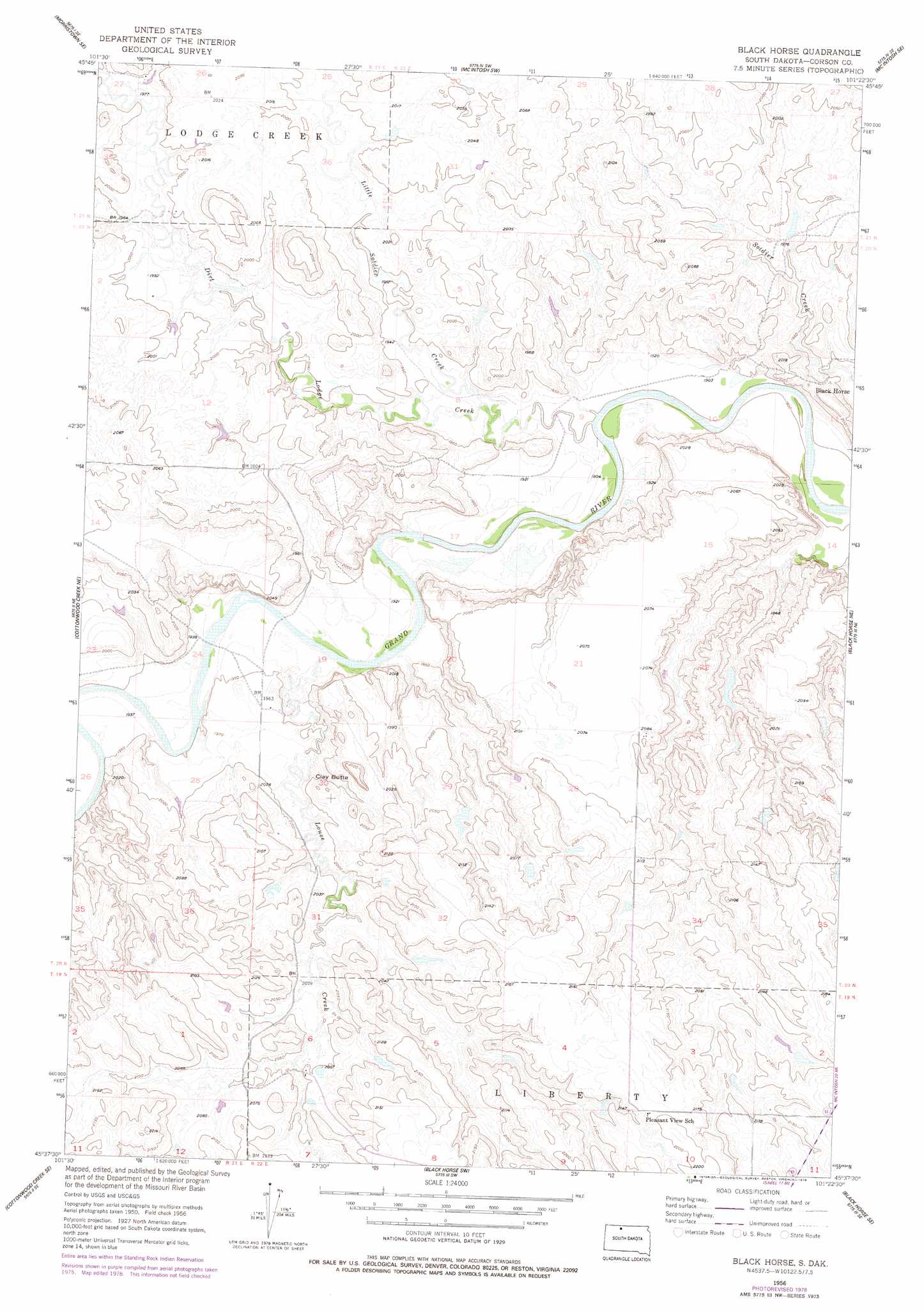
USGS Topo Quad 45101f4 - 1:24,000 scale
| Topo Map Name: | Black Horse |
| USGS Topo Quad ID: | 45101f4 |
| Print Size: | ca. 21 1/4" wide x 27" high |
| Southeast Coordinates: | 45.625° N latitude / 101.375° W longitude |
| Map Center Coordinates: | 45.6875° N latitude / 101.4375° W longitude |
| U.S. State: | SD |
| Filename: | o45101f4.jpg |
| Download Map JPG Image: | Black Horse topo map 1:24,000 scale |
| Map Type: | Topographic |
| Topo Series: | 7.5´ |
| Map Scale: | 1:24,000 |
| Source of Map Images: | United States Geological Survey (USGS) |
| Alternate Map Versions: |
Black Horse SD 1956, updated 1957 Download PDF Buy paper map Black Horse SD 1956, updated 1978 Download PDF Buy paper map Black Horse SD 2012 Download PDF Buy paper map Black Horse SD 2015 Download PDF Buy paper map |
1:24,000 Topo Quads surrounding Black Horse
Morristown |
Watauga |
Hump Butte |
Mcintosh |
Tatanka Lake |
Skull Butte |
Morristown Se |
Mcintosh Sw |
Mcintosh Se |
Bullhead Sw |
Cottonwood Creek Nw |
Cottonwood Creek Ne |
Black Horse |
Black Horse Ne |
Miscol |
Cottonwood Creek Sw |
Cottonwood Creek Se |
Black Horse Sw |
Black Horse Se |
Miscol Sw |
Irish Creek Nw |
Irish Creek Ne |
Isabel |
Firesteel |
Brewer Butte |
> Back to 45101e1 at 1:100,000 scale
> Back to 45100a1 at 1:250,000 scale
> Back to U.S. Topo Maps home
Black Horse topo map: Gazetteer
Black Horse: Dams
Blaine Drageset Dam elevation 602m 1975′Bud Bartell Dam elevation 619m 2030′
Black Horse: Populated Places
Black Horse elevation 597m 1958′Black Horse: Streams
Dirt Lodge Creek elevation 583m 1912′Little Soldier Creek elevation 583m 1912′
Louse Creek elevation 582m 1909′
Black Horse: Summits
Clay Butte elevation 644m 2112′Black Horse digital topo map on disk
Buy this Black Horse topo map showing relief, roads, GPS coordinates and other geographical features, as a high-resolution digital map file on DVD:
Eastern North Dakota & Eastern South Dakota
Buy digital topo maps: Eastern North Dakota & Eastern South Dakota