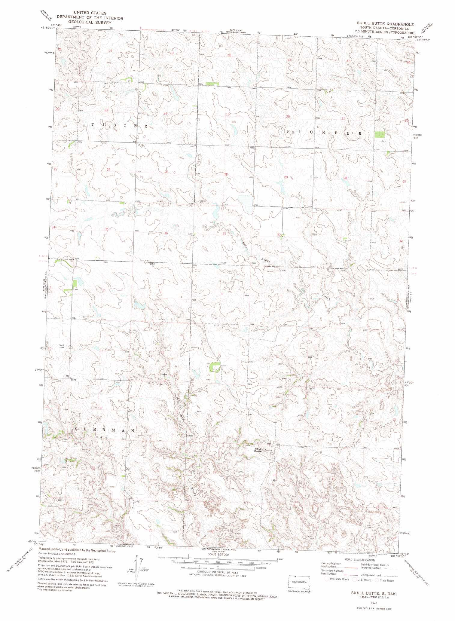
Skull Butte Topo Map South Dakota
To zoom in, hover over the map of Skull Butte
USGS Topo Quad 45101g6 - 1:24,000 scale
| Topo Map Name: | Skull Butte |
| USGS Topo Quad ID: | 45101g6 |
| Print Size: | ca. 21 1/4" wide x 27" high |
| Southeast Coordinates: | 45.75° N latitude / 101.625° W longitude |
| Map Center Coordinates: | 45.8125° N latitude / 101.6875° W longitude |
| U.S. State: | SD |
| Filename: | o45101g6.jpg |
| Download Map JPG Image: | Skull Butte topo map 1:24,000 scale |
| Map Type: | Topographic |
| Topo Series: | 7.5´ |
| Map Scale: | 1:24,000 |
| Source of Map Images: | United States Geological Survey (USGS) |
| Alternate Map Versions: |
Skull Butte SD 1972, updated 1975 Download PDF Buy paper map Skull Butte SD 2012 Download PDF Buy paper map Skull Butte SD 2015 Download PDF Buy paper map |
1:24,000 Topo Quads surrounding Skull Butte
Round Top |
Pretty Rock Butte Se |
Parks Hills |
Pitt Creek |
Lookout Butte |
Thunder Hawk |
Keldron |
Morristown |
Watauga |
Hump Butte |
Thunder Hawk Sw |
Thunder Hawk Se |
Skull Butte |
Morristown Se |
Mcintosh Sw |
Black Horse Butte Nw |
Black Horse Butte Ne |
Cottonwood Creek Nw |
Cottonwood Creek Ne |
Black Horse |
Black Horse Butte |
Twin Butte |
Cottonwood Creek Sw |
Cottonwood Creek Se |
Black Horse Sw |
> Back to 45101e1 at 1:100,000 scale
> Back to 45100a1 at 1:250,000 scale
> Back to U.S. Topo Maps home
Skull Butte topo map: Gazetteer
Skull Butte: Dams
Alfred Cowan Dam elevation 693m 2273′Skull Butte: Summits
Skull Butte elevation 723m 2372′Skull Butte digital topo map on disk
Buy this Skull Butte topo map showing relief, roads, GPS coordinates and other geographical features, as a high-resolution digital map file on DVD:
Eastern North Dakota & Eastern South Dakota
Buy digital topo maps: Eastern North Dakota & Eastern South Dakota