Tatanka Lake Topo Map South Dakota
To zoom in, hover over the map of Tatanka Lake
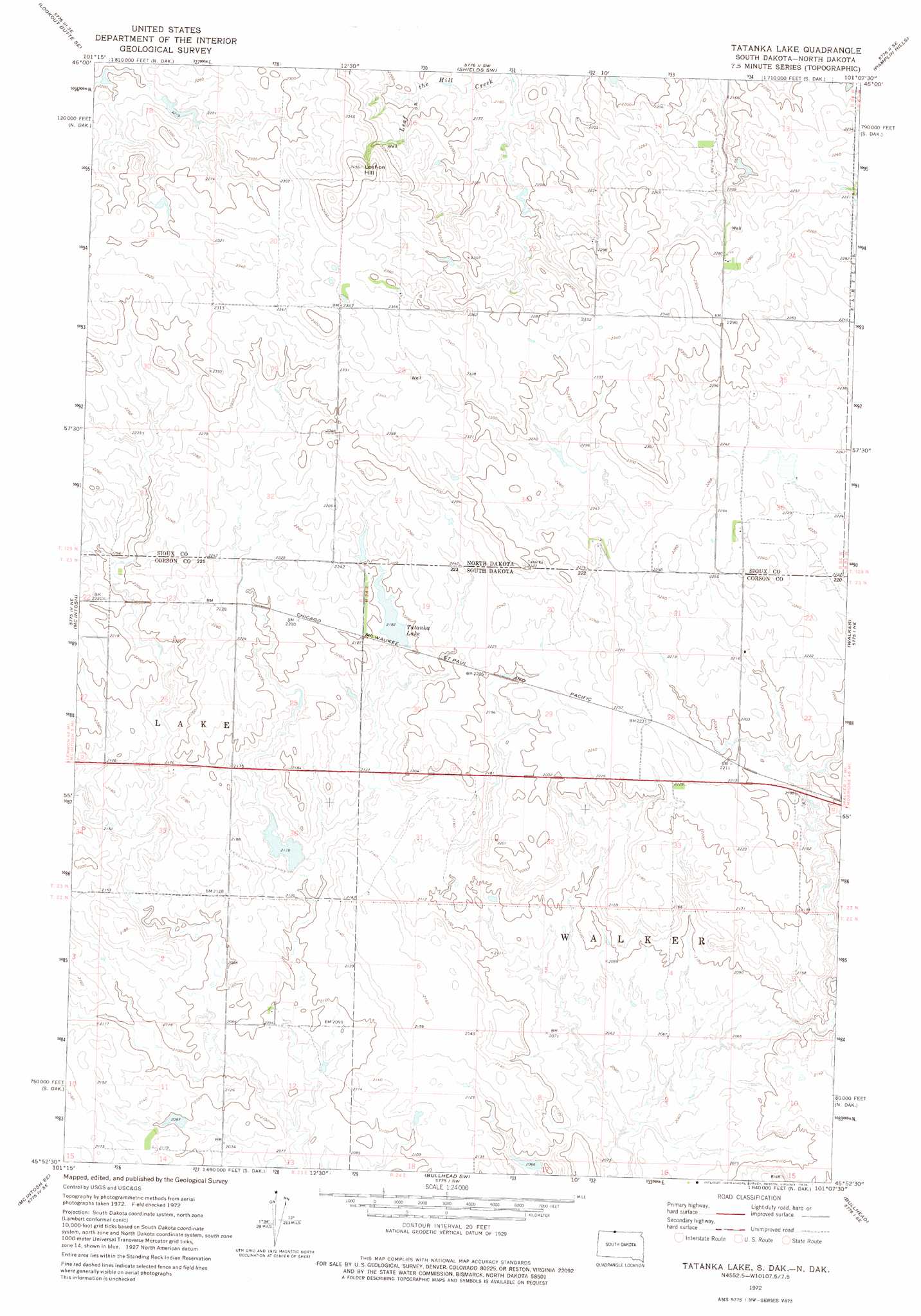
USGS Topo Quad 45101h2 - 1:24,000 scale
| Topo Map Name: | Tatanka Lake |
| USGS Topo Quad ID: | 45101h2 |
| Print Size: | ca. 21 1/4" wide x 27" high |
| Southeast Coordinates: | 45.875° N latitude / 101.125° W longitude |
| Map Center Coordinates: | 45.9375° N latitude / 101.1875° W longitude |
| U.S. States: | SD, ND |
| Filename: | o45101h2.jpg |
| Download Map JPG Image: | Tatanka Lake topo map 1:24,000 scale |
| Map Type: | Topographic |
| Topo Series: | 7.5´ |
| Map Scale: | 1:24,000 |
| Source of Map Images: | United States Geological Survey (USGS) |
| Alternate Map Versions: |
Tatanka Lake SD 1972, updated 1975 Download PDF Buy paper map Tatanka Lake SD 2011 Download PDF Buy paper map Tatanka Lake SD 2012 Download PDF Buy paper map Tatanka Lake SD 2015 Download PDF Buy paper map |
1:24,000 Topo Quads surrounding Tatanka Lake
Bell Coulee West |
Bell Coulee East |
Shields |
Porcupine |
Froelich Dam |
Lookout Butte |
Lookout Butte Se |
Shields Sw |
Pamplin Hills |
Selfridge |
Hump Butte |
Mcintosh |
Tatanka Lake |
Walker |
Maple Leaf |
Mcintosh Sw |
Mcintosh Se |
Bullhead Sw |
Bullhead |
Mclaughlin Sw |
Black Horse |
Black Horse Ne |
Miscol |
Miscol Ne |
Little Eagle Nw |
> Back to 45101e1 at 1:100,000 scale
> Back to 45100a1 at 1:250,000 scale
> Back to U.S. Topo Maps home
Tatanka Lake topo map: Gazetteer
Tatanka Lake: Dams
John Gehring Dam elevation 646m 2119′Richard Glines Dam elevation 672m 2204′
Tatanka Lake: Reservoirs
Tatanka Lake elevation 665m 2181′Tatanka Lake: Summits
Leaf-On Hill elevation 744m 2440′Tatanka Lake digital topo map on disk
Buy this Tatanka Lake topo map showing relief, roads, GPS coordinates and other geographical features, as a high-resolution digital map file on DVD:
Eastern North Dakota & Eastern South Dakota
Buy digital topo maps: Eastern North Dakota & Eastern South Dakota