Keldron Topo Map South Dakota
To zoom in, hover over the map of Keldron
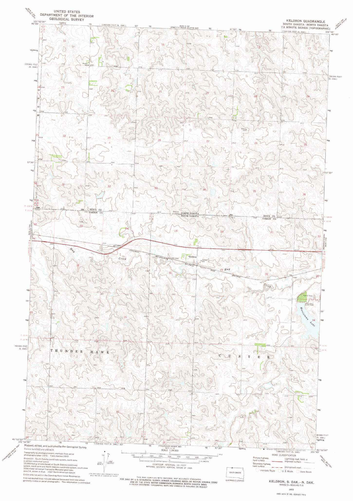
USGS Topo Quad 45101h7 - 1:24,000 scale
| Topo Map Name: | Keldron |
| USGS Topo Quad ID: | 45101h7 |
| Print Size: | ca. 21 1/4" wide x 27" high |
| Southeast Coordinates: | 45.875° N latitude / 101.75° W longitude |
| Map Center Coordinates: | 45.9375° N latitude / 101.8125° W longitude |
| U.S. States: | SD, ND |
| Filename: | o45101h7.jpg |
| Download Map JPG Image: | Keldron topo map 1:24,000 scale |
| Map Type: | Topographic |
| Topo Series: | 7.5´ |
| Map Scale: | 1:24,000 |
| Source of Map Images: | United States Geological Survey (USGS) |
| Alternate Map Versions: |
Keldron SD 1972, updated 1975 Download PDF Buy paper map Keldron SD 1998, updated 2001 Download PDF Buy paper map Keldron SD 2011 Download PDF Buy paper map Keldron SD 2015 Download PDF Buy paper map |
| FStopo: | US Forest Service topo Keldron is available: Download FStopo PDF Download FStopo TIF |
1:24,000 Topo Quads surrounding Keldron
Plum Butte Ne |
Coffin Buttes |
Pretty Rock Butte |
Wheeler Hills |
Paradise Flats |
Nason Hill |
Round Top |
Pretty Rock Butte Se |
Parks Hills |
Pitt Creek |
Lemmon Ne |
Thunder Hawk |
Keldron |
Morristown |
Watauga |
Lemmon Lake |
Thunder Hawk Sw |
Thunder Hawk Se |
Skull Butte |
Morristown Se |
Meadow Ne |
Black Horse Butte Nw |
Black Horse Butte Ne |
Cottonwood Creek Nw |
Cottonwood Creek Ne |
> Back to 45101e1 at 1:100,000 scale
> Back to 45100a1 at 1:250,000 scale
> Back to U.S. Topo Maps home
Keldron topo map: Gazetteer
Keldron: Dams
Leonard Wenck Dam elevation 704m 2309′Keldron: Populated Places
Keldron elevation 723m 2372′Keldron: Reservoirs
Morristown Lake elevation 704m 2309′Keldron digital topo map on disk
Buy this Keldron topo map showing relief, roads, GPS coordinates and other geographical features, as a high-resolution digital map file on DVD:
Eastern North Dakota & Eastern South Dakota
Buy digital topo maps: Eastern North Dakota & Eastern South Dakota