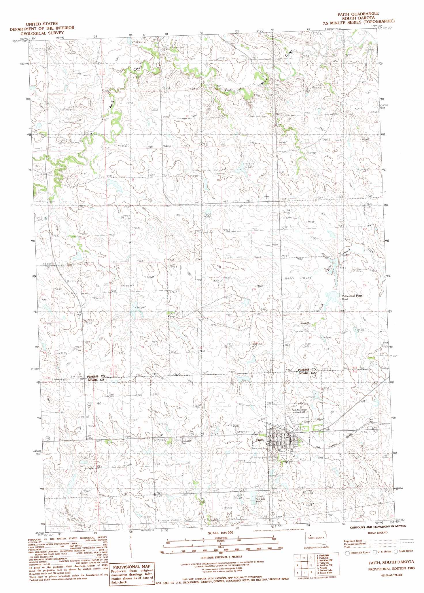
Faith Topo Map South Dakota
To zoom in, hover over the map of Faith
USGS Topo Quad 45102a1 - 1:24,000 scale
| Topo Map Name: | Faith |
| USGS Topo Quad ID: | 45102a1 |
| Print Size: | ca. 21 1/4" wide x 27" high |
| Southeast Coordinates: | 45° N latitude / 102° W longitude |
| Map Center Coordinates: | 45.0625° N latitude / 102.0625° W longitude |
| U.S. State: | SD |
| Filename: | o45102a1.jpg |
| Download Map JPG Image: | Faith topo map 1:24,000 scale |
| Map Type: | Topographic |
| Topo Series: | 7.5´ |
| Map Scale: | 1:24,000 |
| Source of Map Images: | United States Geological Survey (USGS) |
| Alternate Map Versions: |
Faith SD 1983, updated 1984 Download PDF Buy paper map Faith SD 2012 Download PDF Buy paper map Faith SD 2015 Download PDF Buy paper map |
1:24,000 Topo Quads surrounding Faith
Sunrise Butte |
Coal Springs Sw |
Coal Springs Se |
Glad Valley Sw |
Glad Valley Se |
Deep Creek Ne |
Faith Nw |
Faith Ne |
Redelm Nw |
Redelm Ne |
Deep Creek Se |
Faith Sw |
Faith |
Red Elm Sw |
Red Elm |
Lemmon Butte |
Avance |
Durkee Lake |
Bessie Butte |
Bull Creek 2 Ne |
Opal East Se |
Reed Dam |
Avance Se |
Chasing Hawk Draw |
Red Scaffold |
> Back to 45102a1 at 1:100,000 scale
> Back to 45102a1 at 1:250,000 scale
> Back to U.S. Topo Maps home
Faith topo map: Gazetteer
Faith: Airports
Faith Municipal Airport elevation 776m 2545′Faith: Dams
D Ulrich Dam elevation 750m 2460′S Baxter Number 1 Dam elevation 758m 2486′
V Anders Dam elevation 757m 2483′
W Reedy Dam elevation 742m 2434′
William Baxter Dam elevation 770m 2526′
Z Drum Dam elevation 753m 2470′
Faith: Populated Places
Faith elevation 791m 2595′Faith: Reservoirs
Rattlesnake Petes Pond elevation 753m 2470′Faith digital topo map on disk
Buy this Faith topo map showing relief, roads, GPS coordinates and other geographical features, as a high-resolution digital map file on DVD:
Eastern Montana & Western North Dakota
Buy digital topo maps: Eastern Montana & Western North Dakota