Box Car Buttes Topo Map South Dakota
To zoom in, hover over the map of Box Car Buttes
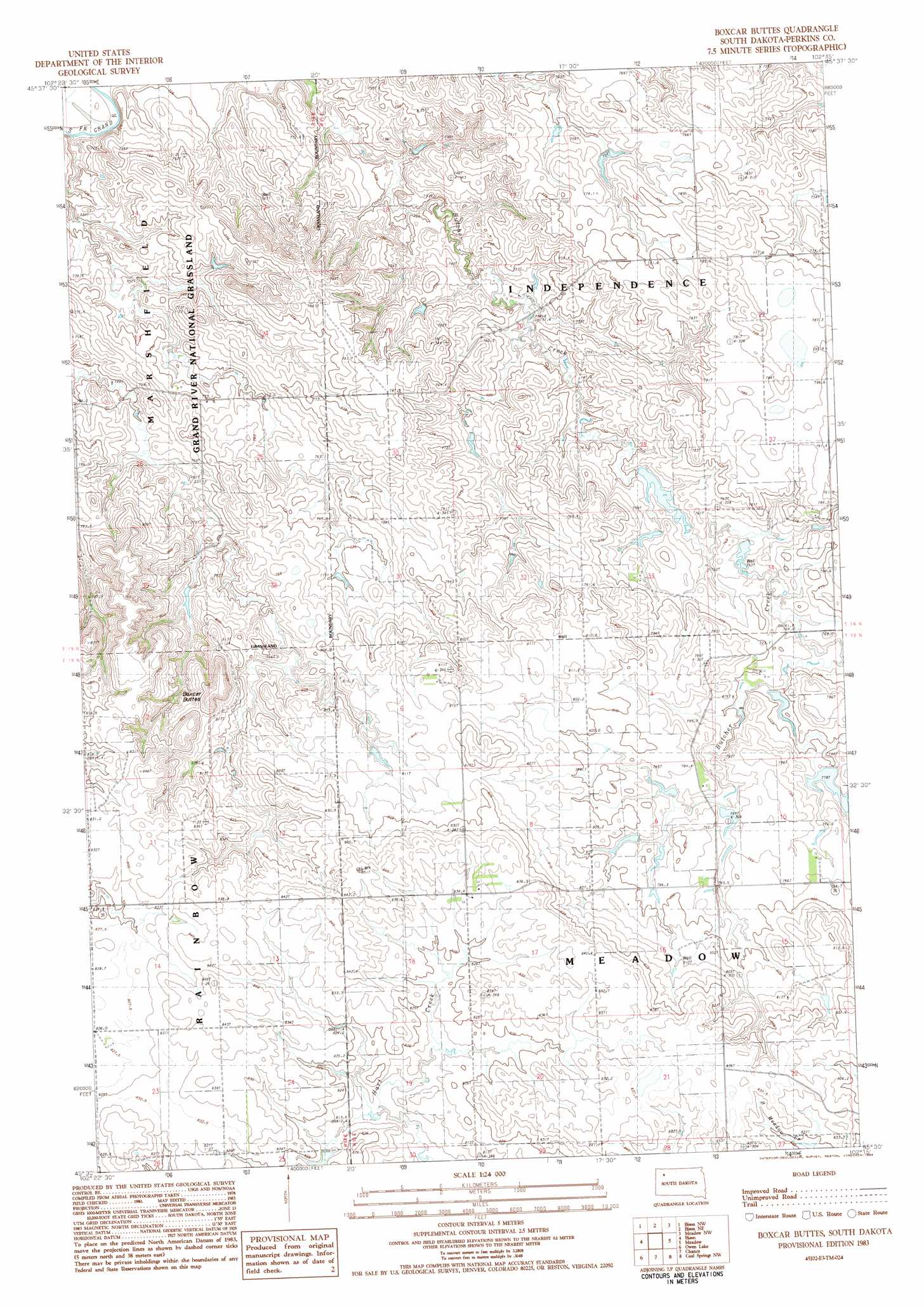
USGS Topo Quad 45102e3 - 1:24,000 scale
| Topo Map Name: | Box Car Buttes |
| USGS Topo Quad ID: | 45102e3 |
| Print Size: | ca. 21 1/4" wide x 27" high |
| Southeast Coordinates: | 45.5° N latitude / 102.25° W longitude |
| Map Center Coordinates: | 45.5625° N latitude / 102.3125° W longitude |
| U.S. State: | SD |
| Filename: | o45102e3.jpg |
| Download Map JPG Image: | Box Car Buttes topo map 1:24,000 scale |
| Map Type: | Topographic |
| Topo Series: | 7.5´ |
| Map Scale: | 1:24,000 |
| Source of Map Images: | United States Geological Survey (USGS) |
| Alternate Map Versions: |
Boxcar Buttes SD 1983, updated 1984 Download PDF Buy paper map Boxcar Buttes SD 1998, updated 2001 Download PDF Buy paper map Boxcar Buttes SD 2012 Download PDF Buy paper map Boxcar Buttes SD 2015 Download PDF Buy paper map |
| FStopo: | US Forest Service topo Boxcar Buttes is available: Download FStopo PDF Download FStopo TIF |
1:24,000 Topo Quads surrounding Box Car Buttes
Lodgepole Se |
Haynes Sw |
Haynes Se |
Sommerville |
Lemmon Lake |
Cole Dam |
Bison Nw |
Bison Ne |
Meadow Nw |
Meadow Ne |
Square Top Butte |
Bison |
Box Car Buttes |
Meadow |
Meadow Se |
Date Ne |
Owen Lake |
Chance |
Coal Springs Nw |
Coal Springs |
Rabbit Butte |
Two Buttes |
Sunrise Butte |
Coal Springs Sw |
Coal Springs Se |
> Back to 45102e1 at 1:100,000 scale
> Back to 45102a1 at 1:250,000 scale
> Back to U.S. Topo Maps home
Box Car Buttes topo map: Gazetteer
Box Car Buttes: Dams
George Hulm Dam elevation 753m 2470′Joe Hulm Dam elevation 789m 2588′
Box Car Buttes: Ranges
Boxcar Buttes elevation 823m 2700′Box Car Buttes digital topo map on disk
Buy this Box Car Buttes topo map showing relief, roads, GPS coordinates and other geographical features, as a high-resolution digital map file on DVD:
Eastern Montana & Western North Dakota
Buy digital topo maps: Eastern Montana & Western North Dakota