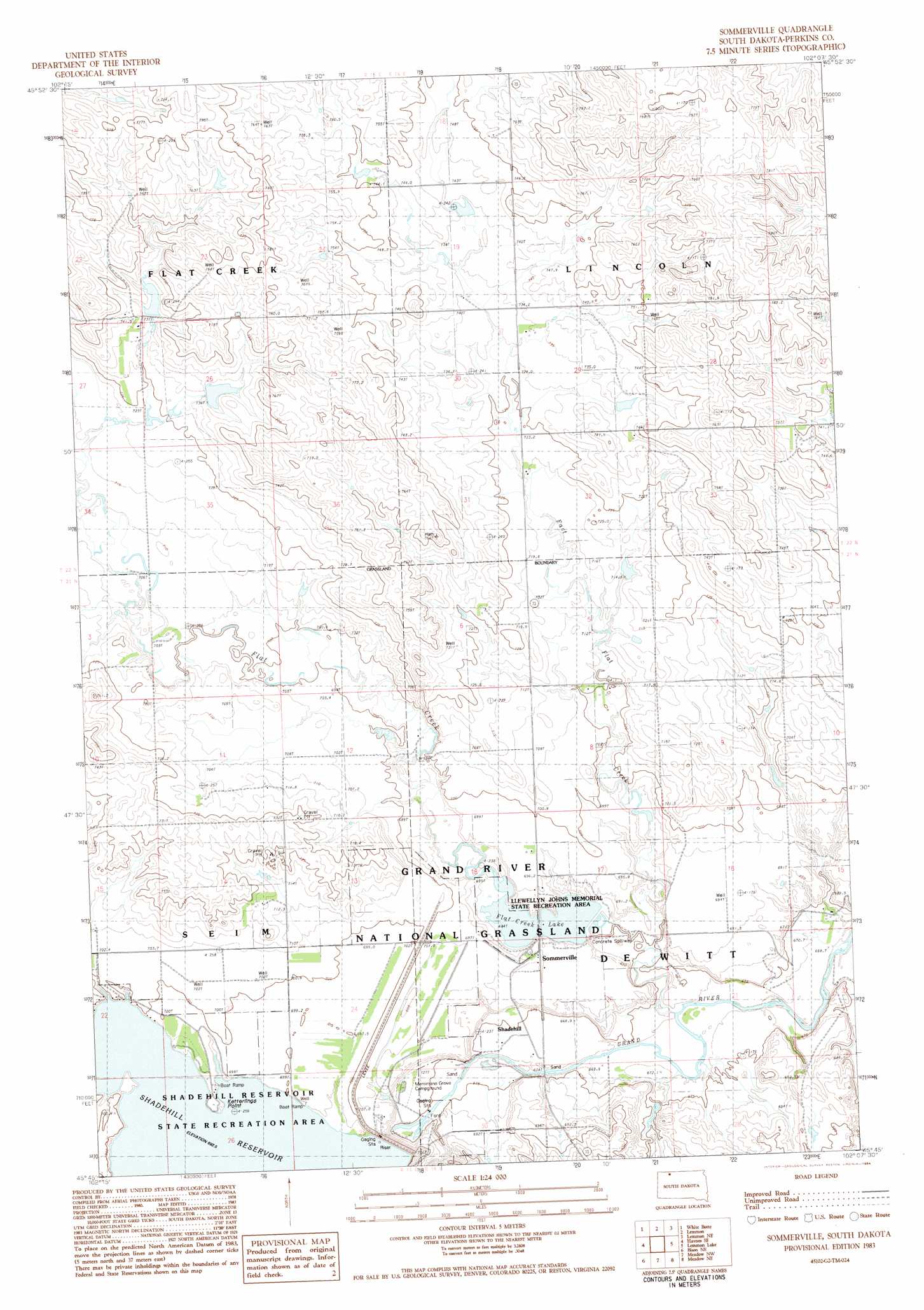
Sommerville Topo Map South Dakota
To zoom in, hover over the map of Sommerville
USGS Topo Quad 45102g2 - 1:24,000 scale
| Topo Map Name: | Sommerville |
| USGS Topo Quad ID: | 45102g2 |
| Print Size: | ca. 21 1/4" wide x 27" high |
| Southeast Coordinates: | 45.75° N latitude / 102.125° W longitude |
| Map Center Coordinates: | 45.8125° N latitude / 102.1875° W longitude |
| U.S. State: | SD |
| Filename: | o45102g2.jpg |
| Download Map JPG Image: | Sommerville topo map 1:24,000 scale |
| Map Type: | Topographic |
| Topo Series: | 7.5´ |
| Map Scale: | 1:24,000 |
| Source of Map Images: | United States Geological Survey (USGS) |
| Alternate Map Versions: |
Sommerville SD 1983, updated 1984 Download PDF Buy paper map Summerville SD 1998, updated 2001 Download PDF Buy paper map Summerville SD 2012 Download PDF Buy paper map Summerville SD 2015 Download PDF Buy paper map |
| FStopo: | US Forest Service topo Summerville is available: Download FStopo PDF Download FStopo TIF |
1:24,000 Topo Quads surrounding Sommerville
Pearl Butte |
Barths Butte |
Cedar Butte |
Nason Hill |
Round Top |
Haynes |
White Butte |
Lemmon |
Lemmon Ne |
Thunder Hawk |
Haynes Sw |
Haynes Se |
Sommerville |
Lemmon Lake |
Thunder Hawk Sw |
Bison Nw |
Bison Ne |
Meadow Nw |
Meadow Ne |
Black Horse Butte Nw |
Bison |
Box Car Buttes |
Meadow |
Meadow Se |
Black Horse Butte |
> Back to 45102e1 at 1:100,000 scale
> Back to 45102a1 at 1:250,000 scale
> Back to U.S. Topo Maps home
Sommerville topo map: Gazetteer
Sommerville: Capes
Ketterlins Point elevation 696m 2283′Sommerville: Dams
Flat Creek Lake Dam elevation 681m 2234′Robert Kressly Dam elevation 742m 2434′
Robert Kressly Dam elevation 756m 2480′
Shadehill Dam elevation 697m 2286′
W D Crockett Dam elevation 742m 2434′
Sommerville: Parks
Llewellyn Johns Memorial State Recreation Area elevation 681m 2234′Sommerville: Populated Places
Shadehill elevation 674m 2211′Summerville elevation 696m 2283′
Sommerville: Reservoirs
Flat Creek Lake elevation 681m 2234′Shadehill Reservoir elevation 697m 2286′
Sommerville: Streams
East Flat Creek elevation 676m 2217′Flat Creek elevation 685m 2247′
North Fork Grand River elevation 697m 2286′
Sommerville digital topo map on disk
Buy this Sommerville topo map showing relief, roads, GPS coordinates and other geographical features, as a high-resolution digital map file on DVD:
Eastern Montana & Western North Dakota
Buy digital topo maps: Eastern Montana & Western North Dakota