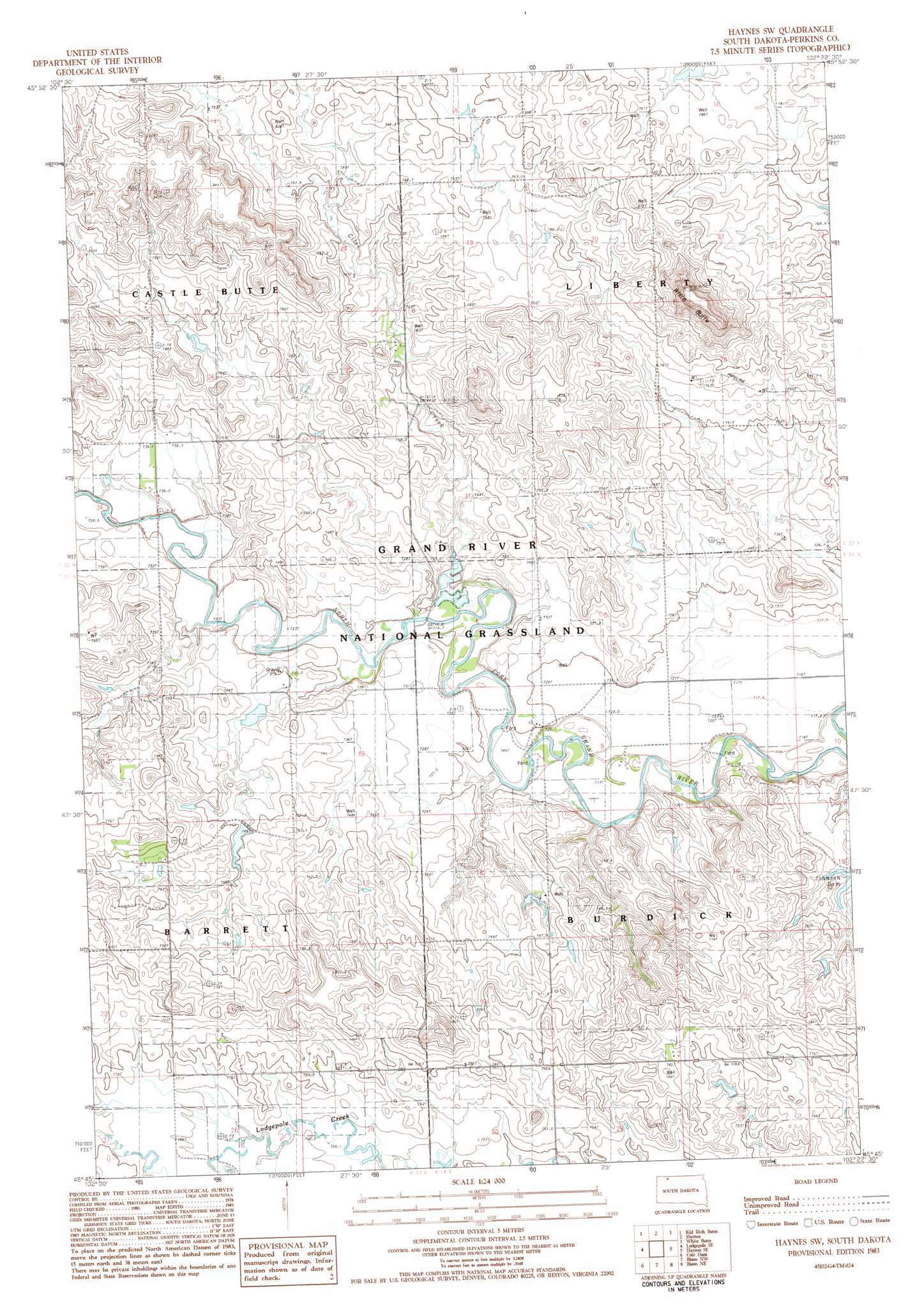
Haynes Sw Topo Map South Dakota
To zoom in, hover over the map of Haynes Sw
USGS Topo Quad 45102g4 - 1:24,000 scale
| Topo Map Name: | Haynes Sw |
| USGS Topo Quad ID: | 45102g4 |
| Print Size: | ca. 21 1/4" wide x 27" high |
| Southeast Coordinates: | 45.75° N latitude / 102.375° W longitude |
| Map Center Coordinates: | 45.8125° N latitude / 102.4375° W longitude |
| U.S. State: | SD |
| Filename: | o45102g4.jpg |
| Download Map JPG Image: | Haynes Sw topo map 1:24,000 scale |
| Map Type: | Topographic |
| Topo Series: | 7.5´ |
| Map Scale: | 1:24,000 |
| Source of Map Images: | United States Geological Survey (USGS) |
| Alternate Map Versions: |
Haynes SW SD 1983, updated 1984 Download PDF Buy paper map Haynes SW SD 1998, updated 2001 Download PDF Buy paper map Haynes SW SD 2012 Download PDF Buy paper map Haynes SW SD 2015 Download PDF Buy paper map |
| FStopo: | US Forest Service topo Haynes SW is available: Download FStopo PDF Download FStopo TIF |
1:24,000 Topo Quads surrounding Haynes Sw
Hettinger North |
Taylor Butte Se |
Pearl Butte |
Barths Butte |
Cedar Butte |
Hettinger South |
Kid Rich Butte |
Haynes |
White Butte |
Lemmon |
Lodgepole |
Lodgepole Se |
Haynes Sw |
Haynes Se |
Sommerville |
Little Nasty Creek |
Cole Dam |
Bison Nw |
Bison Ne |
Meadow Nw |
Grandmas Butte |
Square Top Butte |
Bison |
Box Car Buttes |
Meadow |
> Back to 45102e1 at 1:100,000 scale
> Back to 45102a1 at 1:250,000 scale
> Back to U.S. Topo Maps home
Haynes Sw topo map: Gazetteer
Haynes Sw: Reservoirs
Johnson Dam elevation 731m 2398′Haynes Sw: Streams
Giles Creek elevation 724m 2375′Haynes Sw: Summits
White Butte elevation 888m 2913′Haynes Sw digital topo map on disk
Buy this Haynes Sw topo map showing relief, roads, GPS coordinates and other geographical features, as a high-resolution digital map file on DVD:
Eastern Montana & Western North Dakota
Buy digital topo maps: Eastern Montana & Western North Dakota