White Butte Topo Map South Dakota
To zoom in, hover over the map of White Butte
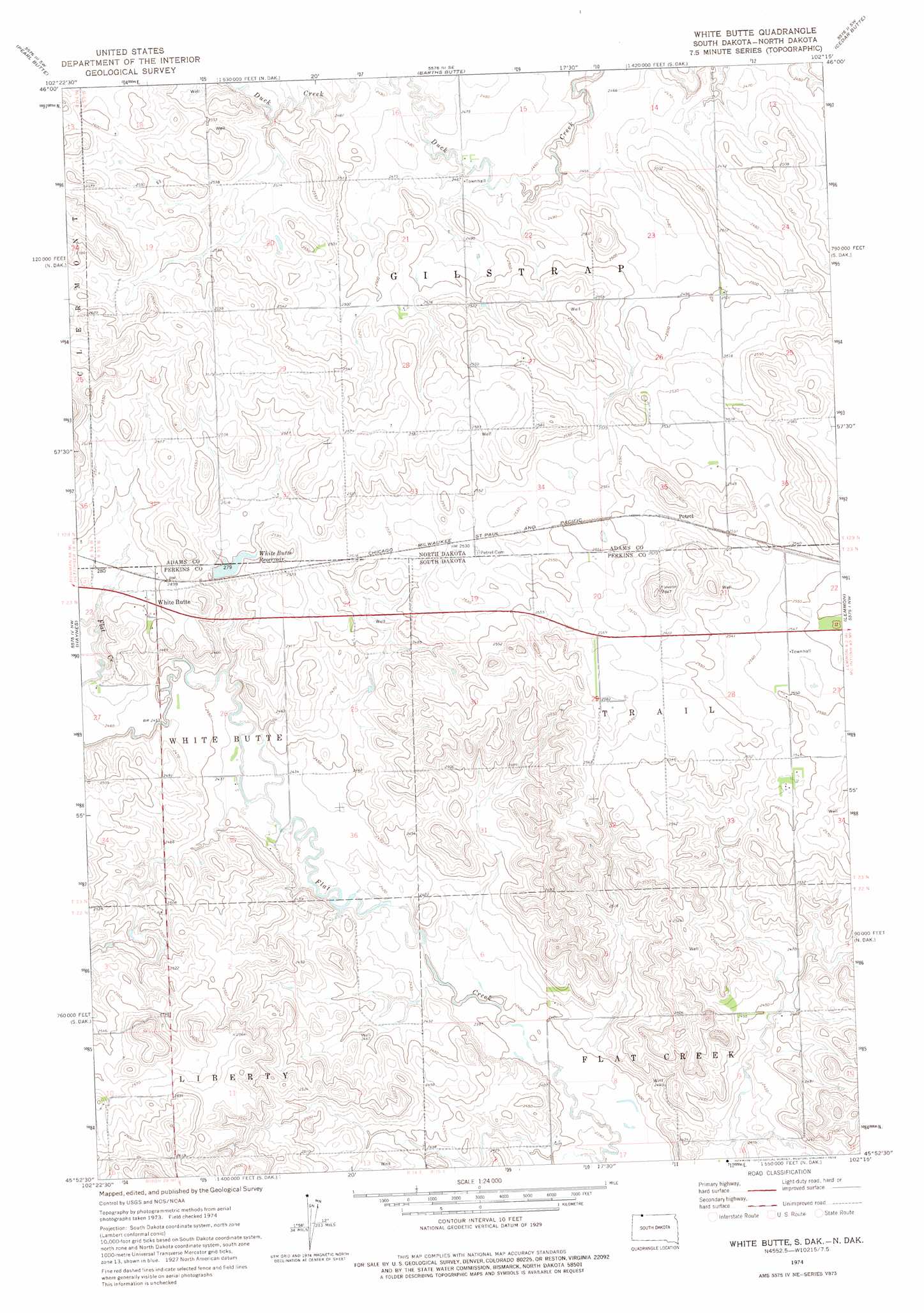
USGS Topo Quad 45102h3 - 1:24,000 scale
| Topo Map Name: | White Butte |
| USGS Topo Quad ID: | 45102h3 |
| Print Size: | ca. 21 1/4" wide x 27" high |
| Southeast Coordinates: | 45.875° N latitude / 102.25° W longitude |
| Map Center Coordinates: | 45.9375° N latitude / 102.3125° W longitude |
| U.S. States: | SD, ND |
| Filename: | o45102h3.jpg |
| Download Map JPG Image: | White Butte topo map 1:24,000 scale |
| Map Type: | Topographic |
| Topo Series: | 7.5´ |
| Map Scale: | 1:24,000 |
| Source of Map Images: | United States Geological Survey (USGS) |
| Alternate Map Versions: |
White Butte SD 1974, updated 1978 Download PDF Buy paper map White Butte SD 1998, updated 2001 Download PDF Buy paper map White Butte SD 2012 Download PDF Buy paper map White Butte SD 2015 Download PDF Buy paper map |
| FStopo: | US Forest Service topo White Butte is available: Download FStopo PDF Download FStopo TIF |
1:24,000 Topo Quads surrounding White Butte
Taylor Butte |
Pearl Butte Nw |
Long Butte |
Plum Butte |
Plum Butte Ne |
Taylor Butte Se |
Pearl Butte |
Barths Butte |
Cedar Butte |
Nason Hill |
Kid Rich Butte |
Haynes |
White Butte |
Lemmon |
Lemmon Ne |
Lodgepole Se |
Haynes Sw |
Haynes Se |
Sommerville |
Lemmon Lake |
Cole Dam |
Bison Nw |
Bison Ne |
Meadow Nw |
Meadow Ne |
> Back to 45102e1 at 1:100,000 scale
> Back to 45102a1 at 1:250,000 scale
> Back to U.S. Topo Maps home
White Butte topo map: Gazetteer
White Butte: Populated Places
Petrel elevation 782m 2565′White Butte elevation 762m 2500′
White Butte: Reservoirs
White Butte Reservoir elevation 762m 2500′White Butte Reservoir elevation 762m 2500′
White Butte digital topo map on disk
Buy this White Butte topo map showing relief, roads, GPS coordinates and other geographical features, as a high-resolution digital map file on DVD:
Eastern Montana & Western North Dakota
Buy digital topo maps: Eastern Montana & Western North Dakota