Cow Butte Topo Map South Dakota
To zoom in, hover over the map of Cow Butte
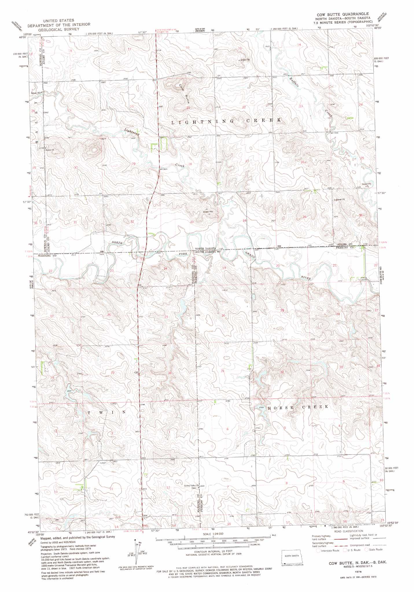
USGS Topo Quad 45102h8 - 1:24,000 scale
| Topo Map Name: | Cow Butte |
| USGS Topo Quad ID: | 45102h8 |
| Print Size: | ca. 21 1/4" wide x 27" high |
| Southeast Coordinates: | 45.875° N latitude / 102.875° W longitude |
| Map Center Coordinates: | 45.9375° N latitude / 102.9375° W longitude |
| U.S. States: | SD, ND |
| Filename: | o45102h8.jpg |
| Download Map JPG Image: | Cow Butte topo map 1:24,000 scale |
| Map Type: | Topographic |
| Topo Series: | 7.5´ |
| Map Scale: | 1:24,000 |
| Source of Map Images: | United States Geological Survey (USGS) |
| Alternate Map Versions: |
Cow Butte ND 1974, updated 1978 Download PDF Buy paper map Cow Butte ND 2011 Download PDF Buy paper map Cow Butte ND 2014 Download PDF Buy paper map |
1:24,000 Topo Quads surrounding Cow Butte
Scranton |
Scranton Ne |
Whetstone Buttes |
Wolf Butte |
Ehler Lake |
Scranton Sw |
Gascoyne |
Reeder |
Bucyrus |
Hettinger North |
Bowman-Haley Dam |
Haley |
Cow Butte |
Cow Butte Ne |
Hettinger South |
Ralph Sw |
Ralph |
Cow Butte Sw |
Cow Butte Se |
Lodgepole |
Reva Nw |
Reva Ne |
Prairie City Nw |
Prairie City Ne |
Little Nasty Creek |
> Back to 45102e1 at 1:100,000 scale
> Back to 45102a1 at 1:250,000 scale
> Back to U.S. Topo Maps home
Cow Butte topo map: Gazetteer
Cow Butte: Dams
Crooked Dam elevation 838m 2749′Kermit-Johnson-Number 1 Dam elevation 826m 2709′
Schaur Dam elevation 805m 2641′
Tadpole Dam elevation 836m 2742′
Cow Butte: Streams
Lightning Creek elevation 787m 2582′Cow Butte: Summits
Cow Butte elevation 874m 2867′Cow Butte digital topo map on disk
Buy this Cow Butte topo map showing relief, roads, GPS coordinates and other geographical features, as a high-resolution digital map file on DVD:
Eastern Montana & Western North Dakota
Buy digital topo maps: Eastern Montana & Western North Dakota