Lone Tree Draw West Topo Map South Dakota
To zoom in, hover over the map of Lone Tree Draw West
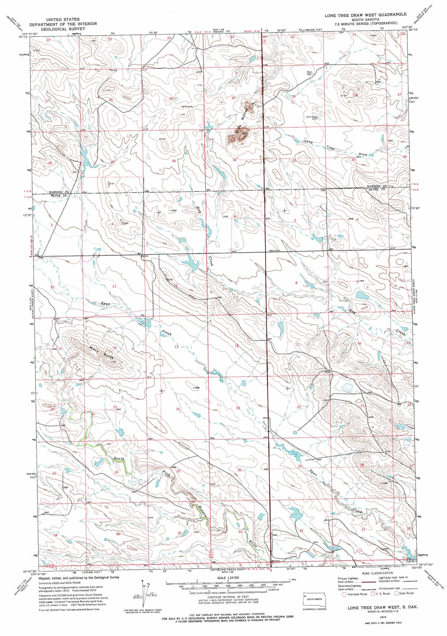
USGS Topo Quad 45103b5 - 1:24,000 scale
| Topo Map Name: | Lone Tree Draw West |
| USGS Topo Quad ID: | 45103b5 |
| Print Size: | ca. 21 1/4" wide x 27" high |
| Southeast Coordinates: | 45.125° N latitude / 103.5° W longitude |
| Map Center Coordinates: | 45.1875° N latitude / 103.5625° W longitude |
| U.S. State: | SD |
| Filename: | o45103b5.jpg |
| Download Map JPG Image: | Lone Tree Draw West topo map 1:24,000 scale |
| Map Type: | Topographic |
| Topo Series: | 7.5´ |
| Map Scale: | 1:24,000 |
| Source of Map Images: | United States Geological Survey (USGS) |
| Alternate Map Versions: |
Lone Tree Draw West SD 1973, updated 1977 Download PDF Buy paper map Lone Tree Draw West SD 2012 Download PDF Buy paper map Lone Tree Draw West SD 2015 Download PDF Buy paper map |
1:24,000 Topo Quads surrounding Lone Tree Draw West
Harding |
Bog Creek |
Redig Ne |
Bams Butte Nw |
Bams Butte |
Hells Canyon |
Moreau Peak |
Redig |
Roundup Butte |
Bams Butte Se |
Alkali Creek West |
Alkali Creek East |
Lone Tree Draw West |
Lone Tree Draw East |
Granger Creek |
Battle Creek Butte |
Antelope Creek West |
Antelope Creek East |
Haystack Butte |
Hoover |
Antelope Butte |
Two Top Butte West |
Two Top Butte East |
Castle Rock |
Sulphur Butte |
> Back to 45103a1 at 1:100,000 scale
> Back to 45102a1 at 1:250,000 scale
> Back to U.S. Topo Maps home
Lone Tree Draw West topo map: Gazetteer
Lone Tree Draw West: Ranges
Crow Buttes elevation 1022m 3353′Lone Tree Draw West: Summits
Macy Butte elevation 968m 3175′Lone Tree Draw West digital topo map on disk
Buy this Lone Tree Draw West topo map showing relief, roads, GPS coordinates and other geographical features, as a high-resolution digital map file on DVD:
Eastern Montana & Western North Dakota
Buy digital topo maps: Eastern Montana & Western North Dakota