Indian Butte Topo Map South Dakota
To zoom in, hover over the map of Indian Butte
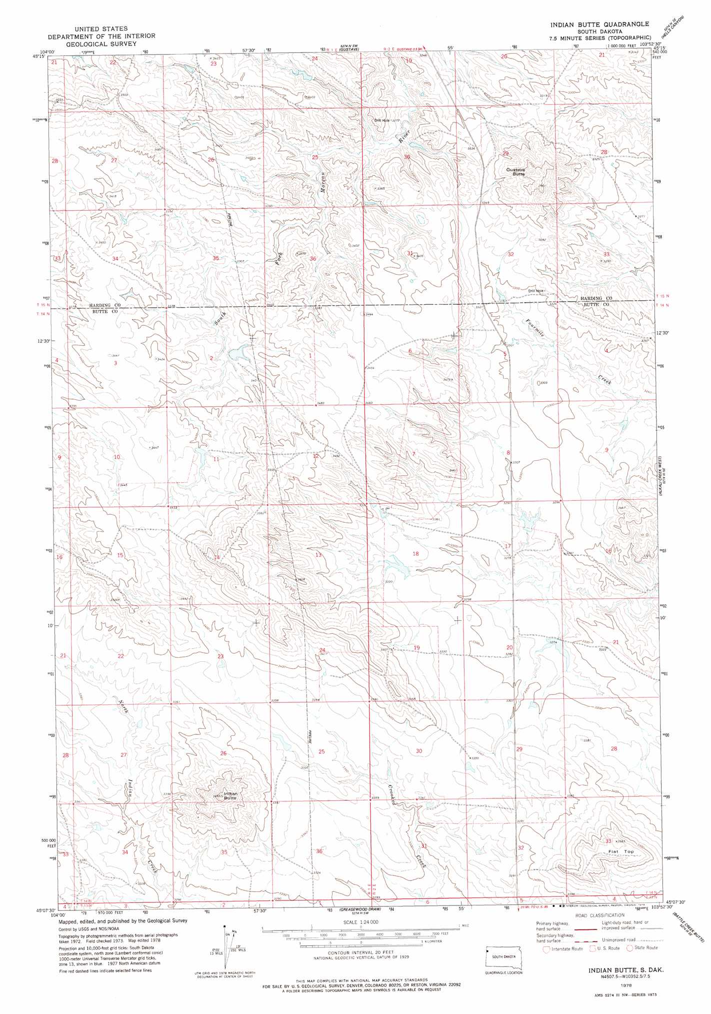
USGS Topo Quad 45103b8 - 1:24,000 scale
| Topo Map Name: | Indian Butte |
| USGS Topo Quad ID: | 45103b8 |
| Print Size: | ca. 21 1/4" wide x 27" high |
| Southeast Coordinates: | 45.125° N latitude / 103.875° W longitude |
| Map Center Coordinates: | 45.1875° N latitude / 103.9375° W longitude |
| U.S. State: | SD |
| Filename: | o45103b8.jpg |
| Download Map JPG Image: | Indian Butte topo map 1:24,000 scale |
| Map Type: | Topographic |
| Topo Series: | 7.5´ |
| Map Scale: | 1:24,000 |
| Source of Map Images: | United States Geological Survey (USGS) |
| Alternate Map Versions: |
Indian Butte SD 2012 Download PDF Buy paper map Indian Butte SD 2015 Download PDF Buy paper map |
1:24,000 Topo Quads surrounding Indian Butte
Capitol Nw |
Capitol |
J K Butte |
Harding |
Bog Creek |
Cactus Creek West |
Cactus Creek East |
Gustave |
Hells Canyon |
Moreau Peak |
Elkhorn Creek West |
Elkhorn Creek East |
Indian Butte |
Alkali Creek West |
Alkali Creek East |
Elkhorn Creek Sw |
Elkhorn Creek Se |
Greasewood Draw |
Battle Creek Butte |
Antelope Creek West |
Shepard Reservoir |
Gravel Draw |
Mud Buttes Nw |
Antelope Butte |
Two Top Butte West |
> Back to 45103a1 at 1:100,000 scale
> Back to 45102a1 at 1:250,000 scale
> Back to U.S. Topo Maps home
Indian Butte topo map: Gazetteer
Indian Butte: Summits
Flat Top elevation 1087m 3566′Gustave Butte elevation 1088m 3569′
Indian Butte elevation 1108m 3635′
Indian Butte digital topo map on disk
Buy this Indian Butte topo map showing relief, roads, GPS coordinates and other geographical features, as a high-resolution digital map file on DVD:
Eastern Montana & Western North Dakota
Buy digital topo maps: Eastern Montana & Western North Dakota