Reva Topo Map South Dakota
To zoom in, hover over the map of Reva
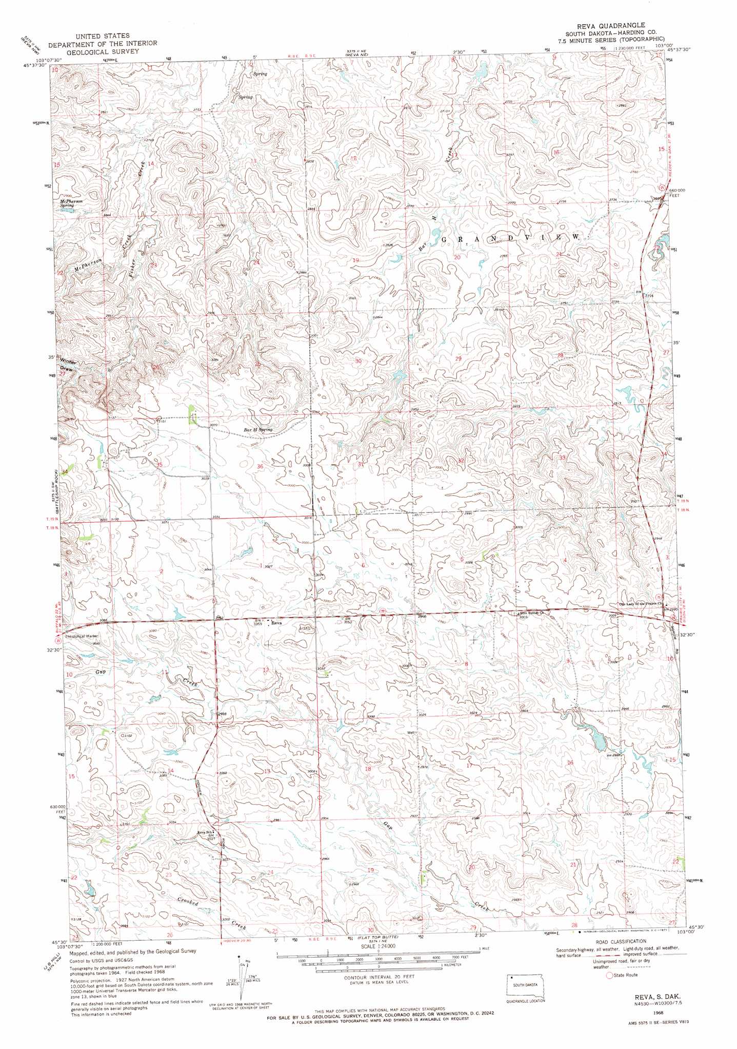
USGS Topo Quad 45103e1 - 1:24,000 scale
| Topo Map Name: | Reva |
| USGS Topo Quad ID: | 45103e1 |
| Print Size: | ca. 21 1/4" wide x 27" high |
| Southeast Coordinates: | 45.5° N latitude / 103° W longitude |
| Map Center Coordinates: | 45.5625° N latitude / 103.0625° W longitude |
| U.S. State: | SD |
| Filename: | o45103e1.jpg |
| Download Map JPG Image: | Reva topo map 1:24,000 scale |
| Map Type: | Topographic |
| Topo Series: | 7.5´ |
| Map Scale: | 1:24,000 |
| Source of Map Images: | United States Geological Survey (USGS) |
| Alternate Map Versions: |
Reva SD 1968, updated 1971 Download PDF Buy paper map Reva SD 1993, updated 1996 Download PDF Buy paper map Reva SD 2005, updated 2007 Download PDF Buy paper map Reva SD 2012 Download PDF Buy paper map Reva SD 2015 Download PDF Buy paper map |
| FStopo: | US Forest Service topo Reva is available: Download FStopo PDF Download FStopo TIF |
1:24,000 Topo Quads surrounding Reva
Ludlow Se |
Ralph Sw |
Ralph |
Cow Butte Sw |
Cow Butte Se |
Sheep Pen Draw |
Reva Nw |
Reva Ne |
Prairie City Nw |
Prairie City Ne |
Sheep Pen Draw Se |
Battleship Rock |
Reva |
White Hill |
Prairie City |
Bams Butte |
J B Hill |
Flat Top Butte |
Sorum |
Sorum Ne |
Bams Butte Se |
Irish Butte |
Sheep Mountain |
Sorum Sw |
Sorum Se |
> Back to 45103e1 at 1:100,000 scale
> Back to 45102a1 at 1:250,000 scale
> Back to U.S. Topo Maps home
Reva topo map: Gazetteer
Reva: Parks
Slim Butte Monument elevation 940m 3083′Reva: Populated Places
Reva elevation 931m 3054′Reva: Springs
Bar H Spring elevation 902m 2959′McPherson Spring elevation 866m 2841′
Reva: Streams
McPherson Creek elevation 848m 2782′Reva: Valleys
Winter Draw elevation 900m 2952′Reva digital topo map on disk
Buy this Reva topo map showing relief, roads, GPS coordinates and other geographical features, as a high-resolution digital map file on DVD:
Eastern Montana & Western North Dakota
Buy digital topo maps: Eastern Montana & Western North Dakota