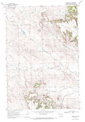
Ladner Se Topo Map South Dakota
To zoom in, hover over the map of Ladner Se
USGS Topo Quad 45103g5 - 1:24,000 scale
| Topo Map Name: | Ladner Se |
| USGS Topo Quad ID: | 45103g5 |
| Print Size: | ca. 21 1/4" wide x 27" high |
| Southeast Coordinates: | 45.75° N latitude / 103.5° W longitude |
| Map Center Coordinates: | 45.8125° N latitude / 103.5625° W longitude |
| U.S. State: | SD |
| Filename: | o45103g5.jpg |
| Download Map JPG Image: | Ladner Se topo map 1:24,000 scale |
| Map Type: | Topographic |
| Topo Series: | 7.5´ |
| Map Scale: | 1:24,000 |
| Source of Map Images: | United States Geological Survey (USGS) |
| Alternate Map Versions: |
Ladner SE SD 1969, updated 1971 Download PDF Buy paper map Ladner SE SD 1993, updated 1996 Download PDF Buy paper map Ladner SE SD 2005, updated 2007 Download PDF Buy paper map Ladner SE SD 2012 Download PDF Buy paper map Ladner SE SD 2015 Download PDF Buy paper map |
| FStopo: | US Forest Service topo Ladner SE is available: Download FStopo PDF Download FStopo TIF |
1:24,000 Topo Quads surrounding Ladner Se
> Back to 45103e1 at 1:100,000 scale
> Back to 45102a1 at 1:250,000 scale
> Back to U.S. Topo Maps home
Ladner Se topo map: Gazetteer
Ladner Se: Basins
Johnnys Pocket elevation 952m 3123′Ladner Se: Gaps
Craig Pass elevation 1000m 3280′Ladner Se: Pillars
Castle Rock elevation 1012m 3320′Ladner Se: Reservoirs
Dry Creek Reservoir elevation 949m 3113′Ladner Se: Springs
Alice Spring elevation 962m 3156′Craig Pass Spring elevation 982m 3221′
Dry Creek Spring elevation 979m 3211′
J B Clarkson Spring Number Two elevation 971m 3185′
J C Spring elevation 939m 3080′
Johnny Pocket Spring Number One elevation 945m 3100′
Johnny Pocket Spring Number Two elevation 944m 3097′
Travers Spring elevation 993m 3257′
Travers Spring Number One elevation 951m 3120′
Ladner Se: Streams
Cottonwood Creek elevation 897m 2942′Middle Creek elevation 879m 2883′
North Bull Creek elevation 902m 2959′
South Bull Creek elevation 902m 2959′
Ladner Se: Valleys
Devils Canyon elevation 963m 3159′Icebox Canyon elevation 916m 3005′
Lane Canyon elevation 945m 3100′
Peterson Canyon elevation 943m 3093′
Sawmill Canyon elevation 935m 3067′
Schleichart Draw elevation 895m 2936′
Timber Canyon elevation 970m 3182′
Ladner Se: Wells
East Clarkson Well elevation 928m 3044′North Clarkson Well elevation 939m 3080′
Ladner Se digital topo map on disk
Buy this Ladner Se topo map showing relief, roads, GPS coordinates and other geographical features, as a high-resolution digital map file on DVD:
Eastern Montana & Western North Dakota
Buy digital topo maps: Eastern Montana & Western North Dakota


