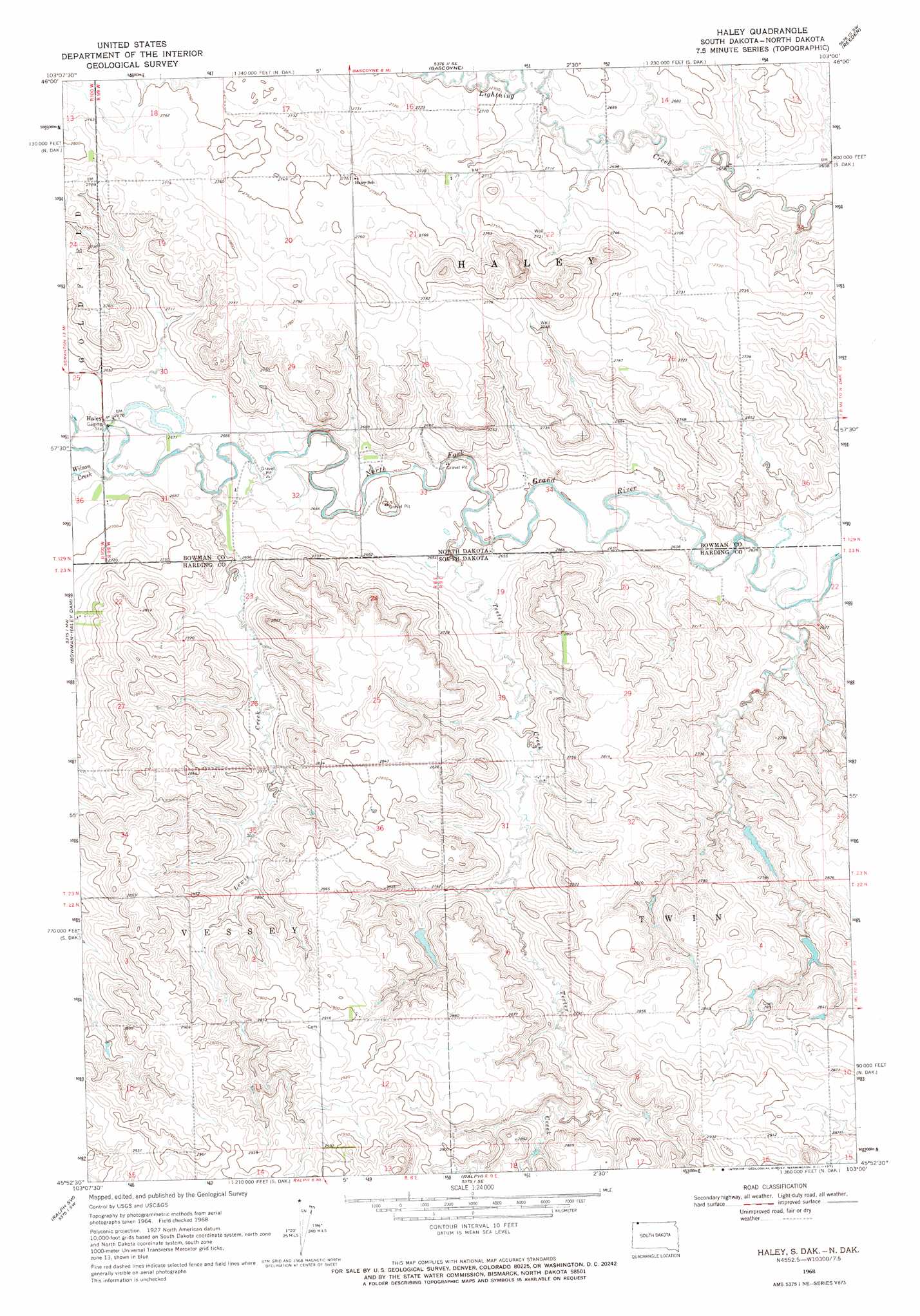
Haley Topo Map South Dakota
To zoom in, hover over the map of Haley
USGS Topo Quad 45103h1 - 1:24,000 scale
| Topo Map Name: | Haley |
| USGS Topo Quad ID: | 45103h1 |
| Print Size: | ca. 21 1/4" wide x 27" high |
| Southeast Coordinates: | 45.875° N latitude / 103° W longitude |
| Map Center Coordinates: | 45.9375° N latitude / 103.0625° W longitude |
| U.S. States: | SD, ND |
| Filename: | o45103h1.jpg |
| Download Map JPG Image: | Haley topo map 1:24,000 scale |
| Map Type: | Topographic |
| Topo Series: | 7.5´ |
| Map Scale: | 1:24,000 |
| Source of Map Images: | United States Geological Survey (USGS) |
| Alternate Map Versions: |
Haley ND 1968, updated 1971 Download PDF Buy paper map Haley ND 2011 Download PDF Buy paper map Haley ND 2014 Download PDF Buy paper map |
1:24,000 Topo Quads surrounding Haley
Talbot Butte |
Scranton |
Scranton Ne |
Whetstone Buttes |
Wolf Butte |
Bowman Se |
Scranton Sw |
Gascoyne |
Reeder |
Bucyrus |
Tepee Buttes |
Bowman-Haley Dam |
Haley |
Cow Butte |
Cow Butte Ne |
Ludlow Se |
Ralph Sw |
Ralph |
Cow Butte Sw |
Cow Butte Se |
Sheep Pen Draw |
Reva Nw |
Reva Ne |
Prairie City Nw |
Prairie City Ne |
> Back to 45103e1 at 1:100,000 scale
> Back to 45102a1 at 1:250,000 scale
> Back to U.S. Topo Maps home
Haley topo map: Gazetteer
Haley: Airports
Nelson Airport elevation 816m 2677′Haley: Dams
Washout Dam elevation 837m 2746′Haley: Populated Places
Haley elevation 817m 2680′Haley: Streams
Lewis Creek elevation 810m 2657′Teeter Creek elevation 804m 2637′
Wilson Creek elevation 814m 2670′
Wilson Creek elevation 814m 2670′
Haley digital topo map on disk
Buy this Haley topo map showing relief, roads, GPS coordinates and other geographical features, as a high-resolution digital map file on DVD:
Eastern Montana & Western North Dakota
Buy digital topo maps: Eastern Montana & Western North Dakota