Doaks Butte Topo Map South Dakota
To zoom in, hover over the map of Doaks Butte
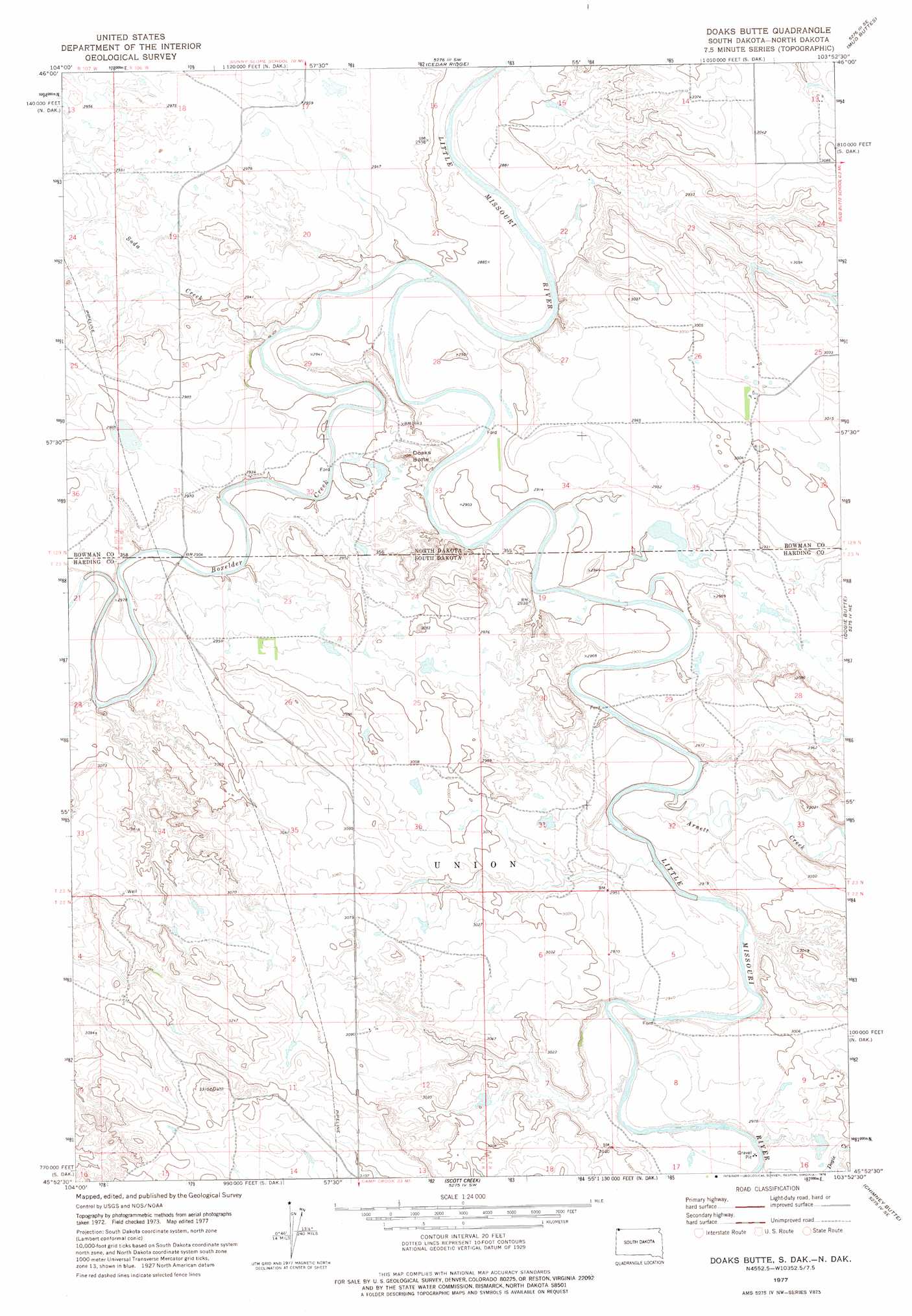
USGS Topo Quad 45103h8 - 1:24,000 scale
| Topo Map Name: | Doaks Butte |
| USGS Topo Quad ID: | 45103h8 |
| Print Size: | ca. 21 1/4" wide x 27" high |
| Southeast Coordinates: | 45.875° N latitude / 103.875° W longitude |
| Map Center Coordinates: | 45.9375° N latitude / 103.9375° W longitude |
| U.S. States: | SD, ND |
| Filename: | o45103h8.jpg |
| Download Map JPG Image: | Doaks Butte topo map 1:24,000 scale |
| Map Type: | Topographic |
| Topo Series: | 7.5´ |
| Map Scale: | 1:24,000 |
| Source of Map Images: | United States Geological Survey (USGS) |
| Alternate Map Versions: |
Doaks Butte ND 1977, updated 1978 Download PDF Buy paper map Doaks Butte ND 2011 Download PDF Buy paper map Doaks Butte ND 2014 Download PDF Buy paper map |
1:24,000 Topo Quads surrounding Doaks Butte
Webster Nw |
Webster Ne |
Kid Creek |
Cedar Hills |
Rhame |
Webster |
Scole School |
Cedar Ridge |
Mud Buttes |
Camel Butte |
Flasted Hill |
Snider Hill |
Doaks Butte |
Dogie Butte |
Table Mountain |
Mill Iron |
Humbolt Hills |
Scott Creek |
Chimney Butte |
Ladner |
Rustler Divide |
North Slick Creek |
Caroline Butte |
Gallup Creek |
Lahti Butte |
> Back to 45103e1 at 1:100,000 scale
> Back to 45102a1 at 1:250,000 scale
> Back to U.S. Topo Maps home
Doaks Butte topo map: Gazetteer
Doaks Butte: Streams
Arnett Creek elevation 881m 2890′Boxelder Creek elevation 885m 2903′
Soda Creek elevation 879m 2883′
Soda Creek elevation 879m 2883′
Doaks Butte: Summits
Doaks Butte elevation 907m 2975′Doaks Butte digital topo map on disk
Buy this Doaks Butte topo map showing relief, roads, GPS coordinates and other geographical features, as a high-resolution digital map file on DVD:
Eastern Montana & Western North Dakota
Buy digital topo maps: Eastern Montana & Western North Dakota