Cochran Reservoir Topo Map Montana
To zoom in, hover over the map of Cochran Reservoir
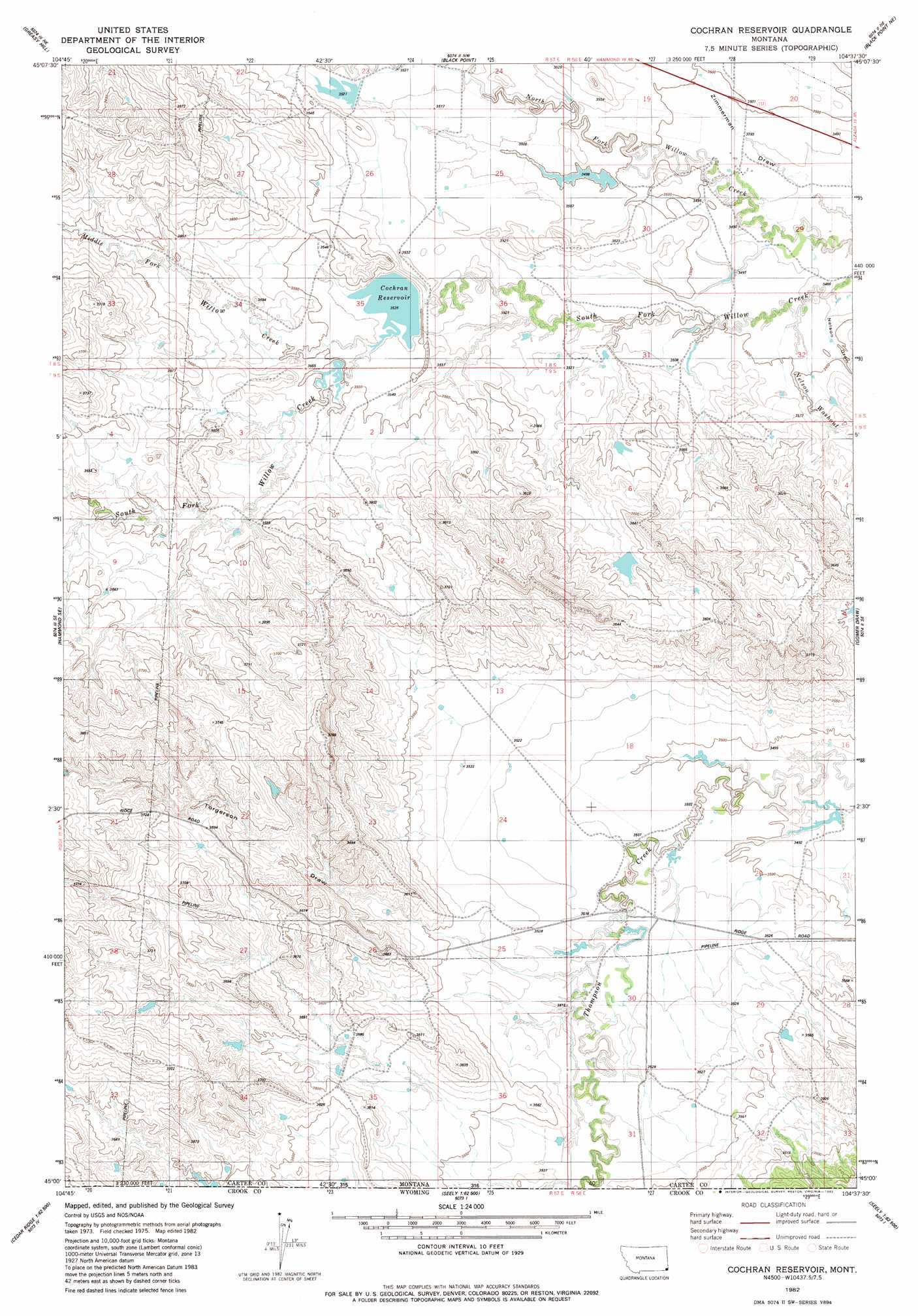
USGS Topo Quad 45104a6 - 1:24,000 scale
| Topo Map Name: | Cochran Reservoir |
| USGS Topo Quad ID: | 45104a6 |
| Print Size: | ca. 21 1/4" wide x 27" high |
| Southeast Coordinates: | 45° N latitude / 104.625° W longitude |
| Map Center Coordinates: | 45.0625° N latitude / 104.6875° W longitude |
| U.S. State: | MT |
| Filename: | o45104a6.jpg |
| Download Map JPG Image: | Cochran Reservoir topo map 1:24,000 scale |
| Map Type: | Topographic |
| Topo Series: | 7.5´ |
| Map Scale: | 1:24,000 |
| Source of Map Images: | United States Geological Survey (USGS) |
| Alternate Map Versions: |
Cochran Reservoir MT 1982, updated 1982 Download PDF Buy paper map Cochran Reservoir MT 2011 Download PDF Buy paper map Cochran Reservoir MT 2014 Download PDF Buy paper map |
1:24,000 Topo Quads surrounding Cochran Reservoir
Knudson Draw |
Phillipi Reservoir |
Tip Top Butte |
Potato Buttes |
Finger Buttes West |
Hammond |
Greasy Hill |
Black Point |
Black Point Ne |
Alzada Nw |
Stack Rocks |
Hammond Se |
Cochran Reservoir |
Gomer Draw |
Alzada |
Moulton Creek |
Storm Draw |
Page Draw |
Gaff Creek |
Antelope Gulch |
Cedar Ridge |
Wood Canyon |
Strawberry Hill |
Seely |
Mona |
> Back to 45104a1 at 1:100,000 scale
> Back to 45104a1 at 1:250,000 scale
> Back to U.S. Topo Maps home
Cochran Reservoir topo map: Gazetteer
Cochran Reservoir: Dams
Cockran Grazing Number 1 Dam elevation 1073m 3520′Cockran Grazing Number 2 Dam elevation 1075m 3526′
Cockran Grazing Number 3 Dam elevation 1083m 3553′
Cockran Grazing Number 4 Dam elevation 1077m 3533′
Pilister Diversion Dam elevation 1070m 3510′
Pilister Number 1 Dam elevation 1086m 3562′
Wyotana Ranch Number 4 Dam elevation 1062m 3484′
Cochran Reservoir: Reservoirs
Cochran Reservoir elevation 1081m 3546′Cochran Reservoir: Streams
Middle Fork Willow Creek elevation 1080m 3543′North Fork Willow Creek elevation 1061m 3480′
South Fork Willow Creek elevation 1080m 3543′
Cochran Reservoir: Valleys
Nelson Draw elevation 1062m 3484′Nelson Washout elevation 1065m 3494′
Torgerson Draw elevation 1070m 3510′
Cochran Reservoir: Wells
08S58E29BBBA01 Well elevation 1065m 3494′Cochran Reservoir digital topo map on disk
Buy this Cochran Reservoir topo map showing relief, roads, GPS coordinates and other geographical features, as a high-resolution digital map file on DVD:
Eastern Montana & Western North Dakota
Buy digital topo maps: Eastern Montana & Western North Dakota