Stack Rocks Topo Map Montana
To zoom in, hover over the map of Stack Rocks
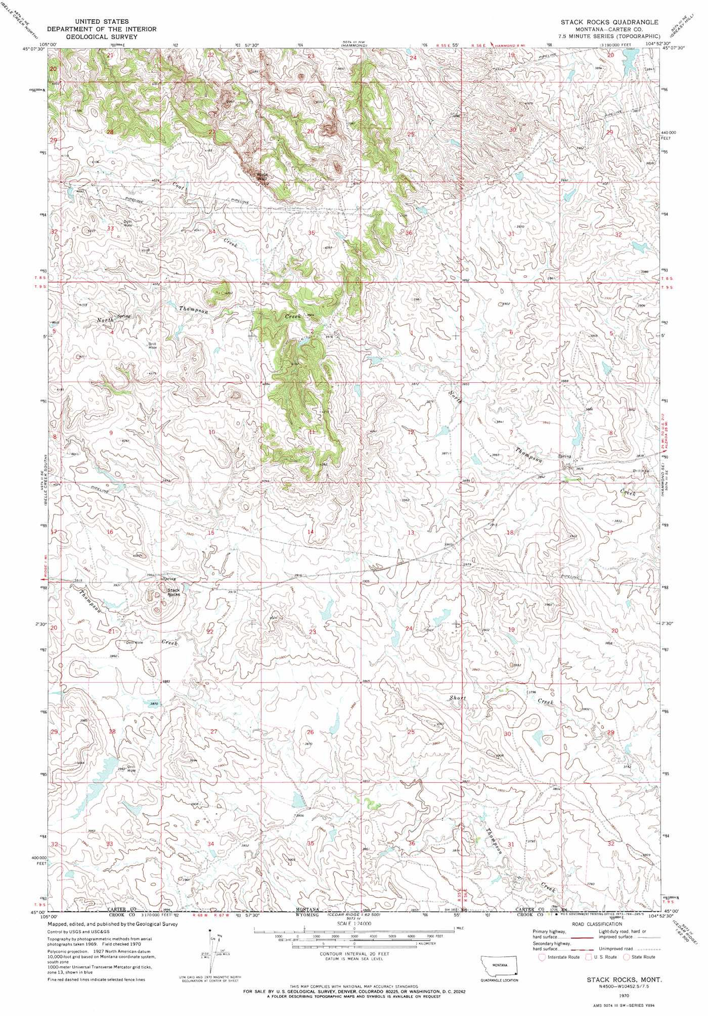
USGS Topo Quad 45104a8 - 1:24,000 scale
| Topo Map Name: | Stack Rocks |
| USGS Topo Quad ID: | 45104a8 |
| Print Size: | ca. 21 1/4" wide x 27" high |
| Southeast Coordinates: | 45° N latitude / 104.875° W longitude |
| Map Center Coordinates: | 45.0625° N latitude / 104.9375° W longitude |
| U.S. States: | MT, WY |
| Filename: | o45104a8.jpg |
| Download Map JPG Image: | Stack Rocks topo map 1:24,000 scale |
| Map Type: | Topographic |
| Topo Series: | 7.5´ |
| Map Scale: | 1:24,000 |
| Source of Map Images: | United States Geological Survey (USGS) |
| Alternate Map Versions: |
Stack Rocks MT 1970, updated 1973 Download PDF Buy paper map Stack Rocks MT 2011 Download PDF Buy paper map Stack Rocks MT 2014 Download PDF Buy paper map |
1:24,000 Topo Quads surrounding Stack Rocks
Dry Creek Butte |
Boyes |
Knudson Draw |
Phillipi Reservoir |
Tip Top Butte |
Sanburn Reservoir |
Belle Creek North |
Hammond |
Greasy Hill |
Black Point |
Belle Creek Sw |
Belle Creek South |
Stack Rocks |
Hammond Se |
Cochran Reservoir |
Mitten Butte |
Rockypoint |
Moulton Creek |
Storm Draw |
Page Draw |
Bowman Hill |
Bonnie Reservoir |
Cedar Ridge |
Wood Canyon |
Strawberry Hill |
> Back to 45104a1 at 1:100,000 scale
> Back to 45104a1 at 1:250,000 scale
> Back to U.S. Topo Maps home
Stack Rocks topo map: Gazetteer
Stack Rocks: Cliffs
Rock Wall elevation 1207m 3959′Stack Rocks: Dams
Ace of Diamonds Dam elevation 1211m 3973′Gerald Craft Number 6 Dam elevation 1164m 3818′
Jack of Diamonds Dam elevation 1193m 3914′
Jack of Hearts Dam elevation 1190m 3904′
Jack of Spades Dam elevation 1198m 3930′
King of Diamonds Dam elevation 1193m 3914′
Queen of Hearts Dam elevation 1172m 3845′
Stack Rocks: Pillars
Stack Rocks elevation 1209m 3966′Stack Rocks: Streams
Coal Creek elevation 1198m 3930′Thompson Creek elevation 1140m 3740′
Stack Rocks digital topo map on disk
Buy this Stack Rocks topo map showing relief, roads, GPS coordinates and other geographical features, as a high-resolution digital map file on DVD:
Eastern Montana & Western North Dakota
Buy digital topo maps: Eastern Montana & Western North Dakota