Potato Buttes Topo Map Montana
To zoom in, hover over the map of Potato Buttes
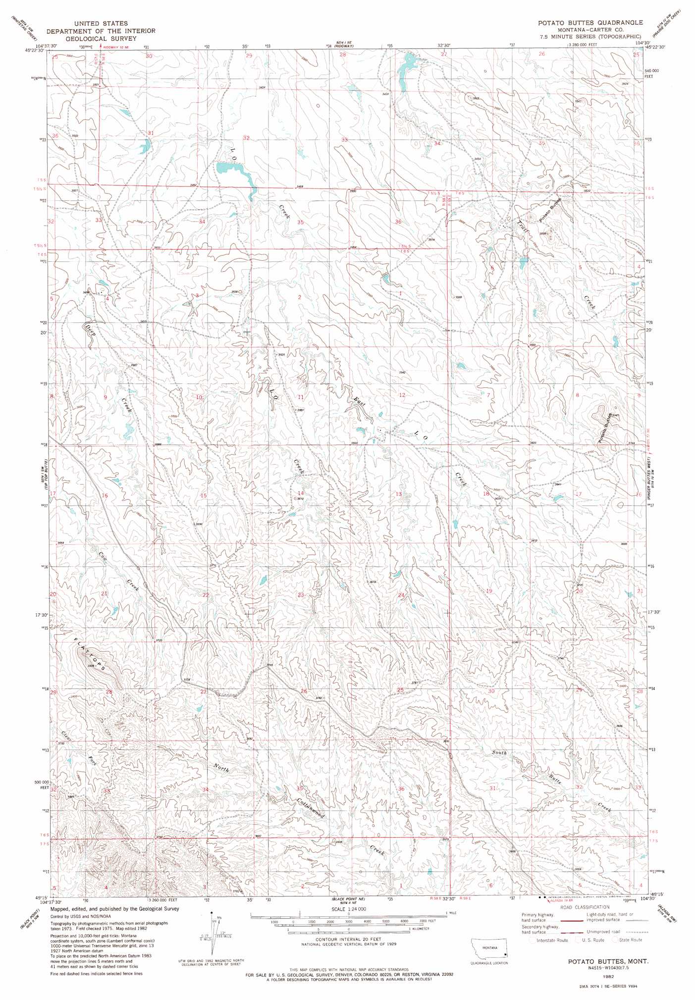
USGS Topo Quad 45104c5 - 1:24,000 scale
| Topo Map Name: | Potato Buttes |
| USGS Topo Quad ID: | 45104c5 |
| Print Size: | ca. 21 1/4" wide x 27" high |
| Southeast Coordinates: | 45.25° N latitude / 104.5° W longitude |
| Map Center Coordinates: | 45.3125° N latitude / 104.5625° W longitude |
| U.S. State: | MT |
| Filename: | o45104c5.jpg |
| Download Map JPG Image: | Potato Buttes topo map 1:24,000 scale |
| Map Type: | Topographic |
| Topo Series: | 7.5´ |
| Map Scale: | 1:24,000 |
| Source of Map Images: | United States Geological Survey (USGS) |
| Alternate Map Versions: |
Potato Buttes MT 1982, updated 1982 Download PDF Buy paper map Potato Buttes MT 2011 Download PDF Buy paper map Potato Buttes MT 2014 Download PDF Buy paper map |
1:24,000 Topo Quads surrounding Potato Buttes
W L Butte |
Dutchman Creek |
Ikey Creek |
School Section Creek |
Belltower Butte |
Knudson Draw Ne |
Whitetail Creek |
Ridgway |
Prairie Dog Creek |
Lone Tree Creek |
Phillipi Reservoir |
Tip Top Butte |
Potato Buttes |
Finger Buttes West |
Finger Buttes East |
Greasy Hill |
Black Point |
Black Point Ne |
Alzada Nw |
Albion |
Hammond Se |
Cochran Reservoir |
Gomer Draw |
Alzada |
Sevenmile Creek |
> Back to 45104a1 at 1:100,000 scale
> Back to 45104a1 at 1:250,000 scale
> Back to U.S. Topo Maps home
Potato Buttes topo map: Gazetteer
Potato Buttes: Dams
Clem-Reid Number 1 Dam elevation 1049m 3441′Potato Buttes: Streams
East Fork L O Creek elevation 1057m 3467′Hawksnest Creek elevation 1050m 3444′
Potato Buttes: Summits
Potato Buttes elevation 1094m 3589′Potato Buttes elevation 1149m 3769′
Potato Buttes digital topo map on disk
Buy this Potato Buttes topo map showing relief, roads, GPS coordinates and other geographical features, as a high-resolution digital map file on DVD:
Eastern Montana & Western North Dakota
Buy digital topo maps: Eastern Montana & Western North Dakota