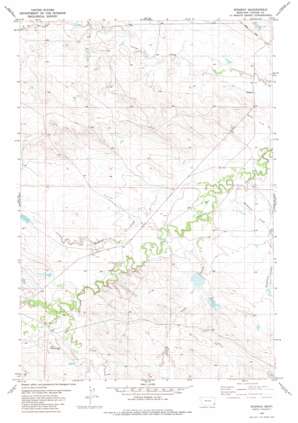
Ridgway Topo Map Montana
To zoom in, hover over the map of Ridgway
USGS Topo Quad 45104d5 - 1:24,000 scale
| Topo Map Name: | Ridgway |
| USGS Topo Quad ID: | 45104d5 |
| Print Size: | ca. 21 1/4" wide x 27" high |
| Southeast Coordinates: | 45.375° N latitude / 104.5° W longitude |
| Map Center Coordinates: | 45.4375° N latitude / 104.5625° W longitude |
| U.S. State: | MT |
| Filename: | o45104d5.jpg |
| Download Map JPG Image: | Ridgway topo map 1:24,000 scale |
| Map Type: | Topographic |
| Topo Series: | 7.5´ |
| Map Scale: | 1:24,000 |
| Source of Map Images: | United States Geological Survey (USGS) |
| Alternate Map Versions: |
Ridgway MT 1982, updated 1982 Download PDF Buy paper map Ridgway MT 2011 Download PDF Buy paper map Ridgway MT 2014 Download PDF Buy paper map |
1:24,000 Topo Quads surrounding Ridgway
> Back to 45104a1 at 1:100,000 scale
> Back to 45104a1 at 1:250,000 scale
> Back to U.S. Topo Maps home
Ridgway topo map: Gazetteer
Ridgway: Dams
Blackford Number 3 Dam elevation 1025m 3362′Blackford Number 5 Dam elevation 1036m 3398′
R Owen Number 1 Dam elevation 1027m 3369′
Ridgway: Populated Places
Ridgeway elevation 1015m 3330′Ridgway: Post Offices
Hawks Home Post Office (historical) elevation 1032m 3385′Ridgway Post Office (historical) elevation 1015m 3330′
Ridgway: Streams
L O Creek elevation 1025m 3362′Muskrat Creek elevation 1013m 3323′
South Fork Corral Creek elevation 1022m 3353′
Trail Creek elevation 1016m 3333′
Whitetail Creek elevation 1026m 3366′
Ridgway: Wells
05S58E08DBCC01 Well elevation 1025m 3362′05S58E17BAAB01 Well elevation 1025m 3362′
Ridgway digital topo map on disk
Buy this Ridgway topo map showing relief, roads, GPS coordinates and other geographical features, as a high-resolution digital map file on DVD:
Eastern Montana & Western North Dakota
Buy digital topo maps: Eastern Montana & Western North Dakota


