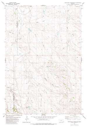
Pentecost Reservoir Topo Map Montana
To zoom in, hover over the map of Pentecost Reservoir
USGS Topo Quad 45104d8 - 1:24,000 scale
| Topo Map Name: | Pentecost Reservoir |
| USGS Topo Quad ID: | 45104d8 |
| Print Size: | ca. 21 1/4" wide x 27" high |
| Southeast Coordinates: | 45.375° N latitude / 104.875° W longitude |
| Map Center Coordinates: | 45.4375° N latitude / 104.9375° W longitude |
| U.S. State: | MT |
| Filename: | o45104d8.jpg |
| Download Map JPG Image: | Pentecost Reservoir topo map 1:24,000 scale |
| Map Type: | Topographic |
| Topo Series: | 7.5´ |
| Map Scale: | 1:24,000 |
| Source of Map Images: | United States Geological Survey (USGS) |
| Alternate Map Versions: |
Pentecost Reservoir MT 1982, updated 1982 Download PDF Buy paper map Pentecost Reservoir MT 2011 Download PDF Buy paper map Pentecost Reservoir MT 2014 Download PDF Buy paper map |
1:24,000 Topo Quads surrounding Pentecost Reservoir
> Back to 45104a1 at 1:100,000 scale
> Back to 45104a1 at 1:250,000 scale
> Back to U.S. Topo Maps home
Pentecost Reservoir topo map: Gazetteer
Pentecost Reservoir: Reservoirs
Pentecost Reservoir elevation 1013m 3323′Pentecost Reservoir: Streams
Dry Creek elevation 939m 3080′Lightning Creek elevation 946m 3103′
North Fork Dry Creek elevation 958m 3143′
South Fork Dry Creek elevation 964m 3162′
Pentecost Reservoir: Summits
Haystack Butte elevation 1001m 3284′Pentecost Reservoir: Valleys
Cedar Canyon elevation 964m 3162′Hay Draw elevation 939m 3080′
Kuster Canyon elevation 1005m 3297′
Moody Draw elevation 943m 3093′
Pentecost Draw elevation 968m 3175′
Quaking Aspen Draw elevation 976m 3202′
Reynolds Draw elevation 959m 3146′
Pentecost Reservoir: Wells
04S54E13CAA_01 Well elevation 957m 3139′04S54E13DAA_01 Well elevation 940m 3083′
04S54E13DABD01 Well elevation 950m 3116′
04S54E13DAC_01 Well elevation 951m 3120′
04S54E24AC__01 Well elevation 952m 3123′
04S55E08CDA_01 Well elevation 986m 3234′
05S54E13ABC_01 Well elevation 1010m 3313′
05S54E24ACAB01 Well elevation 1026m 3366′
05S54E24DBD_01 Well elevation 1036m 3398′
05S55E07ACC_01 Well elevation 991m 3251′
05S55E07CDCC01 Well elevation 1011m 3316′
Pentecost Reservoir digital topo map on disk
Buy this Pentecost Reservoir topo map showing relief, roads, GPS coordinates and other geographical features, as a high-resolution digital map file on DVD:
Eastern Montana & Western North Dakota
Buy digital topo maps: Eastern Montana & Western North Dakota


