Dutchman Creek Topo Map Montana
To zoom in, hover over the map of Dutchman Creek
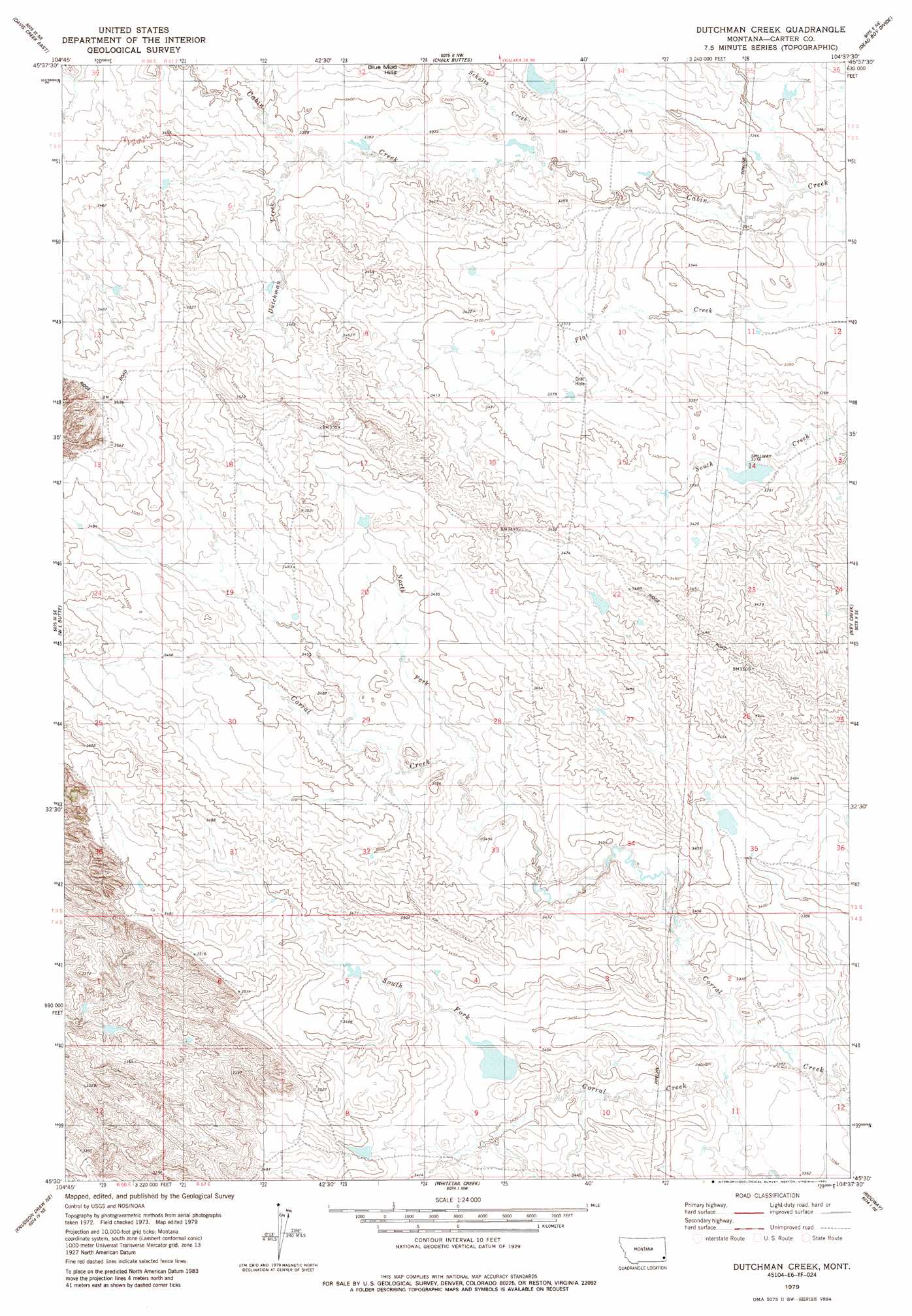
USGS Topo Quad 45104e6 - 1:24,000 scale
| Topo Map Name: | Dutchman Creek |
| USGS Topo Quad ID: | 45104e6 |
| Print Size: | ca. 21 1/4" wide x 27" high |
| Southeast Coordinates: | 45.5° N latitude / 104.625° W longitude |
| Map Center Coordinates: | 45.5625° N latitude / 104.6875° W longitude |
| U.S. State: | MT |
| Filename: | o45104e6.jpg |
| Download Map JPG Image: | Dutchman Creek topo map 1:24,000 scale |
| Map Type: | Topographic |
| Topo Series: | 7.5´ |
| Map Scale: | 1:24,000 |
| Source of Map Images: | United States Geological Survey (USGS) |
| Alternate Map Versions: |
Dutchman Creek MT 1979, updated 1985 Download PDF Buy paper map Dutchman Creek MT 2011 Download PDF Buy paper map Dutchman Creek MT 2014 Download PDF Buy paper map |
1:24,000 Topo Quads surrounding Dutchman Creek
Blacktail Creek Sw |
Blacktail Creek Se |
Beaver Flats South |
Stagville Draw |
Camp Needmore |
Davis Creek West |
Davis Creek East |
Chalk Buttes |
Dead Boy Divide |
Taylor Hills |
Pocochichee Butte |
W L Butte |
Dutchman Creek |
Ikey Creek |
School Section Creek |
Pentecost Reservoir |
Knudson Draw Ne |
Whitetail Creek |
Ridgway |
Prairie Dog Creek |
Knudson Draw |
Phillipi Reservoir |
Tip Top Butte |
Potato Buttes |
Finger Buttes West |
> Back to 45104e1 at 1:100,000 scale
> Back to 45104a1 at 1:250,000 scale
> Back to U.S. Topo Maps home
Dutchman Creek topo map: Gazetteer
Dutchman Creek: Post Offices
Batzel Post Office (historical) elevation 1044m 3425′Dutchman Creek: Streams
Dutchman Creek elevation 1031m 3382′North Fork Corral Creek elevation 1043m 3421′
Schultz Creek elevation 1025m 3362′
Dutchman Creek: Wells
01S57E26AAB_01 Well elevation 1032m 3385′Dutchman Creek digital topo map on disk
Buy this Dutchman Creek topo map showing relief, roads, GPS coordinates and other geographical features, as a high-resolution digital map file on DVD:
Eastern Montana & Western North Dakota
Buy digital topo maps: Eastern Montana & Western North Dakota