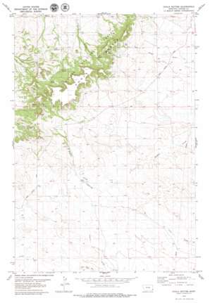
Chalk Buttes Topo Map Montana
To zoom in, hover over the map of Chalk Buttes
USGS Topo Quad 45104f6 - 1:24,000 scale
| Topo Map Name: | Chalk Buttes |
| USGS Topo Quad ID: | 45104f6 |
| Print Size: | ca. 21 1/4" wide x 27" high |
| Southeast Coordinates: | 45.625° N latitude / 104.625° W longitude |
| Map Center Coordinates: | 45.6875° N latitude / 104.6875° W longitude |
| U.S. State: | MT |
| Filename: | o45104f6.jpg |
| Download Map JPG Image: | Chalk Buttes topo map 1:24,000 scale |
| Map Type: | Topographic |
| Topo Series: | 7.5´ |
| Map Scale: | 1:24,000 |
| Source of Map Images: | United States Geological Survey (USGS) |
| Alternate Map Versions: |
Chalk Buttes MT 1993, updated 1996 Download PDF Buy paper map Chalk Buttes MT 2011 Download PDF Buy paper map Chalk Buttes MT 2014 Download PDF Buy paper map |
| FStopo: | US Forest Service topo Chalk Buttes is available: Download FStopo PDF Download FStopo TIF |
1:24,000 Topo Quads surrounding Chalk Buttes
> Back to 45104e1 at 1:100,000 scale
> Back to 45104a1 at 1:250,000 scale
> Back to U.S. Topo Maps home
Chalk Buttes topo map: Gazetteer
Chalk Buttes: Airports
Laird Ranch Airport elevation 1056m 3464′Chalk Buttes: Gaps
Trenk Pass elevation 1181m 3874′Chalk Buttes: Populated Places
Chalk Buttes (historical) elevation 1068m 3503′Chalk Buttes: Post Offices
Chalk Buttes Post Office (historical) elevation 1068m 3503′Chalk Buttes: Ranges
Chalk Buttes elevation 1265m 4150′Chalk Buttes: Reservoirs
Trenk Reservoir elevation 1056m 3464′Chalk Buttes: Springs
Alstrom Spring elevation 1092m 3582′Birch Spring elevation 1139m 3736′
Foster Spring elevation 1151m 3776′
Mud Spring elevation 1136m 3727′
Pete Spring elevation 1041m 3415′
Chalk Buttes: Summits
Blue Mud Hills elevation 1060m 3477′Chalk Buttes: Wells
01S57E19BBAA01 Well elevation 1019m 3343′01S57E26ADCA01 Well elevation 1043m 3421′
01S57E32DCC_01 Well elevation 1111m 3645′
01S57E34BAD_01 Well elevation 1068m 3503′
01S57E34BDD_01 Well elevation 1062m 3484′
01S57E34BDD_02 Well elevation 1062m 3484′
02S56E01BCC_01 Well elevation 1099m 3605′
02S56E13BDDC01 Well elevation 1080m 3543′
02S56E23DAD_01 Well elevation 1047m 3435′
02S57E04ABBB01 Well elevation 1056m 3464′
02S57E07BDCC01 Well elevation 1119m 3671′
Chalk Buttes digital topo map on disk
Buy this Chalk Buttes topo map showing relief, roads, GPS coordinates and other geographical features, as a high-resolution digital map file on DVD:
Eastern Montana & Western North Dakota
Buy digital topo maps: Eastern Montana & Western North Dakota


