Blacktail Creek Nw Topo Map Montana
To zoom in, hover over the map of Blacktail Creek Nw
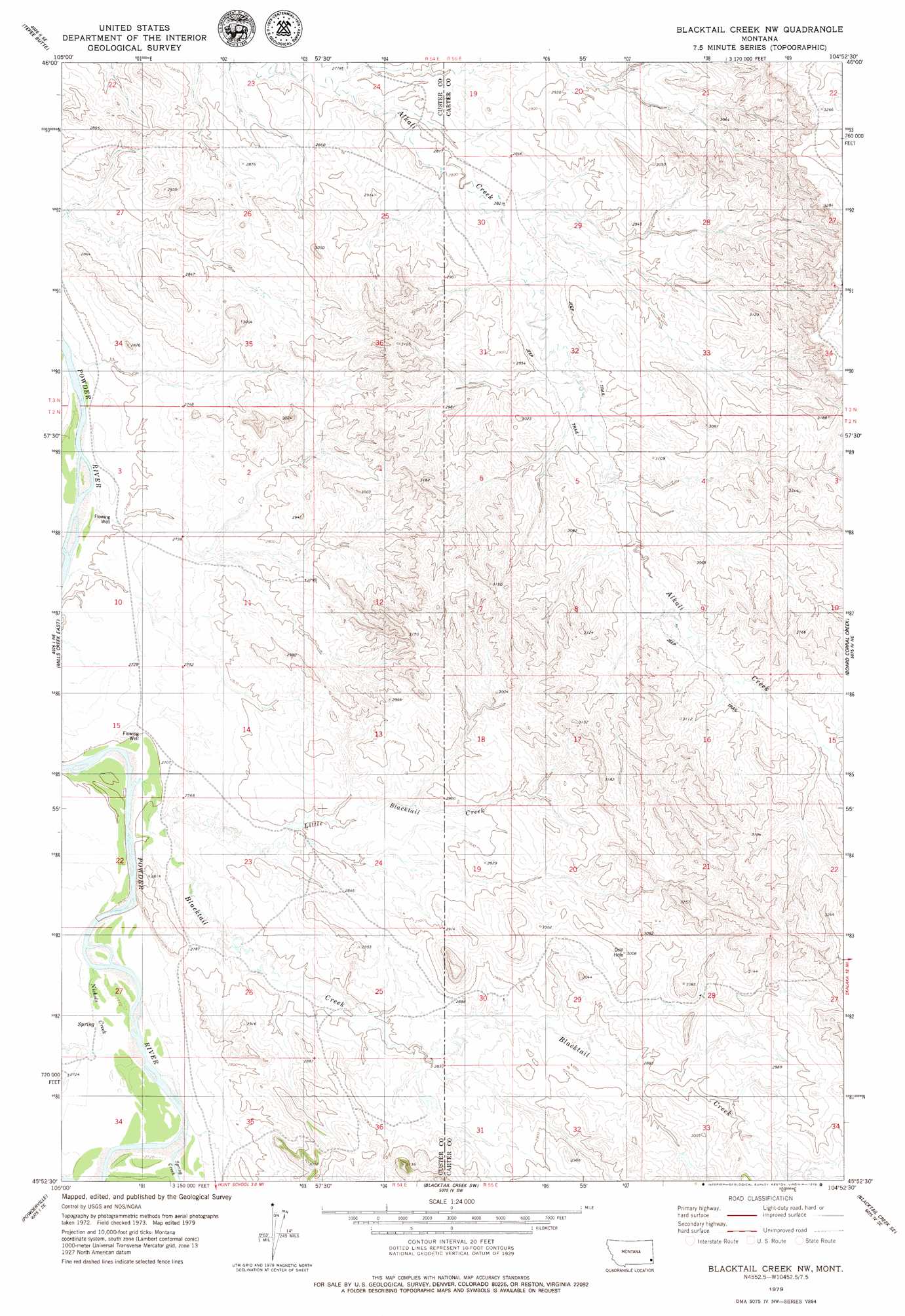
USGS Topo Quad 45104h8 - 1:24,000 scale
| Topo Map Name: | Blacktail Creek Nw |
| USGS Topo Quad ID: | 45104h8 |
| Print Size: | ca. 21 1/4" wide x 27" high |
| Southeast Coordinates: | 45.875° N latitude / 104.875° W longitude |
| Map Center Coordinates: | 45.9375° N latitude / 104.9375° W longitude |
| U.S. State: | MT |
| Filename: | o45104h8.jpg |
| Download Map JPG Image: | Blacktail Creek Nw topo map 1:24,000 scale |
| Map Type: | Topographic |
| Topo Series: | 7.5´ |
| Map Scale: | 1:24,000 |
| Source of Map Images: | United States Geological Survey (USGS) |
| Alternate Map Versions: |
Blacktail Creek NW MT 1979, updated 1979 Download PDF Buy paper map Blacktail Creek NW MT 2011 Download PDF Buy paper map Blacktail Creek NW MT 2014 Download PDF Buy paper map |
1:24,000 Topo Quads surrounding Blacktail Creek Nw
Pennock Creek |
Tepee Butte Ne |
Hooky Dam |
Nelson Butte |
Harmon Butte |
Bear Jaw Creek |
Tepee Butte |
North Fork Alkali Creek |
Skunk Creek |
Piney Butte Sw |
Mills Creek West |
Mills Creek East |
Blacktail Creek Nw |
Board Corral Creek |
Beaver Flats North |
Snake Butte |
Powderville |
Blacktail Creek Sw |
Blacktail Creek Se |
Beaver Flats South |
Oliphant Butte |
Rattlesnake Ridge |
Davis Creek West |
Davis Creek East |
Chalk Buttes |
> Back to 45104e1 at 1:100,000 scale
> Back to 45104a1 at 1:250,000 scale
> Back to U.S. Topo Maps home
Blacktail Creek Nw topo map: Gazetteer
Blacktail Creek Nw: Dams
Mallett Number 2 Dam elevation 888m 2913′Blacktail Creek Nw: Streams
Blacktail Creek elevation 824m 2703′Little Blacktail Creek elevation 829m 2719′
Nichols Creek elevation 827m 2713′
Spring Creek elevation 827m 2713′
Blacktail Creek Nw: Wells
02N54E03CBB_01 Well elevation 818m 2683′Blacktail Creek Nw digital topo map on disk
Buy this Blacktail Creek Nw topo map showing relief, roads, GPS coordinates and other geographical features, as a high-resolution digital map file on DVD:
Eastern Montana & Western North Dakota
Buy digital topo maps: Eastern Montana & Western North Dakota