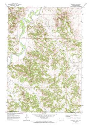
Moorhead Topo Map Montana
To zoom in, hover over the map of Moorhead
USGS Topo Quad 45105a7 - 1:24,000 scale
| Topo Map Name: | Moorhead |
| USGS Topo Quad ID: | 45105a7 |
| Print Size: | ca. 21 1/4" wide x 27" high |
| Southeast Coordinates: | 45° N latitude / 105.75° W longitude |
| Map Center Coordinates: | 45.0625° N latitude / 105.8125° W longitude |
| U.S. States: | MT, WY |
| Filename: | o45105a7.jpg |
| Download Map JPG Image: | Moorhead topo map 1:24,000 scale |
| Map Type: | Topographic |
| Topo Series: | 7.5´ |
| Map Scale: | 1:24,000 |
| Source of Map Images: | United States Geological Survey (USGS) |
| Alternate Map Versions: |
Moorhead MT 1970, updated 1973 Download PDF Buy paper map Moorhead MT 2011 Download PDF Buy paper map Moorhead MT 2014 Download PDF Buy paper map |
1:24,000 Topo Quads surrounding Moorhead
> Back to 45105a1 at 1:100,000 scale
> Back to 45104a1 at 1:250,000 scale
> Back to U.S. Topo Maps home
Moorhead topo map: Gazetteer
Moorhead: Populated Places
Moorhead elevation 1019m 3343′Moorhead: Ridges
The Devils Backbone elevation 1192m 3910′Moorhead: Streams
Buffalo Creek elevation 1006m 3300′Cliff Creek elevation 1016m 3333′
East Thompson Creek elevation 1026m 3366′
Flood Creek elevation 1019m 3343′
Graham Creek elevation 1024m 3359′
Jenkins Creek elevation 1005m 3297′
Thompson Creek elevation 1013m 3323′
Well Creek elevation 1019m 3343′
Moorhead: Summits
Kelsey Hill elevation 1118m 3667′Moorhead: Valleys
Bootjack Draw elevation 1030m 3379′Kelsey Draw elevation 1035m 3395′
Moorhead: Wells
08S49E32CB__01 Well elevation 1095m 3592′09S48E01BBDB01 Well elevation 1056m 3464′
09S48E05AC__01 Well elevation 1038m 3405′
09S48E05ACDC01 Well elevation 1039m 3408′
09S48E05ACDD01 Well elevation 1046m 3431′
09S48E08CABC01 Well elevation 1021m 3349′
09S48E08CDB_01 Well elevation 1021m 3349′
09S48E12AC__01 Well elevation 1117m 3664′
09S48E27DBCB01 Well elevation 1085m 3559′
Moorhead digital topo map on disk
Buy this Moorhead topo map showing relief, roads, GPS coordinates and other geographical features, as a high-resolution digital map file on DVD:
Eastern Montana & Western North Dakota
Buy digital topo maps: Eastern Montana & Western North Dakota


