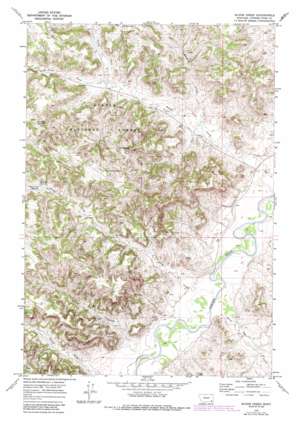
Bloom Creek Topo Map Montana
To zoom in, hover over the map of Bloom Creek
USGS Topo Quad 45105b7 - 1:24,000 scale
| Topo Map Name: | Bloom Creek |
| USGS Topo Quad ID: | 45105b7 |
| Print Size: | ca. 21 1/4" wide x 27" high |
| Southeast Coordinates: | 45.125° N latitude / 105.75° W longitude |
| Map Center Coordinates: | 45.1875° N latitude / 105.8125° W longitude |
| U.S. State: | MT |
| Filename: | o45105b7.jpg |
| Download Map JPG Image: | Bloom Creek topo map 1:24,000 scale |
| Map Type: | Topographic |
| Topo Series: | 7.5´ |
| Map Scale: | 1:24,000 |
| Source of Map Images: | United States Geological Survey (USGS) |
| Alternate Map Versions: |
Bloom Creek MT 1970, updated 1973 Download PDF Buy paper map Bloom Creek MT 1970, updated 1986 Download PDF Buy paper map Bloom Creek MT 1995, updated 1998 Download PDF Buy paper map Bloom Creek MT 2011 Download PDF Buy paper map Bloom Creek MT 2014 Download PDF Buy paper map |
| FStopo: | US Forest Service topo Bloom Creek is available: Download FStopo PDF Download FStopo TIF |
1:24,000 Topo Quads surrounding Bloom Creek
> Back to 45105a1 at 1:100,000 scale
> Back to 45104a1 at 1:250,000 scale
> Back to U.S. Topo Maps home
Bloom Creek topo map: Gazetteer
Bloom Creek: Dams
Plum Dam elevation 1020m 3346′Bloom Creek: Reservoirs
Bull Reservoir elevation 1175m 3854′Clay Reservoir elevation 1151m 3776′
Dunning Reservoir elevation 1164m 3818′
Plum Creek Reservoir elevation 1136m 3727′
Rimrock Reservoir elevation 1176m 3858′
Swope Reservoir elevation 1188m 3897′
Bloom Creek: Springs
Wolf Den Spring elevation 1148m 3766′Bloom Creek: Streams
Basin Creek elevation 994m 3261′Bloom Creek elevation 987m 3238′
Dry Creek elevation 1012m 3320′
Garst Creek elevation 1000m 3280′
Maverick Prong elevation 1024m 3359′
North Fork Bloom Creek elevation 1060m 3477′
Plum Creek elevation 1000m 3280′
South Fork Bloom Creek elevation 1061m 3480′
Spring Creek elevation 1019m 3343′
Three Bar Creek elevation 996m 3267′
Bloom Creek: Valleys
Dutch Gulch elevation 1020m 3346′Bloom Creek: Wells
07S48E15ACAB01 Well elevation 1055m 3461′07S48E24BCDB01 Well elevation 1048m 3438′
07S49E31DDAB01 Well elevation 992m 3254′
07S49E32CCDA01 Well elevation 999m 3277′
08S48E12AACA01 Well elevation 997m 3270′
08S48E13BDDD01 Well elevation 1008m 3307′
08S48E16CCBB01 Well elevation 1053m 3454′
08S49E06AD__01 Well elevation 997m 3270′
Bloom Creek digital topo map on disk
Buy this Bloom Creek topo map showing relief, roads, GPS coordinates and other geographical features, as a high-resolution digital map file on DVD:
Eastern Montana & Western North Dakota
Buy digital topo maps: Eastern Montana & Western North Dakota


