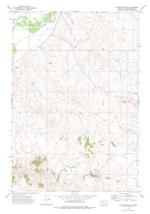
Eldon Mountain Topo Map Montana
To zoom in, hover over the map of Eldon Mountain
USGS Topo Quad 45105c4 - 1:24,000 scale
| Topo Map Name: | Eldon Mountain |
| USGS Topo Quad ID: | 45105c4 |
| Print Size: | ca. 21 1/4" wide x 27" high |
| Southeast Coordinates: | 45.25° N latitude / 105.375° W longitude |
| Map Center Coordinates: | 45.3125° N latitude / 105.4375° W longitude |
| U.S. State: | MT |
| Filename: | o45105c4.jpg |
| Download Map JPG Image: | Eldon Mountain topo map 1:24,000 scale |
| Map Type: | Topographic |
| Topo Series: | 7.5´ |
| Map Scale: | 1:24,000 |
| Source of Map Images: | United States Geological Survey (USGS) |
| Alternate Map Versions: |
Eldon Mountain MT 1973, updated 1976 Download PDF Buy paper map Eldon Mountain MT 2011 Download PDF Buy paper map Eldon Mountain MT 2014 Download PDF Buy paper map |
1:24,000 Topo Quads surrounding Eldon Mountain
> Back to 45105a1 at 1:100,000 scale
> Back to 45104a1 at 1:250,000 scale
> Back to U.S. Topo Maps home
Eldon Mountain topo map: Gazetteer
Eldon Mountain: Dams
Russell Number 1 Dam elevation 965m 3166′Eldon Mountain: Reservoirs
Forsgreen Reservoir elevation 1052m 3451′Garr Reservoir elevation 952m 3123′
Hondu Reservoir elevation 965m 3166′
Eldon Mountain: Streams
East Fork Third Creek elevation 951m 3120′Eldon Mountain: Summits
Castle Rock elevation 1059m 3474′Dog Butte elevation 1069m 3507′
Eldon Mountain elevation 1171m 3841′
Lideen Hill elevation 1074m 3523′
Eldon Mountain: Wells
05S50E25AADB01 Well elevation 939m 3080′05S51E27ABB_01 Well elevation 992m 3254′
05S51E29AADC01 Well elevation 945m 3100′
05S51E33ADAC01 Well elevation 964m 3162′
05S51E35ACAC01 Well elevation 994m 3261′
06S51E15BDCB01 Well elevation 987m 3238′
06S51E20CDDD01 Well elevation 1007m 3303′
06S51E27CBCC01 Well elevation 1044m 3425′
06S52E07CB__01 Well elevation 1019m 3343′
06S52E17BDDC01 Well elevation 1057m 3467′
06S52E29CDBA01 Well elevation 1007m 3303′
Eldon Mountain digital topo map on disk
Buy this Eldon Mountain topo map showing relief, roads, GPS coordinates and other geographical features, as a high-resolution digital map file on DVD:
Eastern Montana & Western North Dakota
Buy digital topo maps: Eastern Montana & Western North Dakota


