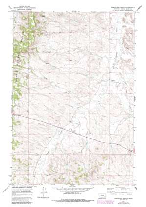
Samuelson Ranch Topo Map Montana
To zoom in, hover over the map of Samuelson Ranch
USGS Topo Quad 45105e7 - 1:24,000 scale
| Topo Map Name: | Samuelson Ranch |
| USGS Topo Quad ID: | 45105e7 |
| Print Size: | ca. 21 1/4" wide x 27" high |
| Southeast Coordinates: | 45.5° N latitude / 105.75° W longitude |
| Map Center Coordinates: | 45.5625° N latitude / 105.8125° W longitude |
| U.S. State: | MT |
| Filename: | o45105e7.jpg |
| Download Map JPG Image: | Samuelson Ranch topo map 1:24,000 scale |
| Map Type: | Topographic |
| Topo Series: | 7.5´ |
| Map Scale: | 1:24,000 |
| Source of Map Images: | United States Geological Survey (USGS) |
| Alternate Map Versions: |
Samuelson Ranch MT 1966, updated 1970 Download PDF Buy paper map Samuelson Ranch MT 1966, updated 1986 Download PDF Buy paper map Samuelson Ranch MT 1995, updated 1998 Download PDF Buy paper map Samuelson Ranch MT 2011 Download PDF Buy paper map Samuelson Ranch MT 2014 Download PDF Buy paper map |
| FStopo: | US Forest Service topo Samuelson Ranch is available: Download FStopo PDF Download FStopo TIF |
1:24,000 Topo Quads surrounding Samuelson Ranch
> Back to 45105e1 at 1:100,000 scale
> Back to 45104a1 at 1:250,000 scale
> Back to U.S. Topo Maps home
Samuelson Ranch topo map: Gazetteer
Samuelson Ranch: Springs
Cain Spring elevation 1127m 3697′Manning Spring elevation 1110m 3641′
Samuelson Ranch: Streams
Fiftyfour Creek elevation 1000m 3280′Short Creek elevation 1011m 3316′
Sixmile Creek elevation 1011m 3316′
Titus Creek elevation 1026m 3366′
Samuelson Ranch: Valleys
Winter Gulch elevation 1031m 3382′Samuelson Ranch: Wells
03S48E03ADBA01 Well elevation 1009m 3310′03S48E05DDDA01 Well elevation 1049m 3441′
03S48E15BBCC01 Well elevation 1031m 3382′
03S48E17DDAD01 Well elevation 1049m 3441′
03S48E18CACC01 Well elevation 1089m 3572′
03S48E23AABD01 Well elevation 1019m 3343′
03S48E28CAAA01 Well elevation 1034m 3392′
04S48E05ADDA01 Well elevation 1080m 3543′
Samuelson Ranch digital topo map on disk
Buy this Samuelson Ranch topo map showing relief, roads, GPS coordinates and other geographical features, as a high-resolution digital map file on DVD:
Eastern Montana & Western North Dakota
Buy digital topo maps: Eastern Montana & Western North Dakota


