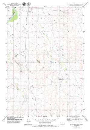
Rattlesnake Ridge Topo Map Montana
To zoom in, hover over the map of Rattlesnake Ridge
USGS Topo Quad 45105f1 - 1:24,000 scale
| Topo Map Name: | Rattlesnake Ridge |
| USGS Topo Quad ID: | 45105f1 |
| Print Size: | ca. 21 1/4" wide x 27" high |
| Southeast Coordinates: | 45.625° N latitude / 105° W longitude |
| Map Center Coordinates: | 45.6875° N latitude / 105.0625° W longitude |
| U.S. State: | MT |
| Filename: | o45105f1.jpg |
| Download Map JPG Image: | Rattlesnake Ridge topo map 1:24,000 scale |
| Map Type: | Topographic |
| Topo Series: | 7.5´ |
| Map Scale: | 1:24,000 |
| Source of Map Images: | United States Geological Survey (USGS) |
| Alternate Map Versions: |
Rattlesnake Ridge MT 1979, updated 1979 Download PDF Buy paper map Rattlesnake Ridge MT 2011 Download PDF Buy paper map Rattlesnake Ridge MT 2014 Download PDF Buy paper map |
1:24,000 Topo Quads surrounding Rattlesnake Ridge
> Back to 45105e1 at 1:100,000 scale
> Back to 45104a1 at 1:250,000 scale
> Back to U.S. Topo Maps home
Rattlesnake Ridge topo map: Gazetteer
Rattlesnake Ridge: Dams
Stump Dam elevation 892m 2926′Rattlesnake Ridge: Reservoirs
Trout Pond elevation 892m 2926′Rattlesnake Ridge: Ridges
Cedar Ridge elevation 994m 3261′Rattlesnake Ridge elevation 956m 3136′
Sixmile Ridge elevation 943m 3093′
Rattlesnake Ridge: Springs
Dunbar Spring elevation 919m 3015′Rattlesnake Ridge: Streams
Butte Creek elevation 860m 2821′Cedar Creek elevation 867m 2844′
Crow Creek elevation 852m 2795′
Flat Creek elevation 879m 2883′
Mamie Creek elevation 877m 2877′
Oliphant Creek elevation 879m 2883′
Rattlesnake Ridge: Summits
Antelope Butte elevation 987m 3238′Red Hill elevation 979m 3211′
Rattlesnake Ridge: Wells
01S54E17CCAC01 Well elevation 865m 2837′01S54E18DDAC01 Well elevation 855m 2805′
01S54E19BABA01 Well elevation 856m 2808′
01S54E28ACCC01 Well elevation 872m 2860′
01S54E35BDD_01 Well elevation 910m 2985′
01S54E35BDDA01 Well elevation 909m 2982′
02S53E12ACBA01 Well elevation 907m 2975′
02S53E13ADDA01 Well elevation 879m 2883′
02S53E25BDDD01 Well elevation 924m 3031′
02S54E06DBB_01 Well elevation 906m 2972′
02S54E19BDD_01 Well elevation 896m 2939′
02S54E20BBD_01 Well elevation 946m 3103′
02S54E23ADBA01 Well elevation 891m 2923′
Rattlesnake Ridge digital topo map on disk
Buy this Rattlesnake Ridge topo map showing relief, roads, GPS coordinates and other geographical features, as a high-resolution digital map file on DVD:
Eastern Montana & Western North Dakota
Buy digital topo maps: Eastern Montana & Western North Dakota


