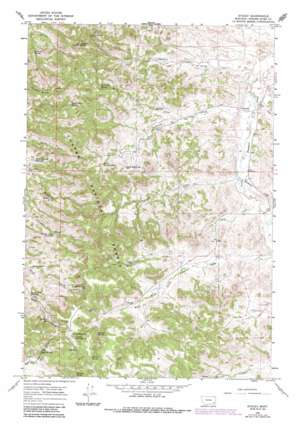
Stacey Topo Map Montana
To zoom in, hover over the map of Stacey
USGS Topo Quad 45105f8 - 1:24,000 scale
| Topo Map Name: | Stacey |
| USGS Topo Quad ID: | 45105f8 |
| Print Size: | ca. 21 1/4" wide x 27" high |
| Southeast Coordinates: | 45.625° N latitude / 105.875° W longitude |
| Map Center Coordinates: | 45.6875° N latitude / 105.9375° W longitude |
| U.S. State: | MT |
| Filename: | o45105f8.jpg |
| Download Map JPG Image: | Stacey topo map 1:24,000 scale |
| Map Type: | Topographic |
| Topo Series: | 7.5´ |
| Map Scale: | 1:24,000 |
| Source of Map Images: | United States Geological Survey (USGS) |
| Alternate Map Versions: |
Stacey MT 1966, updated 1969 Download PDF Buy paper map Stacey MT 1966, updated 1986 Download PDF Buy paper map Stacey MT 1995, updated 1998 Download PDF Buy paper map Stacey MT 2011 Download PDF Buy paper map Stacey MT 2014 Download PDF Buy paper map |
| FStopo: | US Forest Service topo Stacey is available: Download FStopo PDF Download FStopo TIF |
1:24,000 Topo Quads surrounding Stacey
> Back to 45105e1 at 1:100,000 scale
> Back to 45104a1 at 1:250,000 scale
> Back to U.S. Topo Maps home
Stacey topo map: Gazetteer
Stacey: Populated Places
Stacey elevation 1014m 3326′Stacey: Reservoirs
Horse Pasture Reservoir elevation 1051m 3448′Oil Well Reservoir elevation 1158m 3799′
Road Creek Reservoir elevation 1103m 3618′
Sheep Creek Reservoir elevation 1176m 3858′
Straight Creek Reservoir elevation 1077m 3533′
Stacey: Springs
02S47E19CDDB01 Spring elevation 1214m 3982′Bidwell Spring elevation 1187m 3894′
Bottom Crib Spring elevation 1084m 3556′
East Fork Spring elevation 1147m 3763′
Liscom Butte Spring elevation 1163m 3815′
North Stacey Spring elevation 1127m 3697′
Sartin Draw Spring elevation 1135m 3723′
South Stacey Spring elevation 1114m 3654′
Split Rock Spring elevation 1126m 3694′
Spring Number One elevation 1122m 3681′
Spring Number Two elevation 1071m 3513′
Surprise Spring elevation 1105m 3625′
Sutton Spring elevation 1229m 4032′
Thomas Spring elevation 1197m 3927′
Stacey: Streams
Buckberry Creek elevation 1031m 3382′Coal Creek elevation 1009m 3310′
Gaskill Creek elevation 994m 3261′
Gold Creek elevation 1036m 3398′
Green Creek elevation 1030m 3379′
Split Rock Creek elevation 1037m 3402′
Stacey Creek elevation 1008m 3307′
Whitetail Creek elevation 1093m 3585′
Stacey: Summits
Liscom Butte elevation 1324m 4343′Stacey: Wells
01S46E36CDCD01 Well elevation 1053m 3454′01S47E16CBCA01 Well elevation 1121m 3677′
01S47E20ACDA01 Well elevation 1118m 3667′
01S47E22DBAB01 Well elevation 1024m 3359′
01S47E23DDAD01 Well elevation 1007m 3303′
01S47E26CBBB01 Well elevation 1020m 3346′
01S47E27DBBD01 Well elevation 1031m 3382′
01S47E28ACCD01 Well elevation 1062m 3484′
01S47E34AACD01 Well elevation 1051m 3448′
02S47E04ADDB01 Well elevation 1064m 3490′
02S47E08ABBC01 Well elevation 1155m 3789′
02S47E10DADB01 Well elevation 1099m 3605′
Beaver Creek Well elevation 1052m 3451′
Stacey digital topo map on disk
Buy this Stacey topo map showing relief, roads, GPS coordinates and other geographical features, as a high-resolution digital map file on DVD:
Eastern Montana & Western North Dakota
Buy digital topo maps: Eastern Montana & Western North Dakota


