Divide School Topo Map Montana
To zoom in, hover over the map of Divide School
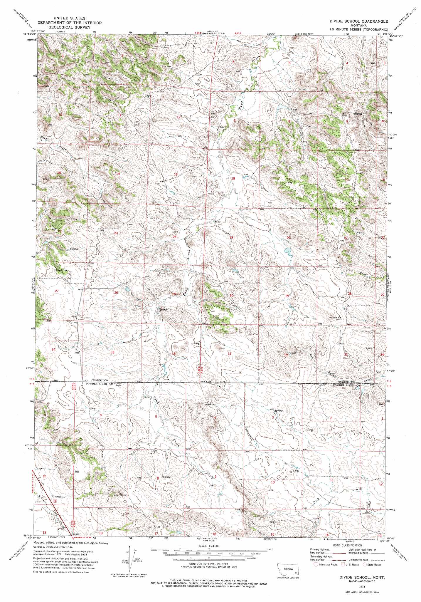
USGS Topo Quad 45105g5 - 1:24,000 scale
| Topo Map Name: | Divide School |
| USGS Topo Quad ID: | 45105g5 |
| Print Size: | ca. 21 1/4" wide x 27" high |
| Southeast Coordinates: | 45.75° N latitude / 105.5° W longitude |
| Map Center Coordinates: | 45.8125° N latitude / 105.5625° W longitude |
| U.S. State: | MT |
| Filename: | o45105g5.jpg |
| Download Map JPG Image: | Divide School topo map 1:24,000 scale |
| Map Type: | Topographic |
| Topo Series: | 7.5´ |
| Map Scale: | 1:24,000 |
| Source of Map Images: | United States Geological Survey (USGS) |
| Alternate Map Versions: |
Divide School MT 1973, updated 1976 Download PDF Buy paper map Divide School MT 2011 Download PDF Buy paper map Divide School MT 2014 Download PDF Buy paper map |
1:24,000 Topo Quads surrounding Divide School
Jack Creek |
Beebe Sw |
Beebe |
Miles City Creek |
Forty Creek |
Carey-Malone School |
Kirkpatrick Hill |
Harris Buttes |
Saddle Horse Butte |
Maxwell Butte |
Foster Creek School |
Volborg |
Divide School |
Witcher Reservoir |
Rattlesnake Hill |
Elk Ridge |
Box Elder Creek |
Coalwood |
Johnnie Creek |
Cross S School |
Samuelson Ranch |
Leslie Creek |
Olive |
Moonlight Creek |
Hawkey Creek |
> Back to 45105e1 at 1:100,000 scale
> Back to 45104a1 at 1:250,000 scale
> Back to U.S. Topo Maps home
Divide School topo map: Gazetteer
Divide School: Wells
01N48E35CBCA01 Well elevation 1019m 3343′01N49E25AACB01 Well elevation 984m 3228′
01N49E26CBBD01 Well elevation 1038m 3405′
01N49E36ADAD01 Well elevation 1004m 3293′
01N50E21ACCB01 Well elevation 998m 3274′
01N50E32BAAA01 Well elevation 1007m 3303′
01S50E08AAAD01 Well elevation 1031m 3382′
01S50E14CACB01 Well elevation 1045m 3428′
Divide School digital topo map on disk
Buy this Divide School topo map showing relief, roads, GPS coordinates and other geographical features, as a high-resolution digital map file on DVD:
Eastern Montana & Western North Dakota
Buy digital topo maps: Eastern Montana & Western North Dakota