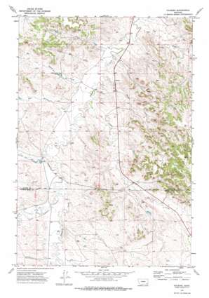
Volborg Topo Map Montana
To zoom in, hover over the map of Volborg
USGS Topo Quad 45105g6 - 1:24,000 scale
| Topo Map Name: | Volborg |
| USGS Topo Quad ID: | 45105g6 |
| Print Size: | ca. 21 1/4" wide x 27" high |
| Southeast Coordinates: | 45.75° N latitude / 105.625° W longitude |
| Map Center Coordinates: | 45.8125° N latitude / 105.6875° W longitude |
| U.S. State: | MT |
| Filename: | o45105g6.jpg |
| Download Map JPG Image: | Volborg topo map 1:24,000 scale |
| Map Type: | Topographic |
| Topo Series: | 7.5´ |
| Map Scale: | 1:24,000 |
| Source of Map Images: | United States Geological Survey (USGS) |
| Alternate Map Versions: |
Volborg MT 1973, updated 1976 Download PDF Buy paper map Volborg MT 2011 Download PDF Buy paper map Volborg MT 2014 Download PDF Buy paper map |
1:24,000 Topo Quads surrounding Volborg
> Back to 45105e1 at 1:100,000 scale
> Back to 45104a1 at 1:250,000 scale
> Back to U.S. Topo Maps home
Volborg topo map: Gazetteer
Volborg: Dams
Allen Number 6 Dam elevation 960m 3149′Volborg: Populated Places
Volborg elevation 910m 2985′Volborg: Post Offices
Volborg Post Office elevation 911m 2988′Volborg: Streams
Deer Creek elevation 884m 2900′Flat Butte Creek elevation 903m 2962′
Little Pumpkin Creek elevation 921m 3021′
Lone Tree Creek elevation 915m 3001′
Prairie Dog Creek elevation 897m 2942′
Ranch Creek elevation 901m 2956′
S L Creek elevation 903m 2962′
Sand Coulee elevation 928m 3044′
Shelter Creek elevation 899m 2949′
Volborg: Wells
01N48E22ACBB01 Well elevation 950m 3116′01N49E18BDAA01 Well elevation 910m 2985′
01N49E30DBBC01 Well elevation 931m 3054′
01S48E13ACAB01 Well elevation 953m 3126′
01S48E20DCAC01 Well elevation 941m 3087′
01S49E09CBAD01 Well elevation 951m 3120′
01S49E14ADCD01 Well elevation 999m 3277′
01S49E18ADAC01 Well elevation 938m 3077′
Volborg digital topo map on disk
Buy this Volborg topo map showing relief, roads, GPS coordinates and other geographical features, as a high-resolution digital map file on DVD:
Eastern Montana & Western North Dakota
Buy digital topo maps: Eastern Montana & Western North Dakota


