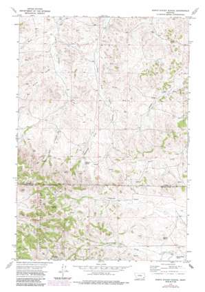
North Stacey School Topo Map Montana
To zoom in, hover over the map of North Stacey School
USGS Topo Quad 45105g8 - 1:24,000 scale
| Topo Map Name: | North Stacey School |
| USGS Topo Quad ID: | 45105g8 |
| Print Size: | ca. 21 1/4" wide x 27" high |
| Southeast Coordinates: | 45.75° N latitude / 105.875° W longitude |
| Map Center Coordinates: | 45.8125° N latitude / 105.9375° W longitude |
| U.S. State: | MT |
| Filename: | o45105g8.jpg |
| Download Map JPG Image: | North Stacey School topo map 1:24,000 scale |
| Map Type: | Topographic |
| Topo Series: | 7.5´ |
| Map Scale: | 1:24,000 |
| Source of Map Images: | United States Geological Survey (USGS) |
| Alternate Map Versions: |
North Stacey School MT 1973, updated 1976 Download PDF Buy paper map North Stacey School MT 1973, updated 1986 Download PDF Buy paper map North Stacey School MT 1995, updated 1998 Download PDF Buy paper map North Stacey School MT 2011 Download PDF Buy paper map North Stacey School MT 2014 Download PDF Buy paper map |
| FStopo: | US Forest Service topo North Stacey School is available: Download FStopo PDF Download FStopo TIF |
1:24,000 Topo Quads surrounding North Stacey School
> Back to 45105e1 at 1:100,000 scale
> Back to 45104a1 at 1:250,000 scale
> Back to U.S. Topo Maps home
North Stacey School topo map: Gazetteer
North Stacey School: Springs
Bathtub Spring elevation 985m 3231′Liscom Mountain Spring elevation 1106m 3628′
Red Shale Spring elevation 1101m 3612′
North Stacey School: Streams
Sagebrush Creek elevation 925m 3034′Scott Creek elevation 891m 2923′
North Stacey School: Summits
Castle Rock elevation 1054m 3458′North Stacey School: Valleys
Mullins Coulee elevation 918m 3011′North Stacey School: Wells
01N46E03DBDD01 Well elevation 909m 2982′01N46E14DABD01 Well elevation 932m 3057′
01N46E26ABCB01 Well elevation 978m 3208′
01N47E04CCAA01 Well elevation 904m 2965′
01N47E20AADC01 Well elevation 947m 3106′
01N47E20ACDC01 Well elevation 964m 3162′
01N47E28DDAD01 Well elevation 960m 3149′
01N47E32ACDC01 Well elevation 980m 3215′
01S47E11DDDD01 Well elevation 1021m 3349′
01S47E18BBDD01 Well elevation 1122m 3681′
01S55E17DAA_01 Well elevation 1075m 3526′
North Stacey School digital topo map on disk
Buy this North Stacey School topo map showing relief, roads, GPS coordinates and other geographical features, as a high-resolution digital map file on DVD:
Eastern Montana & Western North Dakota
Buy digital topo maps: Eastern Montana & Western North Dakota


